Bridport is a market town in Dorset, England, 2 miles (3.2 km) inland from the English Channel near the confluence of the River Brit and its tributary the Asker. Its origins are Saxon and it has a long history as a rope-making centre. On the coast and within the town's boundary is West Bay, a small fishing harbour also known as Bridport Harbour.

Stourport-on-Severn, often shortened to Stourport, is a town and civil parish in the Wyre Forest District of North Worcestershire, England, a few miles to the south of Kidderminster and downstream on the River Severn from Bewdley. At the 2021 census, it had a population of 20,653.

Milton Abbas is a village and civil parish in Dorset, England, lying around 5 miles southwest of Blandford Forum. In the 2011 Census the civil parish had a population of 755.

Okeford Fitzpaine is a village and civil parish in the English county of Dorset, situated in the Blackmore Vale three miles south of the town of Sturminster Newton. It is sited on a thin strip of greensand under the scarp face of the Dorset Downs. In the 2011 census the civil parish—which includes the village of Belchalwell to the west and most of the hamlet of Fiddleford to the north—had 404 dwellings, 380 households and a population of 913.

Arnesby is a village and civil parish in the Harborough district of Leicestershire, England. Arnesby contains approximately 142 households with a population of about 357. The village is situated 8 miles (13 km) south-east of Leicester, on the Welford Road, between Kilby and Shearsby.

Erwarton or Arwarton is a small village and civil parish in the Babergh district of Suffolk, England. The parish includes the hamlet of Shop Corner. Located on the Shotley peninsula around 9 miles (14 km) south of Ipswich, in 2005 it had a population of 110, increasing to 126 at the 2011 Census.

Gladestry is a small village and community in Radnorshire, Powys, mid-Wales, close to the border with England at the end of the Hergest Ridge and south of the large moorland area of Radnor Forest. People living in Gladestry rely on the nearby town of Kington, Herefordshire, for shops, employment, and public services.

Astley is a village, and a civil parish in Worcestershire, England, about two miles outside Stourport-on-Severn and seven miles south-west of Kidderminster.

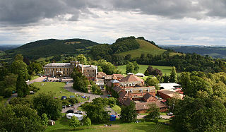
Abberley Hall is a country house in the north-west of the county of Worcestershire, England. The present Italianate house is the work of Samuel Daukes and dates from 1846 to 1849. Since 1916 it has been occupied by Abberley Hall School. It is a Grade II* listed building. The gardens are listed as Grade II on the English Heritage Register of Historic Parks and Gardens of Special Historic Interest in England. In the area close to Stourport-on-Severn there are several large manor and country houses, among which Witley Court, Astley Hall, Pool House, Areley Hall, Hartlebury Castle and Abberley Hall are particularly significant.

Somerby is a hamlet and civil parish in the West Lindsey district of Lincolnshire, England. It is situated approximately 4 miles (6 km) east from the town of Brigg and in the ecclesiastical parish of Somerby. Somerby lies in the Lincolnshire Wolds, a designated Area of Outstanding Natural Beauty, between the villages of Bigby and Searby.

Whitecross Street is a historic street in the town centre of Monmouth, Monmouthshire, Wales. It was in existence by the 15th century, and appears as Whit crose on the 1610 map of the town by cartographer John Speed. It runs in an east-west direction, between Church Street and St James Square. It has been suggested that the street takes its name from a plague cross. Whitecross Street is lined with numerous listed buildings.

Monk Street is an historic street in the town of Monmouth, Monmouthshire, Wales. A portion of it was in existence by the 14th century, and appears on the 1610 map of the town by cartographer John Speed. It runs in a north-south direction, extending northward from its intersection with Whitecross Street. The name of the street relates to the nearby Priory, as well as the gate which was originally on this road and provided part of the town's defences, Monk's Gate. Monk Street is lined with numerous listed buildings.

Kingsley House and Hendre House are a pair of 19th-century, semi-detached houses on the North Parade section of Monk Street in Monmouth, Monmouthshire, Wales. The grade II listed houses were designed by noted Monmouth architect and builder George Vaughan Maddox, who also designed at least two of the twenty-four blue plaque buildings on the Monmouth Heritage Trail, including the Market Hall and the Monmouth Methodist Church. Hendre House should be distinguished from The Hendre, the estate of the Rolls family.
Astley is a settlement in the Metropolitan Borough of Wigan in Greater Manchester, England. Originally a village, it now forms a continuous urban area with Tyldesley to the north. It lies on flat land north of Chat Moss and is crossed by the Bridgewater Canal and the A580 "East Lancashire Road". Astley contains several listed buildings designated by English Heritage and included in the National Heritage List for England. Most are listed at Grade II, the lowest of the three gradings given to listed buildings and is applied to "buildings of national importance and special interest".

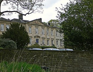
Astley Hall is a country house in Astley near Stourport-on-Severn, Worcestershire, England. The hall was the home of Prime Minister Stanley Baldwin from 1902 until his death there in 1947. It is now a nursing home.

Bilton Hall is a Grade II listed large country house near Harrogate, North Yorkshire. It was historically the home of the prominent Stockdale family, of which three Knaresborough MPs were members.

Field House is a Grade II* listed privately owned historic house in Sowerby Bridge, West Yorkshire, England.

Llandough Castle is a 14th-century tower house located in the Vale of Glamorgan, South Wales. Initially constructed as a fortified residential manor, the property is well preserved and has undergone many structural additions. It is currently a private residence, though the surrounding castle gardens, renovated and opened in 2018, are a notable public attraction. Llandough Castle was assigned Grade II* listed building status in 1981.

Nerquis Hall is a 17th-century gentry house located in the North Wales village of Nercwys, Flintshire. Completed in the mid-1600s, the hall has survived in good condition and is currently a private residence. Nerquis Hall was designated a Grade I listed building in October 1952.


