Related Research Articles

The Dalradian Supergroup is a stratigraphic unit in the lithostratigraphy of the Grampian Highlands of Scotland and in the north and west of Ireland. The diverse assemblage of rocks which constitute the supergroup extend across Scotland from Islay in the west to Fraserburgh in the east and are confined by the Great Glen Fault to the northwest and the Highland Boundary Fault to the southeast. Much of Shetland east of the Walls Boundary Fault is also formed from Dalradian rocks. Dalradian rocks extend across the north of Ireland from County Antrim in the north east to Clifden on the Atlantic coast, although obscured by younger Palaeogene lavas and tuffs or Carboniferous rocks in large sections.
Uriconian rocks are volcanic rocks found in parts of Shropshire, United Kingdom. The name relates to Uriconio, the Latin name for an Iron Age hillfort on the summit of the Wrekin, a hill formed of Uriconian rock.

The Fishguard Volcanic Group is an Ordovician lithostratigraphic group in west Wales. The name is derived from the town of Fishguard in Pembrokeshire. This assemblage of rocks has also been referred to as the Fishguard Volcanic Series or Fishguard Volcanic Complex. These rocks are believed to be the source of the 'bluestones' which form a part of the well-known prehistoric monument of Stonehenge in southern England.

The Snowdon Volcanic Group is an Ordovician lithostratigraphic group in Snowdonia, north-west Wales. The name is derived from Snowdon, the highest peak in Wales where it outcrops. This assemblage of rocks has also been referred to as the Snowdon Volcanic Series.

The Wrekin terrane is one of five inferred fault bounded terranes that make up the basement rocks of the southern United Kingdom. The other notable geological terranes in the region are the Charnwood terrane, Fenland terrane, Cymru terrane and the Monian Composite terrane. The Wrekin terrane is bounded to the west by the Welsh Borderland fault system and to the east by the Malvern lineament. The geological terrane to the west is the Cymru Terrane and to the east is Charnwood Terrane. The majority of rocks in the area are associated with the outcrops that are evident at the faulted boundaries.
The Cymru terrane is one of five inferred fault bounded terranes that make up the basement rocks of the southern United Kingdom. The other notable geological terranes are the Charnwood, Fenland, Wrekin and the Monian Composite terranes. In this article the definition of terrane is that implying rocks associated with the composition of the Precambrian basement. The Cymru terrane is bounded to the northwest by the Menai Strait Fault System and to the southeast by the Pontesford Lineament. The geological terrane to the west is the Monian Composite terrane and to the east is Wrekin terrane. The majority of rocks in the area are associated with the outcrops that are evident at the faulted boundaries.
The Sarn Complex is a group of closely related igneous rocks that intrude and cut through other rock lithologies in the Cymru terrane in Wales. The complex outcrops on the Llyn Peninsula in a variety of places including Mynydd Cefnamlwch and the flanks of Pen y Gopa.

The Grouse Creek block is a Precambrian basement province of 2.45 to 2.70 billion year old orthogneisses. The Grouse Creek block is one of several Proterozoic and Archean accreted terranes that lie to the north and west of the Wyoming craton, including the Farmington Canyon Complex, the Selway terrane, the Medicine Hat block and the Priest River complex. Together, these terranes comprise part of the basement rock of the North American continent and have been critical to studies of crustal accretion in the Precambrian. Ongoing study of the Grouse Creek block will contribute to understanding the paleogeography of the Wyoming craton prior to its incorporation into the supercontinent Laurentia approximately 1.86 billion years ago. The name was proposed by David Foster and others.

The Colonsay Group is an estimated 5,000 m thick sequence of mildly metamorphosed Neoproterozoic sedimentary rocks that outcrop on the islands of Colonsay, Islay and Oronsay and the surrounding seabed. They have been correlated with the Grampian Group, the oldest part of the Dalradian Supergroup.
The Stretton Group is a group of rocks associated with the Longmyndian Supergroup of Ediacaran age, in Shropshire, England. The rocks are located within the tract between two elements of the Welsh Borderland Fault System, the Church Stretton Fault and the Pontesford-Linley Lineament.
The Caerfai Group is a Cambrian lithostratigraphic group in west Wales. The name is derived from Caerfai Bay on the north coast of St Brides Bay on the Pembrokeshire coast where the strata are well exposed in coastal cliffs. This rock succession has previously been known variously as the Caerfai Series, Caerfai Formation and Caerfai Beds and largely ascribed to the British regional stratigraphic unit Comley Epoch, though these terms are now obsolete.

The Aravalli Mountain Range is a northeast-southwest trending orogenic belt in the northwest part of India and is part of the Indian Shield that was formed from a series of cratonic collisions. The Aravalli Mountains consist of the Aravalli and Delhi fold belts, and are collectively known as the Aravalli-Delhi orogenic belt. The whole mountain range is about 700 km long. Unlike the much younger Himalayan section nearby, the Aravalli Mountains are believed much older and can be traced back to the Proterozoic Eon. They are arguably the oldest geological feature on Earth. The collision between the Bundelkhand craton and the Marwar craton is believed to be the primary mechanism for the development of the mountain range.

The Huangling Anticline or Complex represents a group of rock units that appear in the middle of the Yangtze Block in South China, distributed across Yixingshan, Zigui, Huangling, and Yichang counties. The group of rock involves nonconformity that sedimentary rocks overlie the metamorphic basement. It is a 73-km long, asymmetrical dome-shaped anticline with axial plane orientating in the north-south direction. It has a steeper west flank and a gentler east flank. Basically, there are three tectonic units from the anticline core to the rim, including Archean to Paleoproterozoic metamorphic basement, Neoproterozoic to Jurassic sedimentary rocks, and Cretaceous fluvial deposit sedimentary cover. The northern part of the core is mainly tonalite-trondhjemite-gneiss (TTG) and Cretaceous sedimentary rock called the Archean Kongling Complex. The middle of the core is mainly the Neoproterozoic granitoid. The southern part of the core is the Neoproterozoic potassium granite. Two basins are situated on the western and eastern flanks of the core, respectively, including the Zigui basin and Dangyang basin. Both basins are synforms while Zigui basin has a larger extent of folding. Yuanan Graben and Jingmen Graben are found within the Dangyang Basin area. The Huangling Anticline is an important area that helps unravel the tectonic history of the South China Craton because it has well-exposed layers of rock units from Archean basement rock to Cretaceous sedimentary rock cover due to the erosion of the anticline.
The Badenoch Group is a sequence of metamorphosed Tonian age sedimentary rocks that outcrop across the Central Highlands of Scotland, east of the Great Glen. This rock sequence has formerly been referred to as the Central Highland Migmatite Complex and the Central Highland Division.
Reinhardt Adolfo Fuck is a Brazilian geologist and professor emeritus at the University of Brasília. Fuck specializes on geochronology and petrology, having written extensively on Pre-Cambrian geology.

Archean felsic volcanic rocks are felsic volcanic rocks that were formed in the Archean Eon. The term "felsic" means that the rocks have silica content of 62–78%. Given that the Earth formed at ~4.5 billion year ago, Archean felsic volcanic rocks provide clues on the Earth's first volcanic activities on the Earth's surface started 500 million years after the Earth's formation.

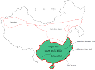
The South China Craton or South China Block is one of the Precambrian continental blocks in China. It is traditionally divided into the Yangtze Block in the NW and the Cathaysia Block in the SE. The Jiangshan–Shaoxing Fault represents the suture boundary between the two sub-blocks. Recent study suggests that the South China Block possibly has one more sub-block which is named the Tolo Terrane. The oldest rocks in the South China Block occur within the Kongling Complex, which yields zircon U–Pb ages of 3.3–2.9 Ga.

The Dharwar Craton is an Archean continental crust craton formed between 3.6-2.5 billion years ago (Ga), which is located in southern India and considered the oldest part of the Indian peninsula.

The Loch Ness Supergroup is one of the subdivisions of the Neoproterozoic sequence of sedimentary rocks in the Scottish Highlands. It is found everywhere in tectonic contact above the older Wester Ross Supergroup. It is thought to be unconformably overlain by the Cryogenian to Cambrian Dalradian Supergroup.

The Port Askaig Tillite Formation (PATF) is a sequence of glacigenic sedimentary rocks deposited during the Cryogenian period of the Neoproterozoic era, forming part of the Dalradian Supergroup. It is exposed along the Dalradian outcrop from Galway, Mayo and Donegal in Ireland in the west through Islay and the Garvellachs in the Inner Hebrides to Schiehallion, Braemar and Fordyce to the east on mainland Scotland. The formation records a time in Earth's history where there were repeated glaciations where ice sheets extended to low latitudes, sometimes referred to as a Snowball Earth.
References
- ↑ "BGS Lexicon of Named Rock Units - Result Details".
- 1 2 A. J. Reedman, B. E. Leveridge, R. B. Evans, The Arfon Group (Arvonian) of North Wales., 1984, Proceedings of the Geologists Association, 95, 313-321
- 1 2 P. J. Brenchley, P. F. Rawson The Geology of England and Wales, 2006, 2nd Ed
- ↑ R. D. Tucker & T. C. Pharaoh, U-Pb Zircon ages for late-Precambrian rocks in southern Britain., 1991, Journal of the Geological Society of London, 148, 435-433
- ↑ W. Compston, A. E. Wright, P. Toghill, Dating the Late Precambrian volcanicity of England and Wales. 2002, Journal of the Geological Society of London. 159 323-339.