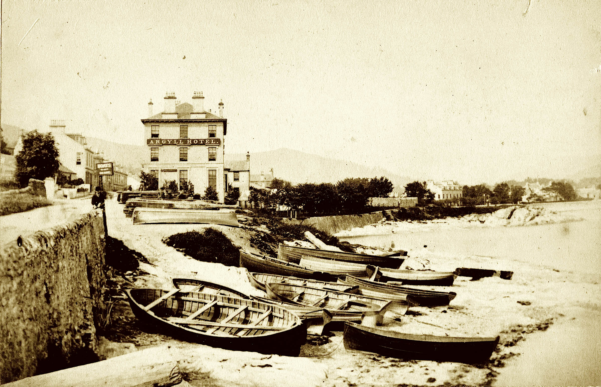
Argyll Hotel

Last updated

Argyll Hotel
The Argyll Hotel (geograph 7339789).jpg
The Argyll Hotel, pictured in 2022
Scotland location map.svg
Red pog.svg
Location within Scotland
Argyll and Bute UK location map.svg
Red pog.svg
Argyll Hotel (Argyll and Bute)
General information
Location54 Argyll Street,
Dunoon,
Argyll and Bute,
Scotland
Coordinates 55°56′54″N4°55′28″W / 55.948433°N 4.924502°W / 55.948433; -4.924502
Technical details
Floor count3 (4 in the tower)
Other information
Number of rooms33
Number of restaurants2
Website
Official website

The Argyll Hotel is a hotel located on Argyll Street in Dunoon, Argyll and Bute, Scotland. It is a Category B listed building built in the mid-19th century. [1]

Contents

The building's tower, at the southern end of the building, was added in 1876. [1] There has been an extension on its northern side, and a two-storey addition on the eastern side, connected to the main block by a curved wing. [1]

The hotel has 33 bedrooms and two restaurants. [2]

Related Research Articles

<span class="mw-page-title-main">Dunoon</span> Town in Scotland

Dunoon is the main town on the Cowal peninsula in the south of Argyll and Bute, Scotland. It is located on the western shore of the upper Firth of Clyde, to the south of the Holy Loch and to the north of Innellan. As well as forming part of the council area of Argyll and Bute, Dunoon also has its own community council. Dunoon was a burgh until 1976.

<span class="mw-page-title-main">Duke of Argyll</span> Title in the peerage of Scotland

Duke of Argyll is a title created in the peerage of Scotland in 1701 and in the peerage of the United Kingdom in 1892. The earls, marquesses, and dukes of Argyll were for several centuries among the most powerful noble families in Scotland. As such, they played a major role in Scottish history throughout the 16th, 17th, and 18th centuries. The Duke of Argyll also holds the hereditary titles of chief of Clan Campbell and Master of the Household of Scotland.

<span class="mw-page-title-main">Helensburgh</span> Town in Argyll and Bute, Scotland

Helensburgh is an affluent coastal town on the north side of the Firth of Clyde in Scotland, situated at the mouth of the Gareloch. Historically in Dunbartonshire, it became part of Argyll and Bute following local government reorganisation in 1996.

<span class="mw-page-title-main">Tobermory, Mull</span> Human settlement in Scotland

Tobermory is the capital of, and until 1973 the only burgh on, the Isle of Mull in the Scottish Inner Hebrides. It is located on the east coast of Mishnish, the most northerly part of the island, near the northern entrance of the Sound of Mull. The village was founded as a fishing port in 1788; its layout was based on the designs of Dumfriesshire engineer Thomas Telford. It has a current population of about 1,000.

<span class="mw-page-title-main">Gourock</span> Coastal town in Inverclyde, Scotland

Gourock is a town in the Inverclyde council area and formerly a burgh of the County of Renfrew in the west of Scotland. It was a seaside resort on the East shore of the upper Firth of Clyde. Its main function today is as a residential area, extending contiguously from Greenock, with a railway terminus and ferry services across the Clyde.

<span class="mw-page-title-main">Inveraray</span> Human settlement in Scotland

Inveraray is a town in Argyll and Bute, Scotland. It is on the western shore of Loch Fyne, near its head, and on the A83 road. It is a former royal burgh, the traditional county town of Argyll, and ancestral seat to the Duke of Argyll.

<span class="mw-page-title-main">Argyll</span> Historic county in Scotland

Argyll, sometimes called Argyllshire, is a historic county and registration county of western Scotland.

<span class="mw-page-title-main">Kilchurn Castle</span> Historic structure in Argyll and Bute, Scotland

Kilchurn Castle is a ruined structure on a rocky peninsula at the northeastern end of Loch Awe, in Argyll and Bute, Scotland. It was first constructed in the mid-15th century as the base of the Campbells of Glenorchy, who extended both the castle and their territory in the area over the next 150 years. After the Campbells became Earls of Breadalbane and moved to Taymouth Castle, Kilchurn fell out of use and was in ruins by 1770. It is now in the care of Historic Environment Scotland and is open to the public in summer.

<span class="mw-page-title-main">Great Marlborough Street</span> Street near Soho, London

Great Marlborough Street is a thoroughfare in Soho, Central London. It runs east of Regent Street past Carnaby Street towards Noel Street.

<span class="mw-page-title-main">Dunstaffnage Castle</span> Castle in Argyll and Bute, Scotland, UK

Dunstaffnage Castle is a partially ruined castle in Argyll and Bute, western Scotland. It lies 3 miles (5 km) NNE of Oban, situated on a platform of conglomerate rock on a promontory at the south-west of the entrance to Loch Etive, and is surrounded on three sides by the sea. The castle and the nearby chapel ruin have been a Historic Scotland property since 1958. Both are Scheduled Ancient Monuments.

<span class="mw-page-title-main">Carnasserie Castle</span>

Carnasserie Castle is a ruined 16th-century tower house, noted for its unusual plan and renaissance detailing. It is located around 2 kilometres north of Kilmartin, in Argyll and Bute, western Scotland, at grid reference NM837009.

<span class="mw-page-title-main">Mugdock Castle</span>

Mugdock Castle was the stronghold of the Clan Graham from the middle of the 13th century. Its ruins are located in Mugdock Country Park, just west of the village of Mugdock in the parish of Strathblane. The castle is within the registration county of Stirlingshire, although it is only 2 kilometres (1.2 mi) north of Milngavie, East Dunbartonshire, on the northern outskirts of Greater Glasgow.

<span class="mw-page-title-main">Craignish</span>

Craignish is a peninsula in Argyll, on the west coast of Scotland. It lies around 25 miles (40 km) south of Oban, and 10 miles (16 km) north-west of Lochgilphead. The peninsula is around 5.5 miles (8.9 km) long, and is aligned along a north-east to south-west orientation, in common with much of the landform of coastal Argyll. To the south is Loch Craignish, which contains several small islands. To the north are the Slate Islands, with the island of Shuna closest. Jura is only 3 miles (4.8 km) west of Craignish Point, the southern tip of Craignish.

<span class="mw-page-title-main">Ardencaple Castle</span> Former castle near Helensburgh

Ardencaple Castle, also known as Ardincaple Castle, and sometimes referred to as Ardencaple Castle Light, is a listed building, situated about 1 statute mile (1.6 km) from Helensburgh, Argyll and Bute, Scotland. Today, all that remains of the castle is a tower, perched on the edge of a plateau, looking down on a flat tract of land between it and the shore of the Firth of Clyde. The original castle was thought to have been built sometime in the 12th century, and part of the remains of the original castle were said to have existed in the 19th century. Today, that sole remaining tower is used as a navigational aid for shipping on the Firth of Clyde. Because of its use as a lighthouse the tower has been called Ardencaple Castle Light.

<span class="mw-page-title-main">Castle Campbell</span> Historic site

Castle Campbell is a medieval castle situated above the town of Dollar, Clackmannanshire, in central Scotland. It was the lowland seat of the earls and dukes of Argyll, chiefs of Clan Campbell, from the 15th to the 19th century, and was visited by Mary, Queen of Scots, in the 16th century. Mary was impressed by this and said "this reminds me of home".

<span class="mw-page-title-main">Oban</span> Coastal town in Scotland

Oban is a resort town within the Argyll and Bute council area of Scotland. Despite its small size, it is the largest town between Helensburgh and Fort William. During the tourist season, the town can have a temporary population of up to over 24,000 people. Oban occupies a setting in the Firth of Lorn. The bay forms a near perfect horseshoe, protected by the island of Kerrera; and beyond Kerrera, the Isle of Mull. To the north, is the long low island of Lismore and the mountains of Morvern and Ardgour.

<span class="mw-page-title-main">Kilmun Parish Church and Argyll Mausoleum</span> Church in Scotland

Kilmun Parish Church and Argyll Mausoleum in Kilmun, Argyll and Bute, Scotland, consists of St Munn's Church, as well as the adjacent mausoleum of the Dukes of Argyll and a historically significant churchyard. The complex is located on the summit of a slight knoll about ten metres from the shoreline of the Holy Loch on the Cowal Peninsula in Argyll, Scotland. The existing church dates from 1841 and occupies the site of an older, medieval church. A partly ruined tower from the medieval period still stands to the west of the present building.

<span class="mw-page-title-main">High Kirk, Dunoon</span> Church in Scotland

High Kirk, also known as the Old Parish Church, is a Church of Scotland church building in Dunoon, Argyll and Bute, Scotland. It is located on Kirk Street, just south of the town centre. Constructed in the Gothic revival style, it is a Category B listed building. The High Kirk is scheduled for closure in 2023.

<span class="mw-page-title-main">Pier Road</span> Street in Luss, Argyll and Bute, Scotland

Pier Road is a street in Luss, Argyll and Bute, Scotland. Located on Loch Lomond's western shore, the road, which is on an east–west alignment, consists of around twenty buildings, many of which are listed cottages dating from the 19th century.

<span class="mw-page-title-main">Argyll Street, Dunoon</span> Prominent street in Dunoon, Scotland

Argyll Street is the main street of the Scottish town of Dunoon, Argyll and Bute. It runs for about 0.9 miles (1.4 km), from Pier Esplanade in the south to Bencorum Brae in the north.

References