Related Research Articles

Beaumaris is a town and community on the Isle of Anglesey in Wales, of which it is the former county town of Anglesey. It is located at the eastern entrance to the Menai Strait, the tidal waterway separating Anglesey from the coast of North Wales. At the 2021 census, its population was 1,121. The community includes Llanfaes.
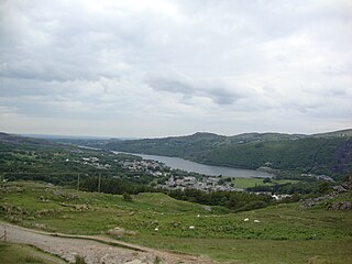
Llanberis is a village, community and electoral ward in Gwynedd, northwest Wales, on the southern bank of the lake Llyn Padarn and at the foot of Snowdon, the highest mountain in Wales. It is a centre for outdoor activities in Snowdonia, including walking, mountaineering, climbing, mountain biking and pony trekking, as well as water sports such as scuba diving. The community includes Nant Peris.

Mostyn is a village and community in Flintshire, Wales, and electoral ward lying on the estuary of the River Dee, located near the town of Holywell. It has a privately owned port that has in the past had a colliery and ironworks and was involved in the export of commodities, and in present times services the offshore wind industry and ships the wings for the Airbus A380 which are manufactured at Broughton.

City of Cessnock is a local government area in the Hunter region of New South Wales, Australia. The area under administration is located to the west of Newcastle. The largest population centre and council seat is the city of Cessnock.

Aberporth is a seaside village, community and electoral ward in Ceredigion, Wales. The population at the 2001 Census, was 2,485, of whom 49 per cent could speak the Welsh language. At the 2011 Census, the population of the community was 2,374 and of the village 1241. Aberporth's beaches have earned Blue Flag status.
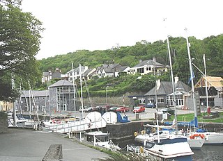
Y Felinheli, formerly known in English as Port Dinorwic, is a village and community beside the Menai Strait between Bangor and Caernarfon in Gwynedd, northwest Wales.

Morfa Nefyn is a village on the northern coast of the Llŷn Peninsula in Gwynedd, Wales. It lies on the crossroads of the B4417 and B4412. The village has seen a rise in popularity as house prices in nearby villages on the Llŷn Peninsula such as Abersoch and Llanbedrog have risen rapidly. Many homes are now holiday homes and a complex of holiday flats has recently been built by the entrance to the beach. The neighbouring town of Nefyn has more in the way of shops and services, and Pwllheli is 7 miles (11 km) on the A497 road.

Cyngor Gwynedd is the governing body for the county of Gwynedd, one of the principal areas of Wales. The council administrates internally using the Welsh language.

The City of Maitland is a local government area in the lower Hunter region of New South Wales, Australia. The area is situated adjacent to the New England Highway and the Hunter railway line.

The City of Newcastle is a local government area in the Hunter region of New South Wales, Australia. The City of Newcastle incorporates much of the area of the Newcastle metropolitan area.

Bellingen Shire is a local government area in the mid north coast region of New South Wales, Australia. The Shire is located adjacent to the Pacific Highway, Waterfall Way and the North Coast railway line.

Singleton Council is a local government area in the Hunter Region of New South Wales, Australia. It is situated adjacent to the New England Highway and the Main North railway line.

Dungog Shire is a local government area in the Hunter region of New South Wales, Australia. The Shire is situated adjacent to the Barrington Tops and consists predominantly of very rugged to hilly country which becomes less rugged from north to south.
Bontnewydd is a small village and community with a population of 1,162 located on the A487 road 1+2⁄3 miles (2.7 km) south of Caernarfon in Gwynedd, Wales, close to the river Gwyrfai, 2 miles (3.2 km) from its outflow into Foryd Bay.
Tal-y-sarn is a village in the slate quarrying Nantlle Valley in Gwynedd, Wales, next to Penygroes. It is part of the community of Llanllyfni and includes some of Llandwrog. The ward had a population of 1,930 at the 2011 census, the built-up area having a population of 1,086.

Llanwddyn is a village and community in Montgomeryshire, Powys, Wales. The community is centred on the Lake Vyrnwy reservoir. The original Llanwddyn village, about 2 miles (3.2 km) northwest, was submerged when the reservoir was created in the 1880s.

Llanrug is a medium-sized village and community in Gwynedd, north-west Wales. It lies about 4 miles (6.4 km) to the east of Caernarfon, 7 miles (11 km) south of Bangor and 3 miles (4.8 km) northwest of Llanberis. It is the largest populated village in the Arfon area of Gwynedd, Wales. The old name of the village was Llanfihangel-y-Rug, derived from Eglwys Sant Mihangel, which is situated about half a mile west of the village.

Bethel is a village in Gwynedd, Wales. It lies east of Caernarfon on the B4366 road. Bethel Primary School is located in the village. The population of Bethel electoral ward was measured in the 2011 Census, and found to be 1,395. The village population is 1,171 with 87.3% having some form of Welsh identity one of the highest figures in the north of Wales.

Deiniol is one of eight electoral wards in the city of Bangor, Gwynedd, Wales, electing councillors to the city and county councils.

Tudno is the name of one of the electoral wards in Llandudno, Conwy County Borough, Wales. It is the middle of the five town wards and covers the town immediately east of the branch line to Llandudno railway station. Mostyn ward lies to the west and Craig-y-Don ward lies to the east, with Llandudno beach to the north.
References
- ↑ "Election Maps GB". Ordnance Survey . Retrieved 26 November 2017.
- ↑ "Arllechwedd: Key Stats". UKcensusdata.com. Retrieved 26 November 2017.
- ↑ Rachel Flint (2 May 2017). "Uncontested council election seats 'mockery of democracy'". BBC News . Retrieved 26 November 2017.
- ↑ "Arllechwedd By-election: 16 June 2011". Gwynedd Council. Retrieved 26 November 2017.
- 1 2 "Welsh Language Change in the percentage of people aged three years or older able to speak Welsh by LSOA 2011 to 2021 | DataMapWales". datamap.gov.wales. Retrieved 2022-12-15.
- ↑ "Welsh language skills (detailed) - Office for National Statistics". www.ons.gov.uk. Retrieved 2022-12-29.