
The Atlas Mountains are a mountain range in the Maghreb in North Africa. It separates the Sahara Desert from the Mediterranean Sea and the Atlantic Ocean; the name "Atlantic" is derived from the mountain range, which stretches around 2,500 km (1,600 mi) through Morocco, Algeria and Tunisia. The range's highest peak is Toubkal, which is in central Morocco, with an elevation of 4,167 metres (13,671 ft). The Atlas Mountains are primarily inhabited by Berber populations.
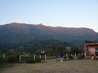
Kalsubai is a mountain in the Western Ghats, located in the Indian state of Maharashtra. Kalsubai is the highest peak in Maharashtra and is located in Ahmednagar district in Akole Taluka. Its summit, situated at an elevation of 1,646 metres (5,400 ft), is the highest point in Maharashtra and hence it is known as the "Everest of Maharashtra".

Toubkal, also Jbel Toubkal or Jebel Toubkal, is a mountain in southwestern Morocco, located in the Toubkal National Park. At 4,167 m (13,671 ft), it is the highest peak in Morocco, the Atlas Mountains, North Africa and the Arab world. Located 63 km (39 mi) south of the city of Marrakesh, and visible from it, Toubkal is an ultra prominent peak, the highest for over 2,000 km (1,200 mi). Toubkal is ranked 27th by topographic isolation.

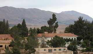
Wadi Rum, known also as the Valley of the Moon, is a valley cut into the sandstone and granite rock in southern Jordan, near the border with Saudi Arabia and about 60 km (37 mi) to the east of the city of Aqaba. With an area of 720 km2 (280 sq mi) it is the largest wadi in Jordan.

Imlil is a small village in the high Atlas Mountains of Morocco. It is 1,800 metres (5,900 ft) above sea level. A portrait of Imlil and the problems and prospects of Morocco's mountain populations appeared in 1984 in the book by James A. Miller called Imlil and published by Westview Press. It is close to the mountain Jebel Toubkal, the highest peak in Northern Africa. Imlil makes a good base for attempting to summit Toubkal as it lies at the end of the tarmac road, and is a natural place to hire mountain guides and mules for the onward trek. Imlil is the centre of mountain tourism in Morocco due to its unique position. From here, 90% of visitors head up to Toubkal, the highest mountain in Morocco.

Aït Benhaddou is a historic ighrem or ksar along the former caravan route between the Sahara and Marrakesh in Morocco. It is considered a great example of Moroccan earthen clay architecture and has been a UNESCO World Heritage Site since 1987.

Bhandardara is a holiday resort village near Igatpuri, in the western ghats of India. The village is located in the Akole tehsil, Ahmednagar district of the state of Maharashtra, about 185 kilometers (115 mi) from Mumbai, 155 kilometers (96 mi) from Ahmednagar and 73 kilometers (45 mi) from Nashik.
Jbel Ayachi is one of the highest mountains in North Africa, and anchors the Eastern High Atlas in central Morocco. Jbel Ayachi rises to a height of 3,757 m above sea level.

Spiti is a high-altitude region of the Himalayas, located in the north-eastern part of the northern Indian state of Himachal Pradesh. The name "Spiti" means "The middle land", i.e. the land between Tibet and India. Spiti incorporates mainly the valley of the Spiti River, and the valleys of several rivers that feed into the Spiti River. Some of the prominent side-valleys in Spiti are the Pin valley and the Lingti valley. Spiti is bordered on the east by Tibet, on the north by Ladakh, on the west and southwest by Lahaul, on the south by Kullu, and on the southeast by Kinnaur. Spiti has a cold desert environment. The valley and its surrounding regions are among the least populated regions of India. The Bhoti-speaking local population follows Tibetan Buddhism.
Vellarimala Hills is a mountain range in Kerala, India, spread across Thiruvambady Panchayat in Kozhikode district and Meppadi Panchayat in Wayanad district.
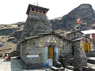
Tungnath Temple (IAST:tuņgnāth) is one of the highest Shiva temples in the world and is the highest of the five Panch Kedar temples located in the Rudraprayag district, in the Indian state of Uttarakhand. The Tungnath mountains form the Mandakini and Alaknanda river valleys. It is located at an altitude of 3,680 m (12,073 ft), and just below the peak of Chandrashila. It has a rich legend linked to the Pandavas, heroes of the Mahabharata epic.
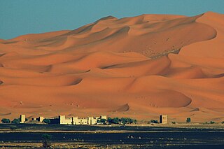
Merzouga is a small village in southeastern Morocco, about 35 km (22 mi) southeast of Rissani, about 55 km (34 mi) from Erfoud and about 50 km (31 mi) from the Algerian border.

The Gobi Desert is a large, cold desert and grassland region located in northern China and southern Mongolia. It is the sixth largest desert in the world. The name of the desert comes from the Mongolian word gobi, used to refer to all of the waterless regions in the Mongolian Plateau; in Chinese, gobi is used to refer to rocky, semi-deserts such as the Gobi itself rather than sandy deserts.

The Jbel Saghro or Djebel Sahrho is a mountain range in south- east Morocco. It is located south of the High Atlas and east of the Anti-Atlas in the northwest of Africa, northeast of Taliouine and southwest of Ouarzazate.
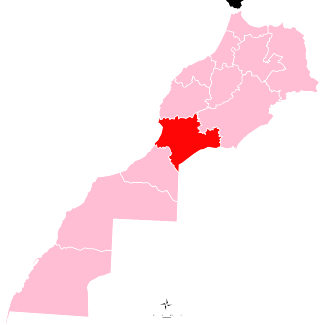
Souss-Massa is one of the twelve regions of Morocco. It covers an area of 51,642 km² and had a population of 2,676,847 as of the 2014 Moroccan census. The capital of the region is Agadir.
Vavul Mala is a peak in the Western Ghats in the Vellarimala range of Kerala, India. It is situated at the trijunction of the districts of Malappuram, Kozhikode, and Wayanad in Kerala. Vavulmala resembles a "Camel Hump". Situated at a height of 2,339m, it is the highest peak in the Western Ghats northwards beyond the Nilgiris and also the highest point of Kozhikode district. These compact hills are floristically similar to Nilgiri hills.
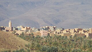
N'Kob is a rural municipality in the Zagora province, in the Atlas Mountains. It is located near the Jbel Saghro and 24 kilometers from Tamsahelte. N'Kob is situated 35 kilometers west of the commune of Tazzarine and 40 kilometers from the intersection with the Draa Valley (Tansikht), the most spectacular stretch of the N9. The village has 45 Kasbahs and is surrounded by two oases full of palm trees, numerous of these ancient kasbahs have now been renovated and became hotels. The most widely spoken language in this region is Shilha (Tamazight). According to results of the 2014 general census of the population and households, the village has a population of about 7,209 people.
Mizane Birhan is a tabia or municipality in the Dogu'a Tembien district of the Tigray Region of Ethiopia. The tabia centre is in Ma’idi village, located approximately 13 km to the southeast of the woreda town Hagere Selam.
Tifnout is a region in Adrar N’Dern or what called High Atlas, located in Tifnout Valley, east Toubkal Mountain, Taroudant Province, in the Souss-Massa region, in the southwest of Morocco.

Lake Ifni is a green lake located in the soil of Toubkal National Park, in the Moroccan Toubkal (commune), deep in the High Atlas mountain range, with a continental climate, and directly overlooked by the highest peak in North Africa, which is the summit of Mount Toubkal. The lake is distinguished by its steep slopes, its location at the end of the valley, its great depth, and its height above sea level, which is about 2,500 meters. It is therefore one of the highest lakes in the world. Its area is about 26 hectares, its length is estimated at 870 meters, and its width is about 490 meters. with a discharge rate of 300 meters per second, and a depth exceeding 30 meters.

