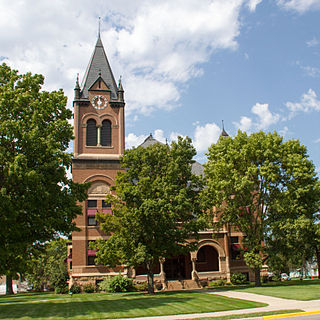
Artichoke Township is a township in Big Stone County, Minnesota, United States. The population was 84 as of the 2000 census. Artichoke is also the name of an unincorporated hamlet within Artichoke Township.

Graceville Township is a township in Big Stone County, Minnesota, United States. The population was 205 as of the 2000 census. Graceville Township took its name from the city of Graceville, which was named for Thomas Langdon Grace, second Roman Catholic Bishop of Saint Paul, Minnesota.

Big Stone Township is a township in Big Stone County, Minnesota, United States. The population was 253 at the 2000 census.
The Artichoke River is a 13.5-mile-long (21.7 km) tributary of the Saint Louis River in northeastern Minnesota in the United States.

Bays Mountain is a ridge of the Ridge-and-Valley Appalachians, located in eastern Tennessee. It runs southwest to northeast, from just south of Knoxville to Kingsport.

WJON is a radio station in St. Cloud, Minnesota airing a News/Talk format. The station is owned by Townsquare Media. Its main competitors are Leighton Broadcasting's KNSI of St. Cloud and WCCO and KTLK of Minneapolis.

WBHR is a sports talk radio station broadcasting on 660 kHz serving the St. Cloud area of Minnesota. The station is owned by Tri-County Broadcasting, and is an affiliate of ESPN Radio and the Chicago Cubs Radio Network. It is the only station in Minnesota to broadcast Chicago Cubs games. The station shares towers with its three other sister stations. There is a total of seven towers at the site.

WVAL is a radio station in St. Cloud, Minnesota airing a classic country format. It airs news on the hour from CBS Radio. The station is owned by Tri-County Broadcasting. WVAL first aired in 1963, went on hiatus in the early 1980's, returning to the airwaves in 1999. The station shares AM towers with its three other sister stations, WMIN, WBHR, and WXYG. There are seven total towers. The call sign is based on owner Herb Hoppe's wife Val.

Westside is an unincorporated community in Fresno County, California. It is located 22 miles (35 km) northeast of Coalinga, at an elevation of 249 feet.

Frink is an unincorporated community in Imperial County, California. It is located on the Southern Pacific Railroad 18 miles (29 km) north-northwest of Calipatria, at an elevation of 171 feet below sea level.
The Nicolum River, formerly Nicolum Creek, is a tributary of the Coquihalla River, rising in the Cascade Mountains and flowing northwest to join that stream near the town of Hope, British Columbia, Canada. Nicolum River Provincial Park is located at the confluence of the two rivers.
Cottonwood Lake is a lake in Grant County and Stevens counties, in the U.S. state of Minnesota.
Big Lake is a lake in Grant County, in the U.S. state of Minnesota.
Pullman Lake is a lake in Grant County, in the U.S. state of Minnesota.
Hart Lake is a lake in Swift County, in the U.S. state of Minnesota.
Artichoke Creek is a stream in Swift County, in the U.S. state of Minnesota.
White Butte is an unincorporated community in Perkins County, in the U.S. state of South Dakota. It is just north of the Grand River National Grassland.

Coesse Corners is an unincorporated community in Union Township, Whitley County, in the U.S. state of Indiana.
Antonia is an unincorporated community in Jefferson County, in the U.S. state of Missouri.


