Arungal

Last updated

Arungal
village
India Tamil Nadu location map.svg
Red pog.svg
Arungal
Location in Tamil Nadu, India
India location map.svg
Red pog.svg
Arungal
Arungal (India)
Coordinates: 11°1′6″N79°6′44″E / 11.01833°N 79.11222°E / 11.01833; 79.11222 Coordinates: 11°1′6″N79°6′44″E / 11.01833°N 79.11222°E / 11.01833; 79.11222
CountryFlag of India.svg  India
State Tamil Nadu
District Ariyalur
Population (2001)
  Total 2,868
Languages
  Official Tamil
Time zone IST (UTC+5:30)
Vehicle registration TN-
Coastline 0 kilometres (0 mi)
Sex ratio 999 /
Literacy 46.24%

Arungal is a village in the Ariyalur taluk of Ariyalur district, Tamil Nadu, India.

Ariyalur taluk is a taluk of Ariyalur district of the Indian state of Tamil Nadu. The headquarters of the taluk is the town of Ariyalur.
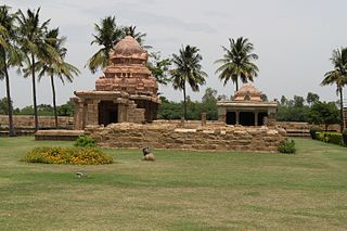
Ariyalur district District in Tamil Nadu, India

Ariyalur district is an administrative district in the state of Tamil Nadu in India. The district headquarters is located at Ariyalur. The district encompasses an area of 1,949.31 km² and had a population of 752,481 As per the 2011 census.

Tamil Nadu State in Southern India

Tamil Nadu is one of the 29 states of India. Its capital and largest city is Chennai. Tamil Nadu lies in the southernmost part of the Indian subcontinent and is bordered by the union territory of Puducherry and the South Indian states of Kerala, Karnataka, and Andhra Pradesh. It is bounded by the Eastern Ghats on the north, by the Nilgiri Mountains, the Meghamalai Hills, and Kerala on the west, by the Bay of Bengal in the east, by the Gulf of Mannar and the Palk Strait on the southeast, and by the Indian Ocean on the south. The state shares a maritime border with the nation of Sri Lanka.

Demographics

As of 2001 census, Arungal had a total population of 2868 with 1435 males and 1433 females. [1]

Related Research Articles

Jayankondam Town in Tamil Nadu, India

Jayankondam is a Second Grade Municipality in Ariyalur district of Tamil Nadu in India. It is also called Jayamkondacholapuram. As of 2011, the town had a population of 33,945.

Sendurai taluk is a taluk of Ariyalur district of the Indian state of Tamil Nadu. The headquarters of the taluk is the town of Sendurai.Thamilselvan T

Ammenabath is a village in the Ariyalur taluk of Ariyalur district, Tamil Nadu, India.

Ariyalur (North) village in Tamil Nadu, India

Ariyalur (North) is a village in the Ariyalur taluk of Ariyalur district, Tamil Nadu, India.

Edayathankudi is a village in the Ariyalur taluk of Ariyalur district, Tamil Nadu, India.

Govindapuram is a village in the Ariyalur taluk of Ariyalur district, Tamil Nadu, India.

Kallankurichi village in Tamil Nadu, India

Kallankurichi is a village in the Ariyalur taluk of Ariyalur district, Tamil Nadu, India.

Kandiratheertham village in Tamil Nadu, India

Kandarathitham is a village in the Ariyalur taluk of Ariyalur district, Tamil Nadu, India.

Karuppilakattalai is a village in the Ariyalur taluk of Ariyalur district, Tamil Nadu, India.

Manjamedu is a village in the Ariyalur taluk of Ariyalur district, Tamil Nadu, India. It is situated on the north bank of the Ponnaiyar River.

Periyanagalur is a village in the Ariyalur taluk of Ariyalur district, Tamil Nadu, India.

Pungankuzhi is a village in the Ariyalur taluk of Ariyalur district, Tamil Nadu, India.

Thirumanur is a village in the Ariyalur taluk of Ariyalur district, Tamil Nadu, India.

Thirumazhapadi is a village in the Ariyalur taluk of Ariyalur district, Tamil Nadu, India.

Vadugapalayam is a village in the Ariyalur Taluk of Ariyalur district, Tamil Nadu, India. The city was part of Perambalu district until 2008 when it became part of the newly formed Ariyalur district.

Asaveerankudikkadu village in Tamil Nadu, India

Asaveerankudikkadu is a village in the Sendurai taluk of Ariyalur district, Tamil Nadu, India.

Devanur village in Tamil Nadu, India

Devanur is a village in the Udayarpalayam taluk of Ariyalur district, Tamil Nadu, India.

References