Shuaib, Shoaib, Shuayb or Shuʿayb is an ancient Midianite Prophet in Islam, and the most revered prophet in the Druze faith. Shuayb is traditionally identified with the biblical Jethro, Moses' father-in-law. Shuaib is mentioned in the Quran a total of 11 times. He is believed to have lived after Abraham, and Muslims believe that he was sent as a prophet to a community: the Midianites, who are also known as the Aṣḥāb al-Aykah, since they used to worship a large tree. To the people, Shuaib proclaimed the straight path and warned the people to end their fraudulent ways. When the community did not repent, God destroyed the community.
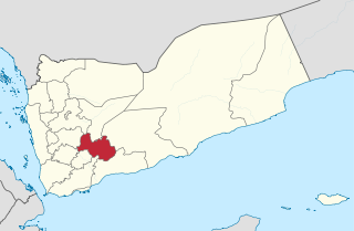
Al Bayda Governorate, also spelt Al-Baidhah or Beida, is one of the governorates (muhafazat) of Yemen. It is located near the centre of the country, around the town of Al Bayda. Its population, according to the 2004 Yemeni census, was 571,778. In 2011, the population was estimated to be 895,000.

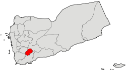
Dhale is one of the Yemeni governorates that was created after the unification of Yemen. The population of the province accounts for 2% of the total population of the republic. The governorate is divided into 9 districts. The city of Dhale is the administrative centre of the province. Dali is one of the governorates that is known for agriculture, and most of the population works in that industry. The most important agricultural crop is coffee. The province also contains mineral resources, most importantly talc, which is used in the manufacture of paper, paint, cosmetics and pesticides. This governorate is also home to the Damt hot-springs (Ḥamam-Damt), a popular tourist attraction. One of the ancient cities in the region is Juban, a city famous for its castle and the historic Mansuria school, built by the Tahrids. The climate in Dhale governorate is mostly temperate throughout the year.

Lahij is a governorate of Yemen.
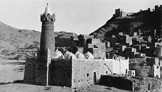
Dhale or Dhala, also spelled Dali and Dhalea and sometimes prefixed with Al or Ad, is the capital town of Dhale Governorate in south-western Yemen. It is located at around 13°41′48″N44°43′51″E, at an elevation of around 1500 metres.
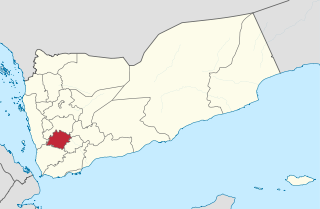
Ibb is a governorate of Yemen. It is located in the inland south of the country with Ta'izz Governorate to the southwest, Ad Dali' Governorate to the southeast, Dhamar Governorate to the north, and short borders with Al Bayda' Governorate to the east and Al Hudaydah Governorate to the west. It has an area of 5,344 km² and a population estimated at around 1,665,000 in 2004, making it the most densely populated governorate in Yemen outside of San'a city. It is the third largest province in Yemen.
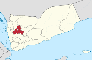
Sanaa, also spelled San'a' or Sana, is a governorate of Yemen. Its capital is Sanaa, which is also the national capital. However, the city of Sanaa is not part of the governorate but instead forms the separate governorate of Amanat Al-Asemah. The Governorate covers an area of 13,850 km2 (5,350 sq mi). As of 2004, the population was 2,918,379 inhabitants. Within this place is Jabal An-Nabi Shu'ayb or Jabal Hadhur, the highest mountain in the nation and the Arabian Peninsula.

Taiz is a governorate of Yemen. The governorate's capital Taiz, the third-largest city in Yemen, is among the most important commercial centres in the country, owing to its proximity to farmland, the Red Sea port of Mocha and Taiz International Airport..
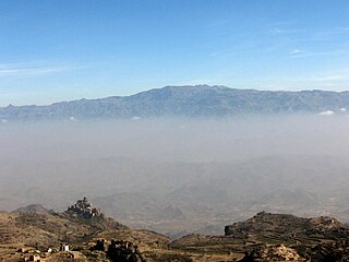
Jabal An-Nabī Shuʿayb, also called Jabal Hadhur, is a mountain of the Harazi subregion of the Sarawat, located in Bani Matar District, Sanaa Governorate, Yemen. It is the highest mountain in the country and the Arabian Peninsula. It is the 62nd most prominent peak in the world, and the third most prominent peak in the Middle East.

The Sarawat Mountains, also known as the Sarat in singular case, is a mountain range in the western part of the Arabian Peninsula. In a broad sense, it runs parallel to the eastern coast of the Red Sea, and thus encompasses the mountains of Fifa', 'Asir, Taif, and the Hijaz. In a narrow sense, the Sarawat start in Taif city in Saudi Arabia, and extend to the Gulf of Aden in the south, running along the entire western coast of Yemen, in what used to be North Yemen, and extend eastwards into part of what used to be South Yemen, thus running parallel to the Gulf of Aden.

Jabal Haraz is a mountainous region of Yemen, between Sanaa and Al-Hudaydah, which is considered to be within the Sarat range. In the 11th century, it was the stronghold of the Sulaihid dynasty, many of whose buildings still survive today. It includes Jabal An-Nabi Shu'ayb, the highest mountain in Yemen and the Arabian Peninsula.
Radman is a small village in Al Haymah Ad Dakhiliyah District of Sanaa Governorate, Yemen. It is located on the mountain of the same name, near Jabal An-Nabi Shu'ayb.
Dhale District is a district of the Dhale Governorate, Yemen. As of 2003, the district had a population of 80,213 inhabitants.
Wusab Al Ali District is a district of the Dhamar Governorate, Yemen. As of 2003, the district had a population of 164,223 inhabitants. It is one of the largest districts of Dhamar Governorate, covering an area of 592 square kilometers, and is characterized by high mountains. As of 2019, it has a population of 275,137. It is part of the historical and geographical region of Wusab.
Al Maafer District is a district of the Taiz Governorate, Yemen. As of 2003, the district had a population of 110,924 inhabitants.
Al-Mawasit District is a district of the Taiz Governorate, Yemen. As of 2003, the district had a population of 115,857 inhabitants.

Bani Matar District is a district of the Sanaa Governorate, Yemen. As of 2003, the district had a population of 100,012 inhabitants.
The Battle of Dhale was a key fight in 2015 for control of Dhale, Yemen, between the Houthis and Yemen Army units loyal to Ali Abdullah Saleh on one side, and militiamen and Yemen Army units loyal to Abd Rabbuh Mansur Hadi on the other side.
Bayt Shuʽayb is a village in Bani Matar District of Sanaa Governorate, Yemen. It is located on the eastern part of Jabal An-Nabi Shu'ayb.
Harir Mountain is located in Yemen, and is one of the largest mountains in Dhale Governorate. The name of Harir Mountain is mentioned in Al-Hamdani's "Description of the Arabian Peninsula" book. Also in "The History of Yemeni Tribes" by Hamza Ali Luqman. Also mentioned by many Yemeni and Arab historians and writers, as well as in history and geography school textbooks. Harir Mountain is located in the east of Dhale governorate and within the administrative division of Al Hussein District. It's 20 kilometers from Dhale, and it is a mountain range that extends from Naqil (Al-Maadi) to the south, until Zahert Al-Atry to the north. Small mountains, rocky outcrops, valleys, and reefs branch off from it, as well as deep abysses to the west and east. The mountain range ends at Al-Hamayer and Al-Hasswa and Seelat Ghafinah in Shaka Valley near Aqram Mountain and at Lakmat El-Nub, Seelat Hamam, and EL-Haza to the west. And the village of Adina Wahid Ali which overlooks Murat Valley and Adina to the east. Harir Mountain is bordered from the south and east by Halimayn District. And from the north is the Shuaib district, and to the west is Shaka, Khella, Al-Hussein, and Al-Sha'ari land. Its altitude is 7800 feet above sea level. At the top of the mountain, there is a flat area on which villages have been built and residences have been constructed, interspersed with valleys and green agricultural terraces.

