Wellington is the capital city of New Zealand. It is located at the south-western tip of the North Island, between Cook Strait and the Remutaka Range. Wellington is the third-largest city in New Zealand by metro area, and is the administrative centre of the Wellington Region. It is the world's southernmost capital of a sovereign state. Wellington features a temperate maritime climate, and is the world's windiest city by average wind speed.

A cherry blossom, also known as Japanese cherry or sakura, is a flower of many trees of genus Prunus or Prunus subg. Cerasus. They are common species in East Asia, including China, Korea and especially in Japan. They generally refer to ornamental cherry trees, not to be confused with cherry trees that produce fruit for eating. It is considered the national flower of Japan.

The Dominion Post is a metropolitan daily newspaper published in Wellington, New Zealand. It is owned by media business Stuff Ltd, formerly the New Zealand branch of Australian media company Fairfax Media. Weekday issues are now in tabloid format, and its Saturday edition is in broadsheet format.

Silverstream is a suburb of Upper Hutt in New Zealand, just under 7 km south-west of the Upper Hutt CBD. It is in the lower (southern) part of the North Island of New Zealand at the southern end of Upper Hutt, close to the Taitā Gorge, which separates Upper Hutt from Lower Hutt. The area is sited at the mouth of a small valley formed by the Wellington Region's tectonic activity and, in part, by Hull's Creek, which discharges into the Hutt River.

Stuff Ltd is a privately held news media company operating in New Zealand. It operates Stuff, the country's largest news website, and owns nine daily newspapers, including New Zealand's second and third-highest circulation daily newspapers, The Dominion Post and The Press, and the highest circulation weekly, Sunday Star-Times. Magazines published include TV Guide, New Zealand's top-selling weekly magazine. Stuff also owns social media network Neighbourly.

Avalon is a suburb of Lower Hutt in New Zealand, formed as a private residential development in the 1970s on land formerly occupied by market-gardens on the left (eastern) bank of the Hutt River. It features mostly California-inspired designed houses, often split-level, with 3 or 4 bedrooms. It also features one of the biggest park/playground in Lower Hutt

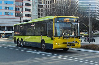
The Wellington Region has a well developed public transport system, the most used in New Zealand. It consists of electric and diesel buses, commuter trains, ferries and a funicular. It also included trams until 1964 and trolleybuses until 2017.
Wellington Regional Council, branded as Greater Wellington Regional Council, is the regional council overseeing the Wellington Region of New Zealand's lower North Island. It is responsible for public transport under the brand Metlink, environmental and flood protection, and the region's water supply.

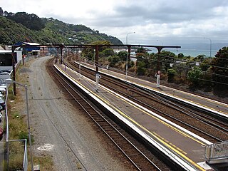
Kaiwharawhara railway station, a former railway station on the North Island Main Trunk and the Wairarapa Line in Wellington in New Zealand, closed in 2013. It was the first station north of Wellington, serving the early suburb of Kaiwharawhara. Prior to its closure it was served by trains operated by Tranz Metro as part of the Metlink network on the Melling Line, the Hutt Valley Line and the Kapiti Line.

The Hutt Valley Line is the electrified train service operated by Transdev Wellington on behalf of Metlink on the section of the Wairarapa Line railway between Wellington and Upper Hutt, New Zealand.

Upper Hutt railway station is a suburban railway station serving central Upper Hutt, New Zealand. The station is on the Wairarapa Line, 32.4 km (20.1 mi) north of Wellington, and is served by Transdev Wellington on behalf of the Greater Wellington Regional Council. The station is the northern terminus for the electrified Hutt Valley Line to and from Wellington. The diesel-hauled Wairarapa Connection stops at Upper Hutt on its route between Wellington and Masterton.

Kaitoke Regional Park is regional park located at Kaitoke, northeast of Upper Hutt, in the Wellington Region of New Zealand's southern North Island. It is administered by Wellington Regional Council, alongside the adjacent regional park of Hutt Water Collection Area.
Trentham Racecourse is the main thoroughbred horse racecourse for the Wellington city area in New Zealand. It is located in the suburb of Trentham in Upper Hutt, next to Trentham Military Camp.

Ava railway station is a suburban railway station serving parts of Petone and Alicetown in Lower Hutt, New Zealand. It is located in a residential area bordering these two suburbs, 12.5 km (7.8 mi) north of Wellington, and is part of the Hutt Valley Line. Services are operated by Transdev Wellington on behalf of the Greater Wellington Regional Council. Trains stopping at Ava run to Wellington, Taitā and Upper Hutt.

Melling railway station is the terminal station on the single track Melling Line in Lower Hutt, New Zealand. The single platform station serves the suburb of Melling. The station is served by Metlink's electric multiple unit trains.
The Wellington Heritage Multiple Unit Preservation Trust (WHMUPT) was formed to preserved D 2130, DM 556 and D 2411 or otherwise known as the "Cyclops" EMU set. The trust is based at Maymorn near the Rimutaka Incline Railway Heritage Trust (RIRHT). The set was purchased in January 2013 and arrived at their base on 21 April the same year. One trailer from this unit has been used as a passenger carriage by the RIRHT for their operational running days, and is stored undercover. Minimal conservation work has been done to the rest of the set which is stored outside.
State Highway 58 (SH 58) is a New Zealand state highway in the Wellington Region linking the Hutt Valley to Porirua City.

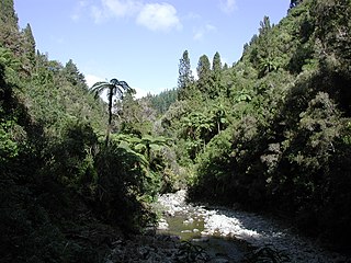
Akatarawa Forest is a regional park in the Upper Hutt within the Wellington Region at the southern tip of the North Island of New Zealand. It encompasses 15,000 hectares of native and plantation forest. It includes the headwaters of the Maungakotukutuku Steam, Akatarawa River West and the Whakatīkei River.
The Wellington Naturist Club is a naturist resort located in Te Mārua, Upper Hutt, 38 kilometres (24 mi) northeast of Wellington in the North Island of New Zealand. Its 4.7 hectares of land hold facilities including a miniature golf course, volleyball court, picnic areas, spa and sauna, and extensive rhododendron gardens, with a large hall for a clubhouse. For accommodation, the resort has four lodges and over 150 campsites. The Club was founded in 1950, under the name "Wellington Sun and Health Society".

The Cannon Point Walkway is a hiking trail in the Akatarawa Forest on the western side of the Hutt Valley in the North Island of New Zealand. The walkway is a loop of 7.7 kilometres (4.8 mi) in length, ascending to the Cannon Point trig at 341 metres (1,119 ft), and with a total elevation gain of 304 metres (997 ft). The portion of the track through the Akatarawa Forest Park is maintained by the Greater Wellington Regional Council.


