Related Research Articles

Yafford is a hamlet on the Isle of Wight. It is located 6 miles (9.7 km) southwest from Newport in an area known as the Back of the Wight between Brighstone and Niton. It is in the civil parish of Shorwell. It has a non-operational water mill, which was working until 1970 and is now a listed building. The mill was a grist mill, working to grind corn to create animal feed; it did not have the machinery to produce fine flour for people. It has an overshot water wheel, powered by the flow of water from a millpond. The pond is fed by a stream from the nearby village of Shorwell, part of the Buddle Brook. The name Yafford derives from the Anglo-Saxon word "hæcc" meaning a hatch or sluice and the word "ford"; probably referring to grating used to stop animals being carried away by the current in a river.


Foreland or Forelands, and the adjacent Foreland Fields, is the easternmost point of the Isle of Wight, part of the village of Bembridge. It is located about 6.5 miles due south of the city of Portsmouth on the British mainland, separated by the eastern reaches of the Solent. It is characterised by a pub called the Crab and Lobster Inn and various beach huts plus a beach cafe and a coast guard lookout. In the sea are the reefs of Bembridge Ledge which is rich in edible crabs, lobsters and spider crabs and shoals of mackerel. In the Crab & Lobster Inn are photographs of the many shipwrecks, which included the submarine HMS Alliance, now a museum ship at Gosport and the First World War troopship the S.S. Mehndi carrying troops from South Africa, with great loss of life.
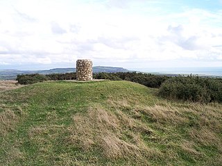
Brighstone Down is a chalk down on the Isle of Wight. It is located close to the village of Brighstone, in the southwest of the island, and rises to 214 metres (702 ft) at its highest point, northeast of the village of Mottistone. Towards the west part is called Mottistone Down, to the East, Shorwell Down.
Little Atherfield is a small settlement in the civil parish of Shorwell, on the Isle of Wight, England. It is near the coast in the Back of the Wight. The Isle of Wight is situated off the south coast of England.

Atherfield is a rural location in the south west of the Isle of Wight, UK. It includes the small settlements of Atherfield Green and Little Atherfield, as well as several farms, and is set in largely open farmland. To the south west it is bounded by the cliffs of Chale Bay and Brighstone Bay, which are divided by Atherfield Point. The south-eastern part of Brighstone Bay is also sometimes known as Atherfield Bay, and was the site of a former holiday camp, now demolished.

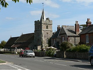
Brighstone is a village and civil parish on the Isle of Wight, 6 miles southwest of Newport on the B3399 road. Brighstone was previously known as "Brixton". The name derives from the Saxon name "Ecgbert's Tun".

Limerstone is a hamlet on the Isle of Wight in England. It is located on the B3399 road between Brighstone and Shorwell, approximately 5 miles (8km) southwest of Newport. Public transport is provided by Southern Vectis buses on route 12. The hamlet features around 25 houses and a farm, called Limerstone Farm.

Shepherd's Chine is a geological feature on the south west coast of the Isle of Wight, England. It lies to the west of the village of Little Atherfield.

Cowleaze Chine is a geological feature on the south west coast of the Isle of Wight, England. It lies to the west of the village of Little Atherfield.

Chale Bay is a bay on the south-west coast of the Isle of Wight, England. It lies to the west of the village of Chale from which it takes its name. It faces south-west towards the English Channel, its shoreline is 3+1⁄4 miles (5.2 km) in length and is gently curving. It stretches from Artherfield Point in the north-west to Rocken End in the south-east.
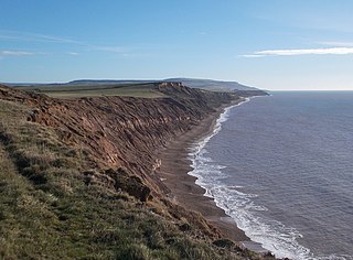
Brighstone Bay is a bay on the south west coast of the Isle of Wight, England. It lies to the south and west of the village of Brighstone from which it takes its name. It faces south west towards the English Channel, its shoreline is 7 km in length and is gently curving. It stretches from Sudmoor Point in the north west to Artherfield Point in the south east.

Buddle Brook a small river on the Isle of Wight, England. The Brook drains water from the southern side of Brighstone Down and as far to the east as the village of Shorwell. Its flow is the greatest of the streams in the South-West of the Island. Near the village of Brighstone its body is split into a series of mill ponds built to power Yafford Mill and Brighstone Mill, and controlled ways passing through the village and under the noted local landmark, the Dragon Tree Brighstone. Beyond the village the stream is re-connected into one and flows into Grange/Marsh Chine. These are heavily vegetated and are the largest chine on the Island. The Brook runs all the way to the beach where its mouth is at least 4 m wide. Once the stream reaches the pebble beach it soaks in and disappears.

Back of the Wight is an area on the Isle of Wight in England. The area has a distinct historical and social background, and is geographically isolated by the chalk hills, immediately to the North, as well as poor public transport infrastructure. Primarily agricultural, the Back of the Wight is made up of small villages spread out along the coast, including Brighstone, Shorwell and Mottistone.

Thorncross is a small hamlet in the South West of the Isle of Wight, England.. It is located near the hamlets of Yafford, Limerstone and the village of Brighstone.
SS Eider was a 4,179 ton German ocean liner built for Norddeutscher Lloyd in 1884 by John Elder & Co. of Glasgow as the fourth ship in the Rivers class. She had four masts and was a two-funnelled steamer 430 feet (130 m) long, with a crew of 167, and capable of carrying 1,204 passengers. However, she had a short service history, being lost in what is remembered as one of the most impressive and memorable shipwrecks on the coast of the Back of the Wight, a region on the Isle of Wight, England.

The SS Espagne was a Belgian cargo ship that was torpedoed by the Imperial German Navy submarine SM UC-71 in the English Channel off St. Catherine's Point, Isle of Wight, United Kingdom while she was travelling from Le Havre, France to Newport, Monmouthshire, United Kingdom.

SS Ultonia was a British passenger-cargo vessel built in 1898 in Wallsend-on-Tyne by C. S. Swan & Hunter. It was sunk by a German torpedo in 1917.