Athikottai

Last updated

Athikottai
Village
India Tamil Nadu location map.svg
Red pog.svg
Athikottai
Location in Tamil Nadu, India
India location map.svg
Red pog.svg
Athikottai
Athikottai (India)
Coordinates: 10°37′58.6″N79°24′26.7″E / 10.632944°N 79.407417°E / 10.632944; 79.407417 Coordinates: 10°37′58.6″N79°24′26.7″E / 10.632944°N 79.407417°E / 10.632944; 79.407417
CountryFlag of India.svg  India
State Tamil Nadu
District Tiruvarur
Taluk Mannargudi
Population
 (2001)
  Total1,100
Languages
  Official Tamil
Time zone UTC+5:30 (IST)
PIN
614014
Telephone code04367
Vehicle registration TN-50
Coastline75 kilometres (47 mi)
Nearest cityTiruchirappalli (Region)
Literacy90%
Lok Sabha constituencyThanjavur
Climate 15 - 38 (Köppen)
Avg. summer temperature38 °C (100 °F)
Avg. winter temperature20 °C (68 °F)

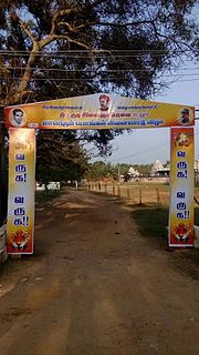
Athikkottai is a village in the Mannargudi taluk of Tiruvarur district in Tamil Nadu, India. The main activities of this village is Agriculture.

Mannargudi taluk is a taluk in Thiruvarur district of the Indian state of Tamil Nadu. The headquarters of the taluk is the town of Mannargudi.

Tiruvarur district District in Tamil Nadu, India

Thiruvarur district is one of the 37 districts in the Tamil Nadu state of India. The district occupies an area of 2161 km². It lies between Nagapattinam district on the east and Thanjavur District on the west, and is bounded by the Palk Strait on the south. The district headquarters is at Thiruvarur town. As of 2011, the district had a population of 1,264,277 with a sex-ratio of 1,017 females for every 1,000 males.

Tamil Nadu State in Southern India

Tamil Nadu, is one of the 29 states of India. Its capital and largest city is Chennai. Tamil Nadu lies in the southernmost part of the Indian subcontinent and is bordered by the union territory of Puducherry and the South Indian states of Kerala, Karnataka, and Andhra Pradesh. It is bounded by the Eastern Ghats on the north, by the Nilgiri Mountains, the Meghamalai Hills, and Kerala on the west, by the Bay of Bengal in the east, by the Gulf of Mannar and the Palk Strait on the southeast, and by the Indian Ocean on the south. The state shares a maritime border with the nation of Sri Lanka.

Demographics

As per the 2001 census, Athikkottai had a population of 1,110 with 555 males and 555 females. The sex ratio was 1000. The literacy rate was 75.91%.

Related Research Articles

A town panchayat or panchayat is a small town of approximately 20,000 to 25,000 inhabitants. It is formed under the panchayati raj administrative system. In census data, the abbreviation T.P. is used to indicate a "town panchayat". Tamil Nadu was the first state to introduce the panchayat town as an intermediate step between rural villages and urban local bodies (ULB).

Injambakkam neighbourhood in Tamil Nadu, India

Injambakkam is a locality in the south of Chennai in the Indian state of Tamil Nadu. Being a part of the Walajabad block of the district, its panchayat is part of Walajabad panchayat union. Injambakkam is located along the ECR.

Kaliyakkavilai city in Tamil Nadu, India

Kaliyakkavilai is a panchayat town in Kanniyakumari district in the Indian state of Tamil Nadu, close to the Tamil Nadu-Kerala border. It lies on Coimbatore-Kochi-Trivandrum-Kanyakumari National highway 47.

Puzhal Neighbourhood in Chennai district, Tamil Nadu, India

Puzhal is a town in Chennai district in the Indian state of Tamil Nadu. The town is well known for Puzhal central prison. Puzhal is located on the banks of Puzhal Lake.

According to the 2011 Census of India, the total population of the state of Tamil Nadu stood at 72,147,039, with 36,137,975 males, 36,009,055 females, a sex ratio of 996 females per 1000 males, literacy rate of 80.09%, 10.51% of the population below seven years and a population density of 555.

Uthukottai town in Tamil Nadu, India

Uthukottai is a border town and panchayat town in Tamil Nadu, next to Andhra Pradesh, located on the banks of the Arani river. The town features a channel which helps to direct water from the Krishna river for local irrigation.

Puthagaram is a village in Tamil Nadu, India. Here ancient Sri Maha kaliamman Temple is located.

Athikkottai village in Tamil Nadu, India

Athikkottai is a village located 3 km from Pattukkottai town in Thanjavur district in Tamil Nadu state in India, en route to pattukottai via Madukkur.It is one of 36 villages of the Musugundan Community.

Papanasam taluk is a taluk of Thanjavur district of the Indian state of Tamil Nadu. The headquarters of the taluk is the town of Papanasam.

Poondi, Thiruvallur district village in Tamil Nadu, India

Poondi is a village in the Thiruvallur taluk of Tiruvallur district, Tamil Nadu, India. It has a has fresh water lake to cater the daily needs of water for Chennai area. The place is also known for Oondreswarar Temple, which was displaced to its current location to ease the construction of the reservoir.

Devanur village in Tamil Nadu, India

Devanur is a village in the Udayarpalayam taluk of Ariyalur district, Tamil Nadu, India.

Vembukudi is a village in the Papanasam taluk of Thanjavur district, Tamil Nadu, India.

Thittakudi, Thanjavur district village in Tamil Nadu, India

Thittakudi is a village in the Pattukkottai taluk of Thanjavur district, Tamil Nadu, India.

Koollu is a village in the Hosur taluk of Krishnagiri district, Tamil Nadu, India.

Kilakalkandarkottai is a village in Tiruchirappalli taluk of Tiruchirappalli district in Tamil Nadu, India.

Kumbakudy is a village in Tiruchirappalli taluk of Tiruchirappalli district in Tamil Nadu, India.

Natarajapuram is a village in Tiruchirappalli taluk of Tiruchirappalli district in Tamil Nadu, India.

Vadamadurai, Chennai village in Tamil Nadu, India

Vadamadurai is a panchayat village in Thiruvallur district in the Indian state of Tamil Nadu.

Puduvoyal Suburb in Tiruvallur, Tamil Nadu, India

Puduvoyal is a village panchayat located in the Thiruvallur district of Indian state of Tamil Nadu.

Kalpalayam Village in Tamil Nadu, India

Kalpalayam is a village located in the Manachanallur taluk of the Tiruchirappalli district of the Indian state Tamil Nadu. It is situated 3 km away from taluk headquarter Manachanallur and 15 km away from district headquarter Tiruchirappalli.

References