Related Research Articles

Van Nuys is a neighborhood in the central San Fernando Valley region of Los Angeles, California. Home to Van Nuys Airport and the Valley Municipal Building, it is the most populous neighborhood in the San Fernando Valley.

Sunset Boulevard is a boulevard in the central and western part of Los Angeles, California, that stretches from the Pacific Coast Highway in Pacific Palisades east to Figueroa Street in Downtown Los Angeles. It is a major thoroughfare in the cities of Beverly Hills and West Hollywood, as well as several districts in Los Angeles.

Chatsworth is a suburban neighborhood in the City of Los Angeles, California, in the San Fernando Valley.

West Hills is a suburban / residential community in the western San Fernando Valley region of the City of Los Angeles, California. The percentage of residents aged 35 and older is among the highest in Los Angeles County.
Mid-Wilshire is a neighborhood in the central region of Los Angeles, California. It is known for the Los Angeles County Museum of Art, the Petersen Automotive Museum, and the Miracle Mile shopping district.

City Terrace is an unincorporated area of East LA, in Los Angeles County, California, east of Downtown Los Angeles. It contains City Terrace Elementary School, Robert F. Kennedy Elementary School, Esteban Torres High School, Harrison Elementary School, William R. Anton Elementary School, Hammel Street Elementary School, Anthony Quinn Library, City Terrace Library, and City Terrace Park. It is part of the Census-designated place of East Los Angeles.
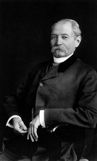
James Robert Toberman served six one year terms as Mayor of Los Angeles. He first served between 1872 and 1874 and again from 1878 to 1882. Mayor James R Toberman switched on the city's first electric streetlights. He helped map out the first street car grid and water and sewer systems. Toberman came to Los Angeles in 1864 when president Abraham Lincoln appointed him U.S. Revenue Assessor.
Huntington Park High School is a public high school in Huntington Park, California, part of the Los Angeles Unified School District.
Los Angeles Street, originally known as Calle de los Negros or Alley of the Black People, is a major thoroughfare in Downtown Los Angeles, California, dating back to the origins of the city as the Pueblo de Los Ángeles.
Spring Street in Los Angeles is one of the oldest streets in the city. Along Spring Street in Downtown Los Angeles, from just north of Fourth Street to just south of Seventh Street is the NRHP-listed Spring Street Financial District, nicknamed Wall Street of the West, lined with Beaux Arts buildings and currently experiencing gentrification. This section forms part of the Historic Core district of Downtown, together with portions of Hill, Broadway, Main and Los Angeles streets.

El Pueblo de Los Ángeles Historical Monument, also known as Los Angeles Plaza Historic District and formerly known as El Pueblo de Los Ángeles State Historic Park, is a historic district taking in the oldest section of Los Angeles, known for many years as El Pueblo de Nuestra Señora la Reina de los Ángeles del Río de Porciúncula. The district, centered on the old plaza, was the city's center under Spanish (1781–1821), Mexican (1821–1847), and United States rule through most of the 19th century. The 44-acre park area was designated a state historic monument in 1953 and listed on the National Register of Historic Places in 1972.

The North University Park Historic District is a historic district in the North University Park neighborhood of Los Angeles, California. The district is bounded by West Adams Boulevard on the north, Magnolia Avenue on the west, Hoover Street on the east, and 28th Street on the south. The district contains numerous well-preserved Victorian houses dating back as far as 1880. In 2004, the district was added to the National Register of Historic Places.
The North Lake Line was a local Pacific Electric Railway route serving Pasadena until 1941.

South Los Angeles, also known as South Central Los Angeles or simply South Central, is a region in southwestern Los Angeles County, lying mostly within the city limits of Los Angeles, south of downtown. It is "defined on Los Angeles city maps as a 16-square-mile rectangle with two prongs at the south end.” In 2003, the Los Angeles City Council renamed this area "South Los Angeles".
Los Angeles City Council District 11 is one of the 15 districts of the Los Angeles City Council, representing the Westside of the city to the Pacific Ocean. Traci Park is the district's current representative on the City Council.

Northwest Los Angeles or Northwest of Downtown is a group of neighborhoods near the central area of Los Angeles, California that are north and west of the city center of Los Angeles, California. This name for the area has been in use off and on for over 100 years, originally applying to Angelino Heights and gradually shifting northwesterly as those areas were built out.
Fiesta Park was a grandstand and sports and entertainment venue in South Park, Los Angeles, California. From 1894 to 1916, it served as venue for various exhibitions and festivals, as well as a field for USC Trojans football games.

Harris & Frank was a clothing retailer and major chain in the history of retail in Southern California, which at its peak had around 40 stores across Southern California and in neighboring states and regions. Its history dates back to a clothing store founded by Leopold Harris in Los Angeles in 1856 near the city's central plaza, only eight years after the city had passed from Mexican to American control. Herman W. Frank joined Harris in partnership 32 years later in 1888.
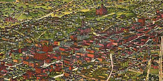
The late-Victorian-era Downtown of Los Angeles grew year by year, around 1880 centered at the southern end of the Los Angeles Plaza area, and over the next two decades, extending south and west along Main Street, Spring Street, and Broadway towards Third Street. Most of the 19th-century buildings no longer exist, surviving only in the Plaza area or south of Second Street. The rest were demolished to make way for the Civic Center district with City Hall, numerous courthouses, and other municipal, county, state and federal buildings, and Times Mirror Square. This article covers that area, between the Plaza, 3rd St., Los Angeles St., and Broadway, during the period 1880 through the period of demolition (1920s–1950s).