
KwaZulu-Natal is a province of South Africa that was created in 1994 when the Zulu bantustan of KwaZulu and Natal Province were merged. It is located in the southeast of the country, enjoying a long shoreline beside the Indian Ocean and sharing borders with three other provinces, and the countries of Mozambique, Eswatini and Lesotho. Its capital is Pietermaritzburg, and its largest city is Durban. It is the second-most populous province in South Africa, with slightly fewer residents than Gauteng.

Durban, nicknamed Durbs, is the third most populous city in South Africa after Johannesburg and Cape Town and the largest city in the South African province of KwaZulu-Natal. Durban forms part of the eThekwini Metropolitan Municipality, which includes neighboring towns and has a population of about 3.44 million, making the combined municipality one of the largest cities on the Indian Ocean coast of the African continent. Durban was one of the host cities of the 2010 FIFA World Cup.

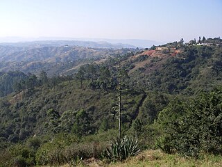
Howick is a town located in the uMgungundlovu District Municipality of KwaZulu-Natal Province, South Africa. The town is 1050 m above sea level, and about 88 kilometres from the port city of Durban. It enjoys warm summers and cool dry winters. A snappy chill descends upon Howick when snow falls on the nearby Drakensberg. The town is located on the N3 freeway, connecting it with the rest of South Africa.

The Durban Ring Road is a half ring road that circles the costal city of Durban, South Africa. It consists fully of the N2 highway which links the North and South Coasts of KwaZulu-Natal, with the main link to the city being provided by the N3.
Kingsmead is a cricket ground in Durban, KwaZulu-Natal, South Africa. Its stated capacity is 25,000, although grass terracing makes up part of the viewing area. The 'end names' are the Umgeni End (north) and the Old Fort Road End (south). It is the home ground of the KwaZulu-Natal Dolphins.

Tongaat is a town in KwaZulu-Natal, South Africa, about 40 kilometres (25 mi) north of Durban and 28 kilometres (17 mi) south of KwaDukuza. It now forms part of eThekwini Metropolitan Municipality, or Greater Durban area. The King Shaka International Airport is 8 kilometres (5.0 mi) road. The R102 is a thoroughfare through the town from KwaDukuza and Ballito in the north to Verulam in the south. Its population is mostly people of Indian descent. The area is home to the oldest Indian community in South Africa, having been where the first indentured Indian laborers settled in 1860 to work in the sugar-cane plantations. Much of the architectural style in the town was the work of Ivan Mitford-Barberton, and many buildings are in the Cape Dutch style of architecture.

The Umgeni River or Mgeni River is a river in KwaZulu-Natal, South Africa. It rises in the "Dargle" in the KZN Midlands, and its mouth is at Durban, some distance north of Durban's natural harbour. The name is taken to mean "the river of entrance" in Zulu, though other meanings have been proposed.
The Valley of a Thousand Hills is a valley between Pietermaritzburg, and Durban, South Africa. There the Umgeni River meets the Msunduzi River in the valley, and the Dusi Canoe Marathon is run through the area every year
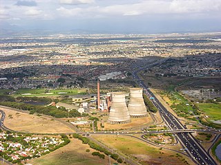
Athlone is a suburb of Cape Town located to the east of the city centre on the Cape Flats, south of the N2 highway. Two of the suburb's main landmarks are Athlone Stadium and the decommissioned coal-burning Athlone Power Station. Athlone is mainly residential and is served by a railway station of the same name. It however includes industrial and commercial zones. There are many "sub-areas" within Athlone, including Gatesville, Rylands, Belgravia Estate, Bridgetown and Hazendal. Colloquially other areas around Athlone are also often included in the greater Athlone area even though the City of Cape Town might classify them as separate neighborhoods such as Rondebosch East, Crawford, and Manenberg.
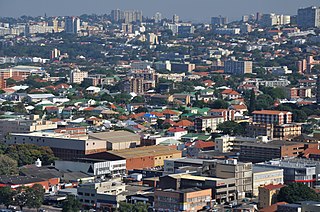
Chatsworth is a large township created by the apartheid government in the 1950s to segregate the Indian population and create a buffer between the white suburbs to the north and the black townships to the south. Located in the South Durban basin and roughly bordered by the Umhlatuzana River in the North and Umlaas River in the south, the suburb is made up mainly of Indian and Black people.

Durban North is an area to the north of Durban in the eThekwini Metropolitan Municipality, KwaZulu-Natal, South Africa. Durban North lies between the N2 freeway and the eastern seashore, with the Umgeni River forming its southern boundary. It has residential suburbs that are some of Durban's most affluent and is flanked by La Lucia in the north.

Kings Park Sporting Precinct is a site located in Stamford Hill, Durban, KwaZulu Natal, South Africa. It was developed primarily to host the 2010 FIFA World Cup, but will also form part of the city's long term plan to host the Summer Olympics. The precinct regularly hosts domestic and international rugby union and association football events, as well as national and international swimming galas.

The Umgeni Steam Railway is a 3 ft 6 in gauge heritage railway at Inchanga, near Durban. The Durban to Pietermaritzburg line was built in the 1880s; it runs through a 53 metres (174 ft) long tunnel at Drummond built in 1878, which is probably the oldest tunnel in use today in South Africa
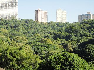
Burman Bush is a nature reserve in Morningside, Durban, situated some 8 km north of the CBD. At about 50 hectares it constitutes a small circular enclave of coastal forest which forms part of the Durban Municipal Open Space System (D'MOSS). It is the northern remnant of a forest that once covered much of the Berea ridge. The reserve's elevation varies from 19 to 133 m a.s.l.
Morningside is a suburb of Durban, KwaZulu-Natal, South Africa.

The Umgeni River Bird Park is a bird zoo located in Durban, in the province of KwaZulu-Natal, South Africa.

The Natal Railway 0-4-0WTNatal of 1860 was a South African steam locomotive from the pre-Union era in the Natal Colony.

The Natal Railway 0-4-0STDurban of 1865 was a South African steam locomotive from the pre-Union era in the Natal Colony.

Beachwood Mangroves Nature Reserve is located at the mouth of the Umgeni River in Durban North, a suburb of Durban, South Africa. The nature reserve, proclaimed in 1977, protects 76 hectares of a natural estuarine system, and was declared a national monument in 1980.

Umgeni Park is a residential area in northern Durban, KwaZulu-Natal, South Africa. Together with its neighbouring Durban North suburb of Athlone, the area is also known as Riverside, due to its location along the northern banks of the Umgeni River. The area is marked by its cluster developments and townhouse complexes, as well as free standing homes. On the western boundary of the suburb is the Briardene Informal Settlement and the Umgeni Park light industrial area.