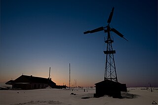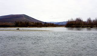
Pevek is an Arctic port town and the administrative center of Chaunsky District in Chukotka Autonomous Okrug, Russia, located on Chaunskaya Bay on a peninsula on the eastern side of the bay facing the Routan Islands, above the Arctic Circle, about 640 kilometers (400 mi) northwest of Anadyr, the administrative center of the autonomous okrug. Population: 4,015 (2021 Census); 4,162 (2010 Census); 5,206 (2002 Census); 12,915 (1989 Soviet census).

Billings is a rural locality in Iultinsky District of Chukotka Autonomous Okrug, Russia. The population is 211 (2010 Census); municipally, it is incorporated as Billings Rural Settlement in Chaunsky Municipal District.

Chaunsky District is an administrative and municipal district (raion), one of the six in Chukotka Autonomous Okrug, Russia. It is located on the northern shore of the autonomous okrug and borders with Iultinsky District in the northeast, Anadyrsky District in the southeast, and with Bilibinsky District in the south and west. The area of the district is 67,091 square kilometers (25,904 sq mi). Its administrative center is the town of Pevek. Population: 5,148 (2010 Census); 6,962 (2002 Census); 32,167 (1989 Soviet census). The population of Pevek accounts for 80.8% of the district's total population.

Beringovsky District was an administrative district (raion) of Chukotka Autonomous Okrug, Russia, which existed in 1957–2011. As a municipal division, it was, together with Anadyrsky Administrative District, incorporated as Anadyrsky Municipal District. It was located on the southeastern shores of the autonomous okrug and bordered with Anadyrsky District in the west and the Bering Sea in the east. Its administrative center was the urban locality of Beringovsky. Population: 2,501 (2010 Census); 3,162 (2002 Census); 8,968 (1989 Soviet census). The area of the district was 37,900 square kilometers (14,600 sq mi).

Bilibinsky District is an administrative and municipal district (raion), one of the six in Chukotka Autonomous Okrug, Russia. It is located in the west of the autonomous okrug and borders with Chaunsky District in the northeast, Anadyrsky District in the east, Koryak Okrug of Kamchatka Krai in the southeast, Magadan Oblast in the southwest, and the Sakha Republic in the west. The area of the district is 174,652 square kilometers (67,434 sq mi). Its administrative center is the town of Bilibino. Population: 7,418 (2021 Census); 7,866 (2010 Census); 8,820 (2002 Census); 27,847 (1989 Soviet census). The population of Bilibino accounts for 74.8% of the district's total population.

Providensky District is an administrative and municipal district (raion), one of the six in Chukotka Autonomous Okrug, Russia. It is located in the northeast of the autonomous okrug, in the southern half of the Chukchi Peninsula with a northwest extension reaching almost to the Kolyuchinskaya Bay on the Arctic. It borders with Chukotsky District in the north, the Bering Sea in the east and south, and with Iultinsky District in the west. The area of the district is 26,800 square kilometers (10,300 sq mi). Its administrative center is the urban locality of Provideniya. Population: 3,923 (2010 Census); 4,660 (2002 Census); 9,778 (1989 Soviet census). The population of Provideniya accounts for 50.2% of the district's total population.

Vayegi is a rural locality in Anadyrsky District of Chukotka Autonomous Okrug, Russia, located near the border with Kamchatka Krai, on the banks of the river Mayn, southwest of Anadyr, the administrative center of the autonomous okrug. As of the 2010 Census, its population was 497.

Khatyrka is a rural locality in Anadyrsky District of Chukotka Autonomous Okrug, Russia, located on the shore of the Bering Sea southwest of Beringovsky. Population: 377 (2010 Census); with an estimated population of 323 as of 2018. Municipally, it is incorporated as Khatyrka Rural Settlement.
Ryrkaypiy is a rural locality just to the west of Mys Shmidta in Iultinsky District of Chukotka Autonomous Okrug, Russia. Municipally, Ryrkaypiy is incorporated as Ryrkaypiy Rural Settlement. Population: 766 (2010 Census);.
Yanranay is a rural locality in Chaunsky District of Chukotka Autonomous Okrug, Russia, located just to the west of Pevek. Population: 217 (2010 Census); Municipally, Yanranay is subordinated to Chaunsky Municipal District and is incorporated as Yanranay Rural Settlement.

Rytkuchi is a rural locality in Chaunsky District of Chukotka Autonomous Okrug, Russia, located southwest of Pevek on the southern shores of Chaunskaya Bay. Established in 1934, its population as at 2010: 517 (2010 Census); The village is a national village with the local economy dominated by reindeer husbandry. Municipally Rytkuchi is subordinated to Chaunsky Municipal District and incorporated as Rytkuchi Rural Settlement.

Lorino is a rural locality in Chukotsky District of Chukotka Autonomous Okrug, Russia. It is located on the boundary of the Chukchi Sea and the Bering Sea. Population: 1,267 (2010 Census); Municipally, Lorino is subordinated to Chukotsky Municipal District and incorporated as Lorino Rural Settlement.
Ostrovnoye is a rural locality in Bilibinsky District of Chukotka Autonomous Okrug, Russia, located on the banks of the Maly Anyuy River about 40 kilometers (25 mi) upstream from Anyuysk and about 179 kilometers (111 mi) from the administrative center of the district, Bilibino and 690 kilometers (430 mi) from Anadyr. Population: 379, of which 317 were indigenous peoples. Population: 384 (2010 Census); Municipally, Ostrovnoye is subordinated to Bilibinsky Municipal District and is incorporated as Ostrovnoye Rural Settlement.
Amguema is a village (selo) in Iultinsky District of Chukotka Autonomous Okrug, in the Far Eastern Federal District of Russia. Population: 531 (2010 Census); the village is based on the Iultin-Egvekinot road, one of the few significant roads in the Okrug. Reindeer herding is the most significant economic activity in the village. Municipally, Amguema is subordinated to Iultinsky Municipal District and incorporated as Amguema Rural Settlement.

Yanrakynnot is a rural locality in Providensky District of Chukotka Autonomous Okrug, Russia. Population: 338 (2010 Census); Municipally, Yanrakynnot is a part of Yanrakynnot Rural Settlement in Providensky Municipal District.
Nunligran is a village (selo) in Providensky Municipal District of Chukotka Autonomous Okrug, in the Far Eastern Federal District of Russia. Population: 360 (2010 Census); Municipally, Nunligran is subordinated to Chukotsky Municipal District and incorporated as Nunligran Rural Settlement.
Enmelen is a village (selo) in Providensky District of Chukotka Autonomous Okrug, in the Far Eastern Federal District of Russia. Population: 367 (2010 Census); Municipally, Enmelen is subordinated to Providensky Municipal District and incorporated as Enmelen Rural Settlement.
Apapelgino is a rural locality in Chaunsky District of Chukotka Autonomous Okrug, Russia, located just to the east of Pevek, on the northeastern shores of Chaunskaya Bay. As of June 2005, its population was estimated to be five people.

Ayon is a rural locality in Chaunsky District of Chukotka Autonomous Okrug, Russia, situated on the northwestern shores of Ayon Island in the entrance to Chaunskaya Bay. It is the only populated place on the island. Its population was estimated to be 252 (2010 Census); Municipally, Ayon is subordinated to Chaunsky Municipal District and is incorporated as Ayon Rural Settlement.

Ilirney is a rural locality in Bilibinsky District of Chukotka Autonomous Okrug, Russia, located southeast of Bilibino, on the banks of the Maly Anyuy River. The population of the village as of 2012 is 281, of which 247 are native Chukchi, a slight reduction on the most recent census data: 287 (2010 Census); Municipally, Ilirney is subordinated to Bilibinsky Municipal District and is incorporated as Ilirney Rural Settlement.


