
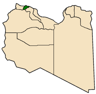
Nuqat al Khams is one of the districts of Libya. It is in the northwest of the country, in what had been the historical region of Tripolitania. Its capital is Zuwara. Nuqat al Khams has a northern shoreline on the Mediterranean Sea. To the west, it borders the Medenine Governorate of Tunisia. Domestically, it borders the districts of Zawiya to the east, Jabal al Gharbi to the southeast, and Nalut to the southwest. Nuqat al Khams is a part of the Tripolitania geographical region of Libya.
San Isidro is a municipality in the Honduran department of Intibucá.

Ben Gardane or Bengardane is a coastal town in south eastern Tunisia, close to the border with Libya. It is located at around 33°8′20″N11°13′0″E.
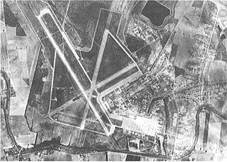
England Air Force Base is a former United States Air Force base in Louisiana, located 5 miles (8.0 km) northwest of Alexandria and about 170 miles (270 km) northwest of New Orleans. Originally known as Alexandria Army Air Base, on 23 June 1955 the facility was renamed England Air Force Base in honor of Lt Col John Brooke England (1923–1954).
Darnah Governorate was one of the governorates (muhafazah) of Libya from 1963 to 1983. It was created out of the Cyrenaica province. Its capital was the town of Derna.

Dairut is a city in Egypt. It is located on the west bank of the Nile, in the Asyut Governorate. This is the point where the Nile divides, and a branch wanders off and eventually ends up in the Faiyum.
Middletown is a neighborhood in San Diego, California, located north of Little Italy, south of Mission Hills and Hillcrest, east of San Diego International Airport, and west of Bankers Hill. Interstate 5 passes through the neighborhood and the San Diego Trolley has one station in the neighborhood. Harper's Topiary Garden is located in the neighborhood as well.
St. Benedict is a village in the Canadian province of Saskatchewan within the Rural Municipality of Three Lakes No. 400 and Census Division No. 15. Located in the Carlton Trail Region of the province, it is 56 km (35 mi) north of the City of Humboldt off Highway 20.
Mizda or Mesdah is a town in the Nafusa Mountains in Libya. It was the capital of the former Mizda District.

Misrata Governorate was one of the governorates (muhafazah) of Libya from 1963 to 1983. Its capital was the town of Misrata. Initially in the 1930s was called "Provincia di Misurata" of Italian Libya. It was created out of the eastern part of Tripolitania province.

Sabha Governorate was one of the governorates (muhafazah) of Libya from 1963 to 1983. It was formed from part of Fezzan province. Its capital was Sabha. In 1970, it had a population of around 97,000.
Tarabulus Governorate or Tripoli Governorate was one of the governorates (muhafazah) of Libya from 1963 to 1983. It contained the city of Tripoli, which was also its administrative capital. Tarabulus is the Arabic name for Tripoli, and was sometimes applied to the entire Tripolitania province.

Jabal al Gharbi Governorate or Jebal al Gharbi Governorate was one of the governorates (muhafazah) of Libya from 1963 to 1983. Its capital was Gharian. Other important towns in the governorate were Yafran, Nalut, Ghadames and Mizda. It was created out of the southwestern part of Tripolitania province.

Al Khums Governorate or Homs Governorate was one of the governorates (muhafazah) of Libya from 1963 to 1983. Its capital was the town of Khoms. It was created out of the Tripolitania province.

Awbari Governorate or Ubari Governorate Arabic: أوباري محافظة was one of the governorates (muhafazah) of Libya from 1963 to 1973. Its capital was the town of Ubari. It was created out of the southwestern part of Fezzan province. In 1973 the Awbari Governorate was merged into an altered Sabha Governorate.
Rank comparison chart of officer ranks for armies/land forces of African states.
Rank comparison chart of enlisted rank for armies/ land forces of African states.
Rank comparison of non-commissioned officers and enlisted personnel for air forces of African states.
Rank comparison chart of officers for armies/land forces of Arabophone states.
Rank comparison chart of Non-commissioned officer and enlisted ranks for armies/land forces of Arabophone states.
This page is based on this
Wikipedia article Text is available under the
CC BY-SA 4.0 license; additional terms may apply.
Images, videos and audio are available under their respective licenses.
