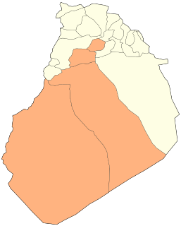
Aïn El Orak | |
---|---|
Commune and town | |
Coordinates: 33°24′36″N0°44′19″E / 33.41000°N 0.73861°E | |
Country | |
Province | El Bayadh Province |
District | El Abiodh Sidi Cheikh District |
Population (2008 [1] ) | |
• Total | 1,424 |
Time zone | UTC+1 (CET) |
Aïn El Orak is a town and commune in El Bayadh Province, Algeria.
The municipalities of Algeria form the second level of administrative subdivisions of Algeria. As of 2002, there were 1,541 municipalities in the country.
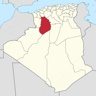
El Bayadh is a province (wilaya) in Algeria, named after its capital El Bayadh.
Algeria, officially the People's Democratic Republic of Algeria, is a country in the Maghreb region of North Africa. The capital and most populous city is Algiers, located in the far north of the country on the Mediterranean coast. With an area of 2,381,741 square kilometres (919,595 sq mi), Algeria is the tenth-largest country in the world, and the largest in Africa. Algeria is bordered to the northeast by Tunisia, to the east by Libya, to the west by Morocco, to the southwest by the Western Saharan territory, Mauritania, and Mali, to the southeast by Niger, and to the north by the Mediterranean Sea. The country is a semi-presidential republic consisting of 48 provinces and 1,541 communes (counties). It has the highest human development index of all non-island African countries.
Brézina is a municipality in El Bayadh Province, Algeria. It is the district seat of Brézina District and has a population of 8.536, which gives it 7 seats in the PMA. Its postal code is 32170 and its municipal code is 3204.
Chellala is a district in El Bayadh Province, Algeria. It was named after its capital, Chellala.
El Abiodh Sidi Cheikh is a district in El Bayadh Province, Algeria. It was named after its capital, El Abiodh Sidi Cheikh, where most of the population lives. This district has one of the longest placenames in the country.
Boualem is a district in El Bayadh Province, Algeria. It was named after its capital, Boualem. It has the highest number of municipalities of any district in El Bayadh Province.
Tousmouline is a municipality of El Bayadh Province in Algeria.
Sidi Ameur is the name of:
El Abiodh Sidi Cheikh (Arabic: الأبيض سيدي الشيخ, is a municipality in El Bayadh Province, Algeria. It is the district seat of El Abiodh Sidi Cheikh District and has a population of 24.949, which gives it 7 seats in the PMA. Its postal code is 32300 and its municipal code is 3207.
Sidi Slimane may refer to:
The Ksour Range or Kçour Range is a mountain range in Algeria. Stretching across the provinces of Béchar and El Bayadh, it is the westernmost range of the Saharan Atlas, with the Amour Range further east.
Sidi Taifour (Arabic: سيدي طيفور, is a municipality in El Bayadh Province, Algeria.
El Bnoud is a town and commune in El Bayadh Province, Algeria.
Arbaouet is a town and commune in El Bayadh Province, Algeria.
Sidi Ameur is a town and commune in El Bayadh Province, Algeria.
Stitten is a town and commune in El Bayadh Province, Algeria.
Sidi Slimane is a town and commune in El Bayadh Province, Algeria.
Boualem is a town and commune in El Bayadh Province, Algeria. It is the district seat of Boualem District.
El Kheiter is a town and commune in El Bayadh Province, Algeria.
Bougtob is a town and commune in El Bayadh Province, Algeria. It is the district seat of Bougtob District.
This article about a location in El Bayadh Province is a stub. You can help Wikipedia by expanding it. |