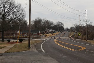
Bellefontaine Neighbors is an inner-ring suburb city in St. Louis County, Missouri, United States. The population was 10,860 at the 2010 census.

Factoria is a mixed-use suburban neighborhood in south Bellevue, Washington and is one of the city's significant commercial districts. Originally timberland from the 1890s to 1920s and later envisioned as an industrial center, Factoria has since the 1960s evolved into commercial and residential development. Factoria was annexed into Bellevue in 1993. The core neighborhood is bounded by Interstate 90 to the north, Interstate 405 to the west, Newport Way to the east, and Coal Creek Parkway to the south.

Osmaniye Province is a province in south-central Turkey. It was named Cebel-i Bereket in the early republic until 1933, when it was incorporated into Adana Province. It was made a province again in 1996. It covers an area of 3,767 km2 and has a population of 479,221. The province is situated in Çukurova, a geographical, economical and cultural region. The capital of the province is Osmaniye. Other major towns include Kadirli and Düziçi.

Limestone is an unincorporated community on the western border of Washington County and the eastern border of Greene County in the northeastern part of the U.S. state of Tennessee. Its zip code is 37681. Limestone is part of the Johnson City Metropolitan Statistical Area, which is a component of the Johnson City–Kingsport–Bristol, TN-VA Combined Statistical Area – commonly known as the "Tri-Cities" region.
Gurvanbulag is a sum (district) of Bayankhongor Province in southern Mongolia. In 2006, its population was 2,594.
Brodno is a village in the administrative district of Gmina Środa Śląska, within Środa Śląska County, Lower Silesian Voivodeship, in south-western Poland. It lies approximately 9 kilometres (6 mi) north of Środa Śląska and 34 km (21 mi) west of the regional capital Wrocław.
Ernestynów is a village in the administrative district of Gmina Złotoryja, within Złotoryja County, Lower Silesian Voivodeship, in south-western Poland. Prior to 1945 it was in Germany.
Berkarat is a town in the Aragatsotn Province of Armenia.
Trzebciny is a village in the administrative district of Gmina Cekcyn, within Tuchola County, Kuyavian-Pomeranian Voivodeship, in north-central Poland. It lies approximately 13 kilometres (8 mi) north-east of Cekcyn, 22 km (14 mi) east of Tuchola, and 59 km (37 mi) north of Bydgoszcz.
Dasht is a town in the Armavir Province of Armenia. Just outside the town is a 1st millennium BCE fortress.

Fort Seneca is a census-designated place in Pleasant Township, Seneca County, Ohio, United States. It is located on State Route 53, approximately 6 miles (9.7 km) North of Tiffin. It had a population of 254 in 2010. Although unincorporated, Fort Seneca had a post office, with the ZIP code of 44829 until 1998. The post office was opened on December 15, 1821.
Pastwiska is a village in the administrative district of Gmina Iłża, within Radom County, Masovian Voivodeship, in east-central Poland. It lies approximately 6 kilometres (4 mi) south of Iłża, 32 km (20 mi) south of Radom, and 123 km (76 mi) south of Warsaw.
Chojno-Młyn is a village in the administrative district of Gmina Wronki, within Szamotuły County, Greater Poland Voivodeship, in west-central Poland. It lies approximately 15 kilometres (9 mi) west of Wronki, 30 km (19 mi) west of Szamotuły, and 60 km (37 mi) north-west of the regional capital Poznań.
Wągniki is a settlement in the administrative district of Gmina Korsze, within Kętrzyn County, Warmian-Masurian Voivodeship, in northern Poland. It lies approximately 8 kilometres (5 mi) north of Korsze, 23 km (14 mi) north-west of Kętrzyn, and 67 km (42 mi) north-east of the regional capital Olsztyn.
Držanovac is a village in the municipality of Žitorađa, Serbia. According to the 2002 census, the village has a population of 947 people.

Șipca is a commune in the Grigoriopol sub-district of Transnistria, Moldova. It is composed of two villages, Șipca and Vesioloe. It is currently under the administration of the breakaway government of the Transnistrian Moldovan Republic.
Riceville is an unincorporated community in Pittsylvania County, in the U.S. state of Virginia.
Bresno Polje is a village in the municipality of Trstenik, Serbia. According to the 2002 census, the village has a population of 725 people.
Pickerel Creek is a stream in Christian and Greene counties in the Ozarks of southwest Missouri. The stream is a tributary to the Sac River.
Smithfield is an unincorporated community in Jasper County, in the U.S. state of Missouri.


