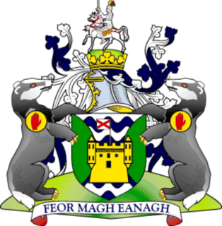
County Fermanagh is one of the thirty-two counties of Ireland and one of the six counties of Northern Ireland. The county covers an area of 1,691 km² and has a population of 61,805 as of 2011. Enniskillen is the county town and largest in both size and population.

County Leitrim is a county in the Republic of Ireland. It is in the province of Connacht and is part of the Border Region. It is named after the village of Leitrim. Leitrim County Council is the local authority for the county, which had a population of 32,044 according to the 2016 census. The county encompasses the historic Gaelic territory of West Breffny (Bréifne) corresponding to the northern part of the county, and Muintir Eolais or Conmaicne Réin, corresponding to the southern part.
The Sligo, Leitrim and Northern Counties Railway (SL&NCR) was a 5 ft 3 in railway in counties Cavan, Fermanagh, Leitrim and Sligo in north-west Ireland. It consisted of one main line, with no branch lines and remained privately owned until its closure.

Belleek is a village and civil parish in County Fermanagh, Northern Ireland. While the greater part of the village lies within County Fermanagh, part of it crosses the border and the River Erne into County Donegal. It lies in the historic barony of Lurg. It had a population of 904 people in the 2011 Census, and is situated within Fermanagh and Omagh district.

The River Erne in the northwest of the island of Ireland, is the second-longest river in Ulster, flowing through Northern Ireland and the Republic of Ireland, and forming part of their border.

The Republic of Ireland–United Kingdom border, sometimes referred to as the Irish border or British-Irish border, runs for 499 km (310 mi) from Lough Foyle in the north of Ireland to Carlingford Lough in the northeast, separating the Republic of Ireland from Northern Ireland.
Glenfarne is a small village located in the north of County Leitrim, Ireland. It is the site of the original "Ballroom of Romance", which inspired a short story by William Trevor and was subsequently turned into a movie by the BBC. Glenfarne also has a lakeside forest near Lough MacNean, a lake bordering parts of Northern Ireland, including towns such as Belcoo in County Fermanagh.

Pettigo is a small village on the border of County Donegal, Republic of Ireland and County Fermanagh, Northern Ireland. It is bisected by the Termon River which is part of the border between the Republic of Ireland and Northern Ireland.

Belcoo ( is a small village and townland in County Fermanagh, Northern Ireland, 10 miles from Enniskillen. It is on the County Fermanagh/County Cavan border beside the village of Blacklion in the Republic of Ireland. It had a population of 540 in the 2011 Census. It is situated within the Fermanagh and Omagh District.

Garrison is a small village near Lough Melvin in County Fermanagh, Northern Ireland. The Roogagh River runs through the village. In the 2001 Census it had a population of 357 people. It is situated within Fermanagh and Omagh district.

Blacklion is a border village in west County Cavan, Ireland. It is situated on the N16 national primary road, just across the border from the County Fermanagh village of Belcoo.
Tullyhommon or Tullyhomman is a small village in County Fermanagh, Northern Ireland. It is beside the bigger village of Pettigo, which lies in County Donegal in the Republic of Ireland. The two are divided by the River Termon, which forms part of the boundary between Northern Ireland and the Republic. In the 2001 Census the village had a population of 63 people.

The A4 is a major east-west road in Northern Ireland. It travels for 69.2 miles from Portadown to Belcoo through County Armagh, County Tyrone and County Fermanagh.

Lough MacNean is a large freshwater lake on the border between Northern Ireland and the Republic of Ireland.

The Black Pig's Dyke or Worm's Ditch is a series of discontinuous linear earthworks in southwest Ulster and northeast Connacht, Ireland. Remnants can be found in north County Leitrim, north County Longford, County Cavan, County Monaghan and County Fermanagh. Sometimes, the Dorsey enclosure in County Armagh and the Dane's Cast in County Down are considered to be part of the dyke.

The A46 is a road in County Fermanagh, in Northern Ireland. It forms part of the route from Dublin to Ballyshannon. It stretches 23.6 miles from Enniskillen to Belleek along the southwestern shoreline of Lower Lough Erne.

The Marble Arch Caves Global Geopark straddles the border between Northern Ireland and the Republic of Ireland. It is centred on the Marble Arch Caves and in 2001 it became one of the first geoparks to be designated in Europe.
The B53 is a relatively short road linking the village of Garrison, County Fermanagh and the B52 and then continues along the shores of Lough Melvin and over the border towards Rossinver and Manorhamilton in County Leitrim as the R282.

The A47 road runs from Kesh to Belleek along the north shore of Lower Lough Erne. The A47 commences from Letterkeen, a townland north of Kesh in County Fermanagh, and heads due west near the shores of Lower Lough Erne and over the eastern causeway and bridge onto Boa Island.
Cashelnadrea or more usually, Cashel as it is known locally is a townland situated near Garrison, County Fermanagh. The area includes the subtownlands of Scribbagh, Kilcoo and Aghoo.


