Related Research Articles

Eklutna is a native village within the Municipality of Anchorage in the U.S. state of Alaska. The Tribal Council estimates the population at 70; many tribal members live in the surrounding communities.

The following lists include extreme and significant points of the geography of Canada.
Ohagamiut is an abandoned village along the Kuskokwim River in the Bethel Census Area of the southwestern part of the U.S. state of Alaska, located between Crow Village and Kalskag. It was abandoned in the 1940s as residents relocated to Kalskag, Aniak, Bethel and other towns. The village site is located just 3 miles east of Upper Kalskag.

The Yukon–Kuskokwim Delta is a river delta located where the Yukon and Kuskokwim rivers empty into the Bering Sea on the west coast of the U.S. state of Alaska. At approximately 129,500 square kilometers (50,000 sq mi) in size, it is one of the largest deltas in the world. It is larger than the Mississippi River Delta ; it is comparable in size to the entire U.S. state of Louisiana. The delta, which consists mainly of tundra, is protected as part of the Yukon Delta National Wildlife Refuge.
Ezcabarte is a town and municipality located in the province and autonomous community of Navarre, northern Spain.
The Skwentna River (Dena'ina: Shqitnu) is a river in the southwestern part of Matanuska-Susitna Borough, Alaska.
The Talachulitna River is a river in Alaska.

Arctic Alaska or Far North Alaska is a region of the U.S. state of Alaska generally referring to the northern areas on or close to the Arctic Ocean.
The Pavlof Islands are a group of seven islands that lie south of Pavlof Bay on the Alaska Peninsula. They are part of the Aleutians East Borough in the U.S. state of Alaska. The islands include Dolgoi Island (Anganax̂six̂), Goloi (Atx̂uunux̂), Inner Iliasik, Outer Iliasik, Poperechnoi (Kuyagdax̂), Ukolnoi (Kitaĝutax̂̂), and Wosnesenski (Unatxux̂). Dolgoi Island is the largest of these in area. They have a total land area of 206.265 km2 (79.639 sq mi) and are uninhabited.
KASH-FM is a commercial country music radio station in Anchorage, Alaska. It is owned by iHeartMedia, Inc. Its studios are located at Dimond Center in Anchorage, and its transmitter is located in Eagle River, Alaska.
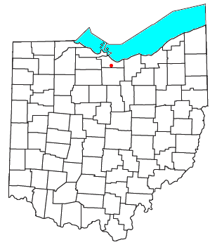
Avery is an unincorporated community in western Milan Township, Erie County, Ohio, United States. It is part of the Sandusky Metropolitan Statistical Area. Avery is located along US Route 250 near that road's interchange with Interstate 80 and Interstate 90, the Ohio Turnpike. It once had a post office, but is now included in the Milan, Ohio postal zone (44846).

Timok Cove is a 580 m wide cove indenting for 400 m the north coast of Rugged Island off the west coast of Byers Peninsula of Livingston Island in the South Shetland Islands, Antarctica, and entered west of Simitli Point.
Another River is a river located within Lake Clark National Park and Preserve in the Kenai Peninsula Borough, Alaska, in the United States.

Mate Creek is a stream in the U.S. state of West Virginia. It is a tributary of Tug Fork.
Goose Creek is a stream in northern Wayne and southern Iron counties in the U.S. state of Missouri. It is a tributary of Big Creek.
Dillia is an extinct town in Ozark County, in the U.S. state of Missouri. The GNIS classifies it as a populated place. However, the location coordinates place it within the waters of Bull Shoals Lake on the Barren Fork Branch of the Little North Fork White River, approximately four miles south-southeast of the Hammond mill site and four miles northeast of Theodosia.
Wachita Creek is a stream in Madison and St. Francois counties in the U.S. state of Missouri. It is a tributary of the St. Francis River.
The Pennsylvania State Game Lands Number 25 are Pennsylvania State Game Lands in Elk County in Pennsylvania in the United States providing hunting, bird watching, and other activities.
Paraje del Perrillo, was a dependable watering and stopping place along the Camino Real de Tierra Adentro, where it passed through the Jornada del Muerto in the vicinity of Point of Rocks in Sierra County, New Mexico. Paraje del Perillo was the next water to the north beyond the Paraje de San Diego overlooking the Rio Grande 5 leagues beyond Paraje de Robledo and a half league from the River.
Chesterfield Township is a township in St. Louis County, in the U.S. state of Missouri. Its population was 38,982 as of the 2010 census.
References
- ↑ U.S. Geological Survey Geographic Names Information System: Babel River
- ↑ Orth, Donald J. (1967). Dictionary of Alaska Place Names. U.S. Government Printing Office. p. 98.
61°37′15″N154°42′00″W / 61.62083°N 154.70000°W
| | This article about a location in the Bethel Census Area, Alaska is a stub. You can help Wikipedia by expanding it. |