Bonaire is a Caribbean island in the Leeward Antilles, and is a special municipality of the Netherlands. Its capital is the port of Kralendijk, on the west (leeward) coast of the island. Aruba, Bonaire and Curaçao form the ABC islands, 80 km off the coast of Venezuela. The islands have an arid climate that attracts visitors seeking warm, sunny weather all year round, and they lie outside the Main Development Region for tropical cyclones. Bonaire is a popular snorkeling and scuba diving destination because of its multiple shore diving sites, shipwrecks and easy access to the island's fringing reefs.

The geography of Aruba, located at the juncture of the South American and Caribbean tectonic plates, has been shaped by a complex interplay of geological processes. From its flat expanses to its rugged coastlines, Aruba's geography and geology reveal the island's geographical diversity and its underlying geological formations, offering a comprehensive understanding of Aruba's terrain and environmental dynamics of this Caribbean destination.

Little Cayman is one of three Islands that make up the Cayman Islands. It is located in the Caribbean Sea, approximately 60 miles (96 km) northeast of East End, Grand Cayman and five miles (8 km) west of West End, Cayman Brac. Little Cayman is the least populous island of the three, with a permanent population of about 160 (2021) including seasonal residents/homeowners. The majority of the population are expatriate workers from Jamaica, the Philippines, and Honduras and from other Latin American countries as well as Canada, the USA, India, Australia, Scotland, England, and South Africa. There are a handful of local Caymanians estimated as fewer than 20. It is about 10 miles (16 km) long with an average width of 1 mile (1600 m) and most of the island is undeveloped. Almost the entire island is at sea level. The highest elevation is about 40 feet. The rainy season, which consists of mostly light showers, occurs in Mid-April until June and again in mid-September to mid-October. There will be occasional quick rain showers in the early morning hours. The coolest months are from End of November until Mid March as the cold fronts coming in from the North which the temperature can drop into the low'70s. The Hottest and dryest months are in Summer starting mid-June to mid-September with temperatures between the mid-80s and high 90s. There are no large or predatory or venomous animals that pose a threat to humans.
Pulau Hantu is located to the south of the main island of Singapore, off the Straits of Singapore. Pulau Hantu is actually made up of two islets: Pulau Hantu Besar and Pulau Hantu Kechil, with a total area of 12.6 hectares. At low tide, it is possible to wade across the shallow lagoon between the two islands, but not at high tide.

San Nicolaas is 19 kilometres (12 mi) southeast of Oranjestad, and is Aruba's second largest city. As of 2010 it has a population of 15,283, most of whom originate from the British Caribbean and rest of the Caribbean.

Lago Colony was a community located on the east end of the island of Aruba, near the area presently known as Seroe Colorado.

Lake tankers were small specially designed shallow-draft tanker ships that carried the crude oil, pumped from beneath Lake Maracaibo in Venezuela, to the three off-shore refineries located on the Dutch islands of Aruba and Curaçao.

Lago Oil & Transport Co. Ltd. was established in 1924 as a shipping company responsible for transporting crude oil from Lake Maracaibo to its transshipment facility on the island of Aruba. The Lago refinery, a subsidiary of the Standard Oil Company (Exxon), remained in operation until March 31, 1985 when Exxon made the decision to shut down and dismantle both the refinery and Lago Colony.

Seroe Colorado is a village situated at the southeastern tip of Aruba, an island located in the Dutch Caribbean. Nowadays, it is known for the Anchor in Memory to All Seamen. Historically, between 1878 and 1914, Seroe Colorado served as the location for the Colorado Guano Mine, which was involved in the extraction of guano. Additionally, the Seroe Colorado Lighthouse can be found in this village, serving as a prominent landmark.

Palm Island is a small private island near Aruba, Kingdom of the Netherlands, serving as a tourist attraction.

Waikoloa Beach is an area located on the South Kohala coast on the island of Hawaii and is located in the census-designated place of Puako. It can be confused for Waikoloa Village, a CDP in the same "ahupuaʻa" and is also known as "Waikoloa".

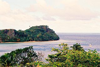
The Great Astrolabe Reef is in Fiji and surrounds the fourth largest island, Kadavu Island, which is approximately 65 km in length. Kadavu Island is approximately 100 km south of Viti Levu, the main island of Fiji.

Plaza Beach Resort Bonaire is the largest diving resort in the southern Caribbean Island of Bonaire, located at 80 Julio A. Abraham Boulevard, south of Kralendijk, just north of Flamingo International Airport. It is operated by the Van der Valk family of hoteliers and is also known as the Plaza Resort Van der Valk. American divers have reportedly voted it one of the top 10 dive resorts in the world. The resort, which claims to be five-star, although this is disputed by several independent publications, is situated on a peninsula, at the mouth of a man-made lagoon with turquoise blue waters. Plaza Beach Resort Bonaire Its beach measures 500 metres (1,600 ft) long and 50–100 metres (160–330 ft) deep and is a notable scuba diving location, known as Toucan Diving.

Flamenco Beach is a public beach on the Caribbean island of Culebra. It is known for its shallow turquoise waters, white sand, swimming areas, and diving sites. It stretches for a mile around a sheltered, horseshoe-shaped bay. Playa Flamenco is a popular beach destination for both Culebra and Puerto Rico. In March 2014, Flamenco Beach was ranked 3rd best beach in the world with a TripAdvisor Travelers' Choice Award. In August 2016, it was announced that Flamenco Beach had regained its Blue Flag Beach international distinction.

Platja S'Estanyol is a beach on the south east seaboard of the Spanish island of Ibiza. It is in the municipality of Santa Eulària des Riu and is 9.4 miles (15.1 km) south west of the town of Santa Eulària des Riu, and 1.8 miles (2.9 km) west of the village of Jesús.

Cala Vadella is a small cove and beach resort on the western seaboard of the Spanish island of Ibiza. The beach resort is in the municipality of Sant Josep de sa Talaia and is 14.5 miles (23.3 km) west of the town of Ibiza town. The nearest village of Sant Josep de sa Talaia is 5.3 miles (8.5 km) east of the beach resort. In 2012 Cala Vadella is one of the 12 blue flag beaches on Ibiza.

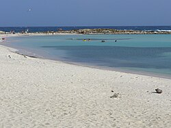
Rodgers Beach, Aruba, officially known as Nanki is a small beach immediately west of Baby Beach. It is known for its calm waters and private feel, though it is a public beach. The water is shallow at first, but further out it becomes a good swimming beach.

The discovery of guano on Klein Curaçao by John Godden in 1871, sparked a "guano mania" across the Antillean islands, including Curaçao. In 1874, J. H. Waters Gravenhorst is credited with the discovery of guano in Aruba, although an earlier interest was shown by an American named S.R. Kimball in 1859. The exact outcome of Kimball's efforts remains uncertain. This ultimately led to the incorporation of a limited company on Curaçao, known as Aruba Phosphate Company on December 18, 1879.

The Marine Park Aruba are marine protected areas (MPAs) situated around the island of Aruba. This nature reserve was established on December 21, 2018 and brought under the management of Fundacion Parke Nacional Aruba on April 16, 2019.


