
The Feather River is the principal tributary of the Sacramento River, in the Sacramento Valley of Northern California. The river's main stem is about 73 miles (117 km) long. Its length to its most distant headwater tributary is just over 210 miles (340 km). The main stem Feather River begins in Lake Oroville, where its four long tributary forks join together—the South Fork, Middle Fork, North Fork, and West Branch Feather Rivers. These and other tributaries drain part of the northern Sierra Nevada, and the extreme southern Cascades, as well as a small portion of the Sacramento Valley. The total drainage basin is about 6,200 square miles (16,000 km2), with approximately 3,604 square miles (9,330 km2) above Lake Oroville.

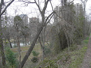
White Rock Creek is a 30-mile (48.3 km) creek in the Elm Fork Trinity River watershed. From its headwaters near Frisco, Texas, it runs south-by-south-east through suburban Dallas for 23.5 miles (37.8 km) where it widens into White Rock Lake, then continues south for another 8 miles (12.9 km) to its mouth on the Trinity River, of which it is a major tributary.
Lewisville Lake is a reservoir in North Texas (USA) on the Elm Fork of the Trinity River in Denton County near Lewisville. Originally engineered in 1927 as Lake Dallas, the reservoir was expanded in the 1940s and 1950s and renamed Lewisville Lake. It was built for flood control purposes and to serve as a water source for Dallas and its suburbs, but residents also use it for recreational purposes.
Lake Fork Reservoir is a reservoir located in Wood, Rains, and Hopkins counties in the state of Texas, between the towns of Quitman, Alba, Emory, and Yantis, Texas.
Turtle Creek is the name of small tributary creek of the Trinity River, with headwaters in northern Dallas, in Dallas County, Texas.
The Little River is a river in Central Texas in the Brazos River watershed. It is formed by the confluence of the Leon River and the Lampasas River near Little River, Texas in Bell County. It flows generally southeast for 75 miles (121 km) until it empties into the Brazos River about 5 miles (8.0 km) southwest of Hearne, at a site called Port Sullivan in Milam County. The Little River has a third tributary, the San Gabriel River, which joins the Little about 8 miles (13 km) north of Rockdale and five miles southwest of Cameron. Cameron, the county seat of Milam County and the only city of any significant size on the Little River, was established in 1846.
Range Creek is a tributary of the Elm Fork of the Trinity River in Texas. It rises just a few miles from the Red River in Grayson County. It reaches its mouth at Lake Ray Roberts, a reservoir formed by a dam on the Elm Fork.
Johnson Creek is a creek and tributary of the Trinity River watershed in Dallas County and Tarrant County, North Texas.

Union Valley Reservoir is a reservoir in eastern El Dorado County, California, about 20 miles (32 km) northeast of Placerville. The 277,000 acre feet (342,000,000 m3) lake is in Eldorado National Forest in the Sierra Nevada at an elevation of 4,870 feet (1,480 m).

The Rio Chama, a major tributary river of the Rio Grande, is located in the U.S. states of Colorado and New Mexico. The river is about 130 miles (210 km) long altogether. From its source to El Vado Dam its length is about 50 miles (80 km), from El Vado Dam to Abiquiu Dam is about 51 miles (82 km), and from Abiquiu Dam to its confluence with the Rio Grande is about 34 miles (55 km).

Lavon Lake is a fresh water reservoir located in southeast Collin County, Texas on the East Fork of the Trinity River near Wylie, off of State Highway 78. It is commonly called Lake Lavon for commercial and recreational purposes but Lavon Lake is its official name according to the U.S. Army Corps of Engineers. It was originally called Lavon Reservoir.

The Millers River is a 52.1-mile-long (83.8 km) river in northern Massachusetts, originating in Ashburnham and joining the Connecticut River just downstream from Millers Falls, Massachusetts. The river was formerly known as Paquag or Baquag, a Nipmuc word meaning "clear water". Sections of the river are used for whitewater kayaking, and a section upriver is popular with flatwater racers.
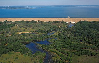
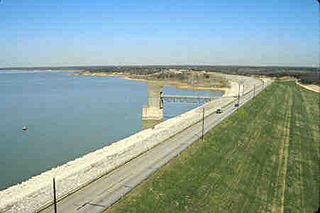
Lake Livingston is a reservoir located in the East Texas Piney Woods. Lake Livingston was built, and is owned and operated, by the Trinity River Authority of Texas (TRA) under contract with the City of Houston for water-supply purposes. The lake is the second-largest lake located wholly within the state of Texas. The Livingston Dam, constructed across the Trinity River approximately 7 miles (11 km) southwest of the city of Livingston is 2.5 miles (4 km) in length and has an average depth of 55 feet (17 m).
Grapevine Lake is an American reservoir located in the North Texas region, approximately 20 mi (32 km) northwest of Dallas and northeast of Fort Worth. It was impounded in 1952 by the US Army Corps of Engineers when they dammed Denton Creek, a tributary of Trinity River.

Benbrook Lake is a reservoir on the Clear Fork of the Trinity River in Tarrant County, Texas, USA. The lake is located approximately 10 miles (16 km) southwest of the center of Fort Worth, where the Clear Fork and the West Fork of the Trinity River join. The lake is impounded by the Benbrook Dam. The lake and dam are owned and operated by the U.S. Army Corps of Engineers, Fort Worth District.

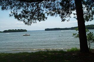
Lake Tawakoni is a 37,879-acre (15,329 ha) reservoir located in Northeast Texas, approximately 45 miles (72 km) east of Dallas, Texas. It lies within three Texas counties, Hunt, Rains, and Van Zandt. It is used for water supply and recreation. It is under the Sabine River Authority of Texas and the original headwaters of the Sabine are converged under the lake surface.
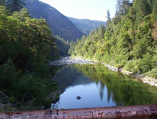
The North Fork Feather River is a watercourse of the northern Sierra Nevada in the U.S. state of California. It flows generally southwards from its headwaters near Lassen Peak to Lake Oroville, a reservoir formed by Oroville Dam in the foothills of the Sierra, where it runs into the Feather River. The river drains about 2,100 square miles (5,400 km2) of the western slope of the Sierras. By discharge, it is the largest tributary of the Feather.
Yegua Creek is a river in Central Texas and is part of the Brazos River drainage basin. Yegua Creek forms in Lee County at the confluence of the Middle Yegua Creek and East Yegua Creek about three miles west of Somerville Lake. It is the primary tributary to form Somerville Lake. The Yegua flows east and becomes part of the Burleson County line for about 31 miles and then joins the Brazos River in southeastern Washington County. The Yegua below the Somerville Dam is a slow-moving, gentle river but is nevertheless used for some mild recreational canoeing and kayaking.


