Related Research Articles

A group of natural lakes in northwestern Iowa in the United States. The three principal lakes of the group are Big Spirit Lake, West Okoboji Lake, and East Okoboji Lake. They are the largest natural lakes in the state of Iowa. The largest, Spirit Lake, is 5,684 acres (2,300 ha).The lake area extends to the north into Jackson County, Minnesota. The headwaters of Little Sioux River flow past the west side of the lake area.

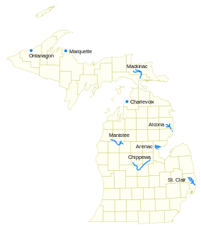
Pine River may refer to any of the following streams in the U.S. state of Michigan:
- Pine River. The main branch forms with the confluence of the East and West Branches of the Pine River at 44°29′38″N83°23′16″W in Alcona County. The South Branch joins approximately 1.5 miles (2.4 km) to the south and flows into Iosco County, where it empties into Van Etten Lake at 44°29′38″N83°23′16″W northwest of Oscoda.
- Pine River. The main branch is formed by the confluence of the North and Middle Branches northeast of Standish and flows into the Saginaw Bay of Lake Huron at 43°58′32″N83°51′16″W. The South Branch Pine River joins the main stream at 43°59′08″N83°53′17″W.
- Pine River is a short waterway, which along with Round Lake, connects Lake Charlevoix with Lake Michigan at Charlevoix.
- Pine River rises in Chippewa County and flows south through Mackinac County into the St. Martin Bay of Lake Huron at 46°03′09″N84°39′22″W The North Pine River, also known as the North Branch Pine River, joins at 46°12′20″N84°36′17″W. Another tributary, Hemlock Creek, is also known as Pine River.
- Pine River, also known as the South Branch Manistee River, rises in southeast Wexford County, flows southwest across northwest Osceola County, then west and north through the northeast corner of Lake County and back into southwest Wexford County, emptying into the Tippy Dam Pond on the Manistee River at 44°13′37″N85°54′27″W. The main stream is formed from the confluence of the East Branch Pine River with the North Branch Pine River at 44°06′02″N85°31′40″W. Another tributary, the Spaulding Creek, is also known as the Little Pine River
- Pine River, in Marquette County, is a very short stream draining Pine Lake into Lake Superior at 46°53′27″N87°52′13″W, north of the Huron Mountains.
- Pine River rises in from Pine Lake in eastern Mecosta County, flows mostly south and east through Isabella County, then south along eastern edge of Montcalm County, then east and north through Gratiot County and Midland County, emptying into the Chippewa River at 43°36′06″N84°17′33″W, just about two miles before it joins the Tittabawassee River near Midland. The South Branch Pine River joins the main stream at 43°30′37″N85°00′02″W Another tributary, Miller Creek, is also sometimes known as Pine River or the West Branch Pine River. The North Branch Pine River joins the main stream at 43°26′03″N84°50′18″W.
- Pine River empties into the St. Clair River at 42°49′13″N82°29′08″W on the south side of St. Clair. The South Branch Pine River joins the main stream at 42°58′11″N82°37′10″W. Another tributary, Quakenbush Drain, is also sometimes known as Pine River.
- Pine Creek empties into Lake Superior and is also known as the Pine River.

The Cass River is a 61.5-mile-long (99.0 km) river in the Thumb region of the U.S. state of Michigan. It drains large portions of Sanilac and Tuscola counties and smaller portions of Genesee, Huron, Lapeer, and Saginaw counties.
String Lakes is a pair of lakes in Cottonwood County, in the U.S. state of Minnesota.
Iowa Lake is a lake in the U.S. states of Iowa and Minnesota.
Carey Lake is a lake in Cottonwood County, in the U.S. state of Minnesota.
Talcot Lake is a lake in the U.S. state of Minnesota.
Kansas Lake is a lake in Watonwan County, in the U.S. state of Minnesota.

The Chippewa River is a 153-mile-long (246 km) tributary of the Minnesota River in western and southwestern Minnesota in the United States. Via the Minnesota River, it is part of the watershed of the Mississippi River.
Jack Creek is a 64-mile-long (103 km) stream in southern Minnesota in the United States. It is a tributary of Heron Lake, the outlet of which flows to the Des Moines River.
Okabena Creek is a 40-mile-long (64 km) waterway in southern Minnesota. It is a tributary, via the short Diversion Creek, of Heron Lake, the outlet of which flows to the Des Moines River. Okabena Creek begins in Worthington, Minnesota, connecting by a ditch to the outlet of Okabena Lake, then flows northeast past the towns of Brewster and Okabena to the Heron Lake/South Heron Lake system.
Rat Lake is a lake in Cottonwood County, in the U.S. state of Minnesota.
Heron Lake is a lake in Jackson County, in the U.S. state of Minnesota.
Lake Independence is a lake in Jackson County, in the U.S. state of Minnesota.
Plum Lake is a lake in Jackson County, in the U.S. state of Minnesota.
Timber Lake is a lake in Jackson County, in the U.S. state of Minnesota.
Lake Wilson is a lake in Murray County, in the U.S. state of Minnesota.
Lime Lake is a lake in Murray County, in the U.S. state of Minnesota.
Summit Lake is a lake in Murray County, in the U.S. state of Minnesota.
Rice Lake is a lake in Pope County, in the U.S. state of Minnesota.
References
- ↑ U.S. Geological Survey Geographic Names Information System: North Badger Lake
- ↑ U.S. Geological Survey Geographic Names Information System: South Badger Lake
- ↑ Upham, Warren (1920). Minnesota Geographic Names: Their Origin and Historic Significance. Minnesota Historical Society. p. 369.
Coordinates: 43°55′N95°44′W / 43.917°N 95.733°W
| This article about a location in Murray County, Minnesota is a stub. You can help Wikipedia by expanding it. |