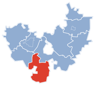
Zabłocie is a village in the administrative district of Gmina Kcynia, within Nakło County, Kuyavian-Pomeranian Voivodeship, in north-central Poland. It lies approximately 7 kilometres (4 mi) north-east of Kcynia, 13 km (8 mi) south of Nakło nad Notecią, and 32 km (20 mi) west of Bydgoszcz.
Siwe Bagno is a village in the administrative district of Gmina Cekcyn, within Tuchola County, Kuyavian-Pomeranian Voivodeship, in north-central Poland.
Kolonia Czaplino is a settlement in the administrative district of Gmina Choroszcz, within Białystok County, Podlaskie Voivodeship, in north-eastern Poland.
Bagno is a settlement in the administrative district of Gmina Gródek, within Białystok County, Podlaskie Voivodeship, in north-eastern Poland, close to the border with Belarus.

Markowszczyzna is a village in the administrative district of Gmina Turośń Kościelna, within Białystok County, Podlaskie Voivodeship, in north-eastern Poland.

Xanoba is a village in the Khojavend Rayon of Azerbaijan.

Jeziorko is a village in the administrative district of Gmina Lutomiersk, within Pabianice County, Łódź Voivodeship, in central Poland. It lies approximately 13 kilometres (8 mi) north-west of Lutomiersk, 30 km (19 mi) north-west of Pabianice, and 31 km (19 mi) west of the regional capital Łódź.

Kwasów is a village in the administrative district of Gmina Pacanów, within Busko County, Świętokrzyskie Voivodeship, in south-central Poland. It lies approximately 3 kilometres (2 mi) north-west of Pacanów, 23 km (14 mi) east of Busko-Zdrój, and 59 km (37 mi) south-east of the regional capital Kielce.

Żabia Wola is a village in Grodzisk Mazowiecki County, Masovian Voivodeship, in east-central Poland. It is the seat of the gmina called Gmina Żabia Wola. It lies approximately 10 kilometres (6 mi) south-east of Grodzisk Mazowiecki and 30 km (19 mi) south-west of Warsaw.

Czernice Borowe is a village in Przasnysz County, Masovian Voivodeship, in east-central Poland. It is the seat of the gmina called Gmina Czernice Borowe. It lies approximately 12 kilometres (7 mi) west of Przasnysz and 93 km (58 mi) north of Warsaw.
Radaczewo is a village in the administrative district of Gmina Trzebielino, within Bytów County, Pomeranian Voivodeship, in northern Poland.

Raduń is a village in the administrative district of Gmina Dziemiany, within Kościerzyna County, Pomeranian Voivodeship, in northern Poland. It lies approximately 5 kilometres (3 mi) south of Dziemiany, 22 km (14 mi) south-west of Kościerzyna, and 72 km (45 mi) south-west of the regional capital Gdańsk.

Pole Rakowieckie is a village in the administrative district of Gmina Kwidzyn, within Kwidzyn County, Pomeranian Voivodeship, in northern Poland. It lies approximately 7 kilometres (4 mi) east of Kwidzyn and 74 km (46 mi) south of the regional capital Gdańsk.

Łabuń is a village in the administrative district of Gmina Stary Targ, within Sztum County, Pomeranian Voivodeship, in northern Poland. It lies approximately 6 kilometres (4 mi) north-west of Stary Targ, 9 km (6 mi) north-east of Sztum, and 55 km (34 mi) south-east of the regional capital Gdańsk.

Pojezierce is a village in the administrative district of Gmina Miłakowo, within Ostróda County, Warmian-Masurian Voivodeship, in northern Poland. It lies approximately 10 kilometres (6 mi) south of Miłakowo, 25 km (16 mi) north of Ostróda, and 35 km (22 mi) north-west of the regional capital Olsztyn.

Lipnik is a village in the administrative district of Gmina Stargard, within Stargard County, West Pomeranian Voivodeship, in north-western Poland. It lies approximately 5 kilometres (3 mi) west of Stargard and 27 km (17 mi) east of the regional capital Szczecin.

Bogalinac is a village in Central Serbia (Šumadija), in the municipality of Rekovac, lying at 43°49′19″N21°01′53″E, at the elevation of 375 m. According to the 2002 census, the village had 163 citizens.
Malawa, Niger is a village and rural commune in Niger.
Tondikiwindi is a village and rural commune in Niger.

Joniškėlis Manor is a former residential manor in Joniškėlis. It is one of the biggest buildings and parks ensemble in Zemgale. Manor territory is currently used by Lithuanian Institute of Agriculture.


