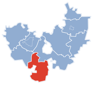
Stare Kiejkuty is a village in the administrative district of Gmina Szczytno, within Szczytno County, Warmian-Masurian Voivodeship, in northern Poland. It lies approximately 10 kilometres (6 mi) north-east of Szczytno and 41 km (25 mi) south-east of the regional capital Olsztyn. It is an old small village lying near road DK58, between two lakes: Wałpusz and Starokiejkuckie, popular vacation spots in the summertime with many vacation properties.
Stare Chlebiotki is a village in the administrative district of Gmina Zawady, within Białystok County, Podlaskie Voivodeship, in north-eastern Poland.

Stare Kiełcze is a village in the administrative district of Gmina Kolno, within Kolno County, Podlaskie Voivodeship, in north-eastern Poland. It lies approximately 7 kilometres (4 mi) north of Kolno and 89 km (55 mi) north-west of the regional capital Białystok.

Stare Rakowo is a village in the administrative district of Gmina Mały Płock, within Kolno County, Podlaskie Voivodeship, in north-eastern Poland. It lies approximately 9 kilometres (6 mi) south of Kolno and 84 km (52 mi) west of the regional capital Białystok.

Stare Chojny is a village in the administrative district of Gmina Łomża, within Łomża County, Podlaskie Voivodeship, in north-eastern Poland. It lies approximately 11 kilometres (7 mi) west of Łomża and 83 km (52 mi) west of the regional capital Białystok.

Stare Sierzputy is a village in the administrative district of Gmina Łomża, within Łomża County, Podlaskie Voivodeship, in north-eastern Poland. It lies approximately 8 kilometres (5 mi) west of Łomża and 81 km (50 mi) west of the regional capital Białystok.
Stare Jemielite is a village in the administrative district of Gmina Śniadowo, within Łomża County, Podlaskie Voivodeship, in north-eastern Poland.
Krasne Stare is a village in the administrative district of Gmina Jasionówka, within Mońki County, Podlaskie Voivodeship, in north-eastern Poland.

Stare Trzciano is a village in the administrative district of Gmina Szudziałowo, within Sokółka County, Podlaskie Voivodeship, in north-eastern Poland, close to the border with Belarus. It lies approximately 7 kilometres (4 mi) south-west of Szudziałowo, 16 km (10 mi) south of Sokółka, and 33 km (21 mi) north-east of the regional capital Białystok.
Stare Truskolasy is a village in the administrative district of Gmina Sokoły, within Wysokie Mazowieckie County, Podlaskie Voivodeship, in north-eastern Poland.
Stare Gardzienice is a village in east-central Poland, in the administrative district of Gmina Ciepielów, within Lipsko County, Masovian Voivodeship.

Stare Janki is a village in the administrative district of Gmina Troszyn, within Ostrołęka County, Masovian Voivodeship, in east-central Poland. It lies approximately 5 kilometres (3 mi) south-east of Troszyn, 17 km (11 mi) south-east of Ostrołęka, and 103 km (64 mi) north-east of Warsaw.

Stare Gronowo is a village in the administrative district of Gmina Debrzno, within Człuchów County, Pomeranian Voivodeship, in northern Poland. It lies approximately 10 kilometres (6 mi) east of Debrzno, 13 km (8 mi) south of Człuchów, and 124 km (77 mi) south-west of the regional capital Gdańsk.

Ostrów is a village in the administrative district of Gmina Stare Juchy, within Ełk County, Warmian-Masurian Voivodeship, in northern Poland. It lies approximately 12 kilometres (7 mi) south-west of Stare Juchy, 21 km (13 mi) west of Ełk, and 103 km (64 mi) east of the regional capital Olsztyn.

Stare Kiełbonki is a village in the administrative district of Gmina Piecki, within Mrągowo County, Warmian-Masurian Voivodeship, in northern Poland. It lies approximately 10 kilometres (6 mi) south of Piecki, 23 km (14 mi) south of Mrągowo, and 57 km (35 mi) east of the regional capital Olsztyn.
Stare Połcie is a village in the administrative district of Gmina Janowiec Kościelny, within Nidzica County, Warmian-Masurian Voivodeship, in northern Poland.

Stare Guty is a village in the administrative district of Gmina Pisz, within Pisz County, Warmian-Masurian Voivodeship, in northern Poland. It lies approximately 8 kilometres (5 mi) east of Pisz and 96 km (60 mi) east of the regional capital Olsztyn.

Stare Uściany is a village in the administrative district of Gmina Pisz, within Pisz County, Warmian-Masurian Voivodeship, in northern Poland. It lies approximately 11 kilometres (7 mi) south-west of Pisz and 83 km (52 mi) east of the regional capital Olsztyn.

Stare Gonne is a village in the administrative district of Gmina Czaplinek, within Drawsko County, West Pomeranian Voivodeship, in north-western Poland. It lies approximately 14 kilometres (9 mi) north of Czaplinek, 34 km (21 mi) north-east of Drawsko Pomorskie, and 114 km (71 mi) east of the regional capital Szczecin.

Stare Czarnowo is a village in Gryfino County, West Pomeranian Voivodeship, in north-western Poland. It is the seat of the gmina called Gmina Stare Czarnowo. It lies approximately 21 kilometres (13 mi) east of Gryfino and 20 km (12 mi) south-east of the regional capital Szczecin.


