Related Research Articles

Valencia, officially the Municipality of Valencia, is a 1st class municipality in the province of Negros Oriental, Philippines. According to the 2015 census, it has a population of 34,852 people.

Malabuyoc, officially the Municipality of Malabuyoc,, is a 5th class municipality in the province of Cebu, Philippines. According to the 2015 census, it has a population of 19,373 people. Malabuyoc is situated in the southwestern coast of the island of Cebu and is about 125 kilometres (80 mi) from Cebu City.

Carmen, officially the Municipality of Carmen,, is a 4th class municipality in the province of Agusan del Norte, Philippines. According to the 2015 census, it has a population of 20,839 people.
Nasipit, officially the Municipality of Nasipit,, is a 3rd class municipality in the province of Agusan del Norte, Philippines. According to the 2015 census, it has a population of 41,957 people.

San Francisco, officially the Municipality of San Francisco,, is a 1st class municipality in the province of Agusan del Sur, Philippines. According to the 2015 census, it has a population of 74,542 people.

Daraga, officially the Municipality of Daraga,, is a 1st class municipality in the province of Albay, Philippines. According to the 2015 census, it has a population of 126,595 people.

Isulan, officially the Municipality of Isulan, is a 1st class municipality in the province of Sultan Kudarat, Philippines. It is the provincial capital of Sultan Kudarat. According to the 2015 census, it has a population of 90,682 people.

Catigbian, officially the Municipality of Catigbian,, is a 4th class municipality in the province of Bohol, Philippines. According to the 2015 census, it has a population of 22,675 people.

Valencia, officially the Municipality of Valencia,, is a 4th class municipality in the province of Bohol, Philippines. According to the 2015 census, it has a population of 27,126 people.

Valencia, officially the City of Valencia or simply referred to as Valencia City, is a 2nd class city in the province of Bukidnon, Philippines. According to the 2015 census, it has a population of 192,993 people.

Paombong, officially the Municipality of Paombong,, is a 3rd class municipality in the province of Bulacan, Philippines. According to the 2015 census, it has a population of 53,294 people.

Balangkayan,, officially the Municipality of Balangkayan, is a 5th class municipality in the province of Eastern Samar, Philippines. According to the 2015 census, it has a population of 10,125 people.
Mountain View College is a private, co-educational, Seventh-day Adventist college in Valencia, Bukidnon, Philippines which was established in 1949. It was the second Adventist college to be established in the Philippines and the first in Mindanao. It is a part of the Seventh-day Adventist education system, the world's second largest Christian school system.

Catbalogan, officially the City of Catbalogan, or simply referred to as Catbalogan City, is the capital of the province of Samar, Philippines. According to the 2015 census, it has a population of 103,879 people.

Punturin is one of the 33 barangays that comprises the City of Valenzuela, Philippines. It is a mix of industrial and residential areas like its neighboring barangays of Bignay and Lawang Bato.

Onse is a barangay (village) in San Juan, Metro Manila, Philippines. According to the 2010 census, the barangay has a population of 29,337. It has an area of about 125 acres. The village is the second largest in San Juan after Addition Hills. It is located near Quezon City.
Briz District, also known as Barangay Magugpo East, is a district of Tagum City in the Philippines.
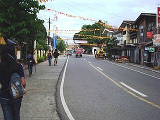
San Carlos is one of the 31 barangays of Valencia City, Bukidnon. It is bounded by Lurogan in the west, Bagontaas, Mailag, and Colonia in the east, Barobo in the south, and the Poblacion in the southeast.

Lomangog is one of the 44 barangays of the municipality of Ubay, in the province of Bohol, Philippines.
Legaspi is one of 14 Barangays of the municipality of Cagdianao, Dinagat Islands, Philippines, and is the location of Cagdianao Valencia Multi-Purpose Cooperative (CVAMPCO), situated in the east central portion of the province.
References
Coordinates: 7°57′N125°06′E / 7.950°N 125.100°E

A geographic coordinate system is a coordinate system that enables every location on Earth to be specified by a set of numbers, letters or symbols. The coordinates are often chosen such that one of the numbers represents a vertical position and two or three of the numbers represent a horizontal position; alternatively, a geographic position may be expressed in a combined three-dimensional Cartesian vector. A common choice of coordinates is latitude, longitude and elevation. To specify a location on a plane requires a map projection.
| This article about a location in Northern Mindanao region is a stub. You can help Wikipedia by expanding it. |