
Dili is the capital and largest city of East Timor. It lies on the northern coast of the island of Timor, in a small area of flat land hemmed in by mountains. The climate is tropical, with distinct wet and dry seasons. The city has served as the economic hub and chief port of what is now East Timor since its designation as the capital of Portuguese Timor in 1769. It also serves as the capital of the Dili Municipality, which includes some rural subdivisions in addition to the urban ones that make up the city itself. Dili's growing population is relatively youthful, being mostly of working age. The local language is Tetum; however, residents include many internal migrants from other areas of the country.

In East Timor, transportation is reduced due to the nation's poverty, poor transportation infrastructure.

East Timor is divided into 14 municipalities, which are former districts. One municipality is also a Special Administrative Region (SAR). The municipalities are divided into administrative posts, and further subdivided into sucos (villages). Atauro Island was initially a part of Dili Municipality, but became a separate municipality on 1 January 2022. The borders between Cova Lima and Ainaro and between Baucau and Viqueque were changed in 2003.

Baucau is a municipality, and was formerly a district, of East Timor, on the northern coast in the eastern part of the country. The capital is also called Baucau. The population of the municipality is 111,694 and it has an area of 1,506 km2.
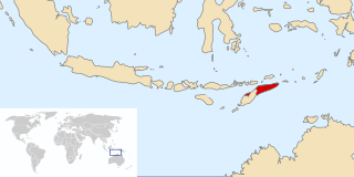
East Timor was a province of Indonesia between 1976 and 1999, during the Indonesian occupation of the country. Its territory corresponded to the previous Portuguese Timor and to the present-day independent country of East Timor.

Lautém is one of the municipalities of East Timor, at the eastern end of the country. It has a population of 64,135 and an area of 1,813 km2. Its capital is Lospalos, which lies 248 km east of the national capital, Dili.

Viqueque is the largest of the municipalities of East Timor. It has a population of 77,402 and an area of 1,877 km2. The capital of the municipality is also named Viqueque.

Cova Lima is a municipality of East Timor, in the Southwest part of the country. It has a population of 59,455 and an area of 1,230 km2. The capital of the municipality is Suai, which lies 136 km from Dili, the national capital.

The national emblem of Timor-Leste, also known as the Belak, is one of the national symbols of the country.

Dili Airport, officially Presidente Nicolau Lobato International Airport, and formerly Comoro Airport, is an international airport serving Dili, the capital city of East Timor. Since 2002, the airport has been named after Nicolau dos Reis Lobato (1946–1978), an East Timorese politician and national hero.

The Armed Forces for the National Liberation of East Timor originally began as the military wing of the Fretilin party of East Timor. It was established on 20 August 1975 in response to Fretilin's political conflict with the Timorese Democratic Union (UDT).

Baguia, officially Baguia Administrative Post, is an administrative post in Baucau municipality, East Timor. Its seat or administrative centre is Alawa Leten, and it has ten sucos.

Parliamentary elections were held in East Timor on 30 June 2007. The new composition of East Timor's national parliament was determined by the country's population. 529,198 voters were entitled to vote, 708 polling stations were ready.
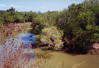
The Seiçal River is a major river in northeastern East Timor. It flows for the most part in a northerly direction from headwaters in Timor's central mountains; after running past the eastern edge of the Baucau Plateau, it discharges into Wetar Strait.
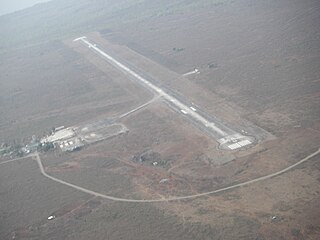
Baucau Airport, formerly Cakung Airport, is an unattended and mostly unused airport near Baucau, East Timor. It is the largest airport in East Timor and has a much longer runway than Dili's Presidente Nicolau Lobato International Airport, long enough to handle large commercial airliners.

Timor-Leste, also known as East Timor, officially the Democratic Republic of Timor-Leste, is a country in Southeast Asia. It comprises the eastern half of the island of Timor, the exclave of Oecusse on the island's north-western half, and the minor islands of Atauro and Jaco. The western half of the island of Timor is administered by Indonesia. Australia is the country's southern neighbour, separated by the Timor Sea. The country's size is 14,950 square kilometres (5,770 sq mi). Dili, on the north coast of Timor, is its capital and largest city.

Adaljiza Albertina Xavier Reis Magno is an East Timorese politician and diplomat, and a member of the Fretilin political party.

The 1959 Viqueque rebellion was an uprising against the Portuguese rule in the southeastern part of East Timor. It was concentrated in the remote regions of Uatolari and Uatocarbau. It was an anti-colonial rebellion against the Portuguese, who had been the colonial masters of East Timor since the sixteenth century. The rebellion is significant in East Timorese history because it was the only rebellion that erupted after World War II. For the longest time, due to lack of information and research, there were speculations and assumptions made about the origins of the rebellion which focus more on external factors, like the role of Indonesia. However, in the last decade, there has been more research done that has helped to illuminate this part of East Timor's history and it has also highlighted the agency of the East Timorese for participating in the rebellion.
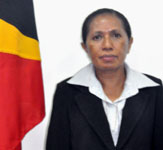
Ilda Maria da Conceição, whose resistance names were Lalo Imin and Wairaha Gae Imin, is a politician from East Timor. She is a member of the FRETILIN party.


