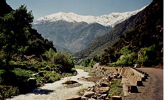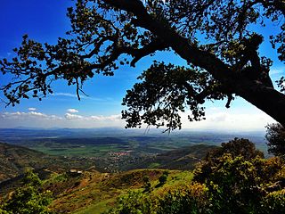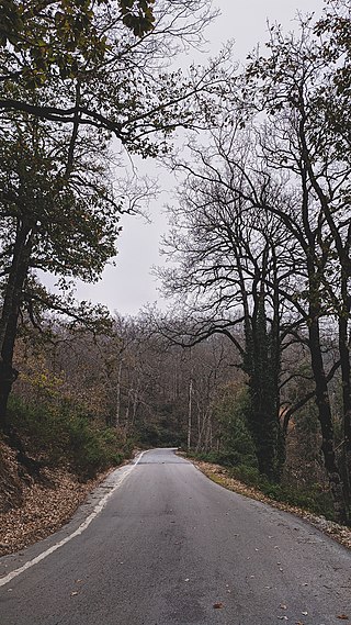
The Rif or Riff, also called Rif Mountains, is a geographic region in northern Morocco. It is bordered on the north by the Mediterranean Sea and Spain and on the west by the Atlantic Ocean, and is the homeland of the Rifians and the Jebala people. This mountainous and fertile area is bordered by Cape Spartel and Tangier to the west, by Berkane and the Moulouya River to the east, by the Mediterranean to the north, and by the Ouergha River to the south. The Rif mountains are separated into the eastern Rif mountains and western Rif mountains.

Salé is a city in northwestern Morocco, on the right bank of the Bou Regreg river, opposite the national capital Rabat, for which it serves as a commuter town. Along with some smaller nearby towns, Rabat and Salé form together a single metropolitan area.

Petite Kabylie or Petite Kabylia is a natural region in the mountainous area of northern Algeria. The Petite Kabylie is part of the greater Kabylie region.

Ifrane is a city in the Middle Atlas region of northern Morocco. The capital of Ifrane Province in the region of Fès-Meknès, Ifrane is located at an elevation of 1,665 m (5,463 ft). In the regional Tamazight language, "ifran" means caves.

The Middle Atlas is a mountain range in Morocco. It is part of the Atlas mountain range, a mountainous region with more than 100,000 km2, 15 percent of its landmass, rising above 2,000 metres. The Middle Atlas is the northernmost and second highest of three main Atlas Mountains chains of Morocco. To south, separated by the Moulouya and Um Er-Rbiâ rivers, lies the High Atlas. The Middle Atlas form the westernmost end of a large plateaued basin extending eastward into Algeria, also bounded by the Tell Atlas to the north and the Saharan Atlas to the south, both lying largely in Algeria. North of the Middle Atlas and separated by the Sebou River, lie the Rif mountains which are an extension of the Baetic System, which includes the Sierra Nevada in the south of Spain. The basin of the Sebou is not only the primary transportation route between Atlantic Morocco and Mediterranean Morocco but is an area, watered by the Middle Atlas range, that constitutes the principal agricultural region of the country.

Ourika River is a river in Morocco, at 31.4°N 7.783333°W. It rises in the High Atlas and flows through the Ourika Valley, 30 km from Marrakech.

The national park of Djurdjura is one of the national parks of Algeria. It is located in Kabylie and is named after the Djurdjura Range of the Tell Atlas.

Ifrane National Park is a national park located in the Middle Atlas mountain range, in Morocco. Its territory extends over the Western part of the Middle Atlas mountains and areas within the provinces of Ifrane and Boulmane. It was established in 2004 and covers an area of 125,000 hectares. Much of the park is forested with Atlas cedar. Ifrane National Park is one of the few remaining habitats for the Barbary macaque, Macaca sylvanus; this primate prehistorically had a much broader range in North Africa, but currently survives as an endangered species in narrowly restricted and fragmented habitats.
The Djebel Babor Nature Reserve is a protected area in Algeria. The reserve is within the Babor Mountains. Much of this area is forested with Mediterranean conifer and mixed forests. This reserve offers one of the few remaining disjunctive habitats for the endangered Barbary macaque, Macaca sylvanus, a primate species which prehistorically held a much wider range. The reserve is also a significant birdwatching area.

Guerrouch is a region of Algeria within the Petite Kabylie of the Tell Atlas Mountain Range. The Guerrouch is one of the few remaining habitats for the endangered primate Barbary macaque, Macaca sylvanus; prehistorically this primate had a much wider distribution, prior to deforestation activity by the expanding human population.

Pic des Singes is a peak in northern Algeria, northwest of the town of Béjaïa. It is located in the Cap Carbon area of the Tell Atlas range, on the Mediterranean coast.
The Tizguit Valley is a river-cut landform in the Middle Atlas mountain range, in the Fès-Meknès region of Morocco.

The Ouergha River or Oued Ouerrha is a watercourse in Morocco that is a tributary to the Sebou River.

The Inaouen River is a watercourse in Morocco. It is a tributary of the Sebou River. The river rises in the Middle Atlas mountain range. A major dam, the Idriss I, was constructed on the Inaouen in 1973.

The Idriss I Dam, also known as the Idriss the First Dam, is a gravity dam on the Inaouen River, a tributary of the Sebou River. The dam is situated in the Gharb Basin and is located 27 kilometres (17 mi) northeast of Fes in Taza and Taounate Province, Morocco. The dam serves to provide irrigation water for 72,300 hectares of land and its power plant generates 66 GWh of electricity annually. It is named after Idriss I. It has faced criticism since it failed to deliver irrigation to the projected number of acres and it has also denied water use to historical downstream agricultural and residential users.
Abu Salim 'Abd Allah ibn Mohammed ibn Abu Bakr al-'Ayyashi was a well-known travel writer, poet, lawyer, and Sufi scholar from Morocco.
Dr. Mohammed Zniber (1923–1993) was a Moroccan writer and historian. In February 1944, he was arrested by the French together with his brother and father and spent three months in prison.
Ali Oumlil is a Moroccan philosopher, thinker, human rights activist, diplomat and political persona.

Aziza Jalal is a Moroccan Arabic pop singer and actress.
Wadi al-Batʼha, historically known as Wadi al-Wutar, is an ancient river valley under rehabilitation in the Najd region of Riyadh Province, Saudi Arabia. The valley once descended from Shiʿb Abu Rufia, and traversed from northwest to south, cutting through town of Riyadh before meeting Wadi Hanifa in the southwest. The remnants of the valley today originate and end in the al-Masani neighborhood and has a length of almost 6.5 km, with the stream draining into Wadi Hanifa as per its previous river mouth. It has lent its name to the al-Batʼha Street in downtown Riyadh, which runs parallel to the now-dried up stream of the wadi, as well as the locality surrounding it and the sub-municipality.


