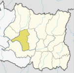
Khotang District is one of 14 districts of Koshi Province of eastern Nepal. The district, with Diktel as its district headquarters, covers an area of 1,591 km2 (614 sq mi) and has a population (2021) of 206,312. The district has been bordered by Bhojpur District in the east, Udayapur District in the south, Okhaldhunga District in the west and Solukhumbu District in the North. In this district there are 2 municipalities and 8 rural/urban municipalities.

Solukhumbu District (Nepali: सोलुखुम्बु जिल्ला[solukʰumbu], Sherpa: ཤར་ཁུམ་བུ་རྫོང་།, Wylie: shar khum bu dzong) is one of 14 districts of Koshi Province of eastern Nepal. As the name suggests, it consists of the subregions Solu and Khumbu. The closest post office to Solukhumbu with a postal code assigned to it is the Sindhuli D.P.O., which has the postal code 56000.

The Halesi-Maratika Caves are located next to the village of Mahadevasthan, in the Khotang District of eastern Nepal, 3,100 ft. – 4,734 ft. above sea level. The cave and temple are about 185 km south west of Mount Everest. The temple is a venerated pilgrimage site for Hindus, Buddhists and Kirat. The caves are called the Halesi Mahadev Temple by Hindus who associate them with Mahadeva, a form of Shiva; while they are known as the sacred place to Buddhists, who consider them to be the caves associated with the legend of Padmasambhava. The Kirati Rai of the region worship Halesi as an ancestral deity of the community. The Kirat mundhum, a rich oral tradition of the Kirats, manifests that their ancestor Raechhakule (Khokchilipa) also known as Hetchhakuppa used to stay inside the Halesi cave in the remote past. For that reason, the Kirat/Rais consider Halesi as their ancestral place.

Diktel Rupakot Majhuwagadhi is a Municipality in Khotang District of Province No. 1 of Nepal. The municipality was established in May 2014 merging some existing VDCs: Bamrang, Laphyang and Kahalle as Diktel Municipality.
Baksila is a village and village development committee in Khotang District in the Sagarmatha Zone of eastern Nepal. At the time of the 1991 Nepal census it had a population of 3,996 persons living in 796 individual households. Baksila is a five hours walk from Diktel, headquarters of Khotang District. Surrounded by Baspani, Sungdel, Dipsung, Rakha Saptewor and Kharmi, the village is split into nine wards geographically. It became the headquarters of Kepilasgadhi rural municipality after the local level division in line with the constitution and local level election. It is ward number 4 of Kepilasgadhi RM and Ganesh Bahadur Adhikari is the chairperson of ward. Shree Prithvi Higher Secondary School, Local Buddha Bajar, Kepilasgadhi, etc. are the main places/offices.
Dhitung is a village and Village Development Committee in Khotang District in the Sagarmatha Zone of eastern Nepal. At the time of the 1991 Nepal census it had a population of 3,009.
Khotang Bazar is a village and Village Development Committee in Khotang District in Province No. 1 in eastern Nepal. At the time of the 1991 Nepal census, it had a population of 2,433 persons living in 458 individual households.....
Mahadevasthan is a village and Village Development Committee in Khotang District in the Sagarmatha Zone of eastern Nepal. At the 1991 Nepal census, it had a population of 2,343 persons living in 453 individual households.
Rajapani is a town and Village Development Committee in Khotang District in the Sagarmatha Zone of eastern Nepal. At the time of the 1991 Nepal census it had a population of 3,444 people living in 622 individual households.
Tilung is a moribund Kiranti language spoken in Nepal. According to Opgenort, Tilung occupies an independent position within the Kiranti language family, and can be placed roughly between the Western languages Thulung, Khaling and Dumi, on the one side, and the Southern Central Kiranti languages Kulung, Chamling and Bantawa, on the other. Even though Tilung is spoken directly to the south of the Wambule speaking area, Tilung and Wambule are not mutually intelligible. The Choskule and Dorungkecha "dialects" may be related languages.
Chaudandigadhi is a municipality in Udayapur District of Province No. 1 in Nepal that was established on 10 March 2017 by merging the former Village development committees Chaudandi, Siddipur, Hadiya and Sundarpur with the former municipality Beltar Basaha. At the time of the 2011 Nepal census, the localities out of which Chaudandigadhi would be formed had a joint population of 48,574 people living in 10,519 individual households. It is surrounded by Belka Municipality in the east, Triyuga in the west, the districts of Khotang and Bhojpur in the north and Sunsari District in the south.
Halesi Tuwachung is a municipality out of two municipalities in Khotang District of Province No. 1 of Nepal. It is in western part of the district and about 40 km far from Diktel, the headquarter of the district. It is named after the famous Halesi Mahadev.
Khotehang is a rural municipality (gaunpalika) in Khotang District of Province No. 1 of Nepal.
DiprungChuichumma is a rural municipality (gaunpalika), and one of eight rural municipalities located in Khotang District of Province No. 1 in Nepal. There are a total of 10 municipalities in Khotang in which 2 are urban and 8 are rural.
Aiselukharka is a rural municipality (gaunpalika) out of eight rural municipality located in Khotang District of Province No. 1 of Nepal. There are a total of 10 municipalities in Khotang in which 2 are urban and 8 are rural.
Jantedhunga is a rural municipality (gaunpalika) out of eight rural municipality located in Khotang District of Province No. 1 of Nepal. There are a total of 10 municipalities in Khotang in which 2 are urban and 8 are rural.
Kepilasgadhi is a rural municipality (gaunpalika) out of eight rural municipality located in Khotang District of Province No. 1 of Nepal. There are a total of 10 municipalities in Khotang in which 2 are urban and 8 are rural.
Barahapokhari is a rural municipality (gaunpalika) out of eight rural municipality located in Khotang District of Province No. 1 of Nepal. There are a total of 10 municipalities in Khotang in which 2 are urban and 8 are rural.
Rawabesi is a rural municipality (gaunpalika) in Khotang District of Province No. 1 of Nepal.
Sakela is a rural municipality (gaunpalika) out of eight rural municipality located in Khotang District of Province No. 1 of Nepal. There are a total of 10 municipalities in Khotang in which 2 are urban and 8 are rural.