Bahía de los Ángeles is a coastal bay on the Gulf of California, located along the eastern shore of the Baja California Peninsula in the state of Baja California, Mexico. The town of the same name is located at the east end of Federal Highway 12 about 42 miles (68 km) from the Parador Punta Prieta junction on Federal Highway 1. The area is part of the Ensenada Municipality.

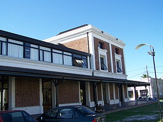
Ensenada is a coastal city in Mexico, the third-largest in Baja California. Lying 125 kilometres (78 mi) south of San Diego on the Baja California Peninsula, it is locally referred to as La Cenicienta del Pacífico, "The Cinderella of the Pacific."
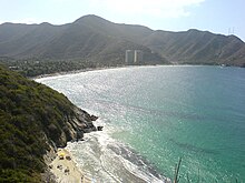
Maracay is a city in north-central Venezuela, near the Caribbean coast, and is the capital and most important city of the state of Aragua. Most of it falls under the jurisdiction of the Girardot Municipality. The population of Maracay and its surroundings as per the 2011 census was 955,362. In Venezuela, Maracay is known as "Ciudad Jardín", or "Garden City".
Huatulco, formally Bahías de Huatulco, centered on the town of La Crucecita, is a tourist development in Mexico. It is located on the Pacific coast in the state of Oaxaca. Huatulco's tourism industry is centered on its nine bays, thus the name Bahias de Huatulco, but has since been unofficially shortened to simply Huatulco. Huatulco has a wide variety of accommodations from rooms for rent, small economy luxury hotels, luxury villas, vacation condominiums, bed and breakfasts, as well as several luxury resorts standing on or near the shores of Tangolunda Bay. The Camino Real Zaashila, Quinta Real Huatulco, Las Brisas, Dreams Resort & Spa, and the Barceló are examples of the most popular larger resorts in the area.

San Quintín is a coastal town on the west coast of the Mexican state of Baja California, in the Municipality of Ensenada, some 190 km (118 mi.) south of the city of Ensenada on Mexican Federal Highway 1. The town is also in the middle of an important agricultural area, especially for growing strawberries and tomatoes. The largest nearby locality is Lázaro Cardenas, home to 16,294 people as of the 2010 census. The whole area houses roughly 25,000 people, up from 20,000 in 2000. This is the largest population cluster south of Ensenada within the state.

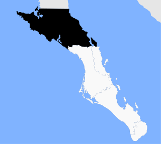
The municipality of Ensenada, with a land area of 52,482.40 km2 (20,263.57 sq mi), takes up the majority of the state of Baja California. It is the largest municipality in Mexico and in the Americas by area. It contains all of Baja California apart from a strip at the north and, at the northeast extremity of the state, the municipality of Mexicali. It is bordered by the Pacific Ocean on the west, the Gulf of California on the east, and by all of the other municipalities in Baja California on the North. Its municipal seat is Ensenada, which lies near the northwest corner of the municipality, although almost all of the municipality's territory lies far to its southeast. Its current municipal president is Enrique Pelayo Torres. A major port is planned to be built in Punta Colonet, a largely uninhabited area 80 km (50 mi) south of the city of Ensenada. Located offshore, Guadalupe Island is part of the municipality, making Ensenada the westernmost municipality of Latin America.
Mulegé is the northernmost municipality of the Mexican state of Baja California Sur. It is the second-largest municipality by area in the country, with an area of 32,092.2 km². In the census of 2010 it had a population of 59,114 inhabitants. Isla Natividad is part of the municipality.

La Manga, or La Manga del Mar Menor is a seaside spit of Mar Menor in the Region of Murcia, Spain.
Ensenada is a city and port in Buenos Aires Province, Argentina, located around the Ensenada de Barragán. It has 31,031 inhabitants as per the 2001 census [INDEC]. It is the capital of Ensenada Partido, and
together with Berisso Partido they are the main suburbs of the Gran La Plata conurbation around the provincial capital of La Plata.

Tongoy is a Chilean coastal town in the commune of Coquimbo in Elqui Province, Coquimbo Region. It is located 42 km (26 mi) to the south of Chile's second oldest city, La Serena, next to Guanaqueros beach, on a rocky promontory opposite the Pacific Ocean, between the beaches of Socos (4 km) and Grande (26 km), to the north of the Talinay Mountain range.
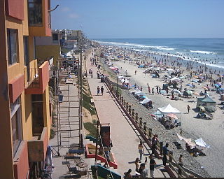
Playas de Tijuana is the westernmost borough of the municipality of Tijuana, Baja California.

Gulf of the Farallones is a gulf of the Pacific Ocean off the northern California coast. It extends westward from the opening of the San Francisco Bay and Drakes Bay to the Farallon Islands. Most of the gulf lies in Gulf of the Farallones National Marine Sanctuary, which protects about 1,250 square miles (3,200 km2).
Bahía Soledad Airstrip was a private dirt airstrip located in Bahía Soledad, a private beach located 30 km south of Ensenada, Municipality of Ensenada, Baja California, Mexico, on the Pacific Ocean coast. The airstrip was used solely for general aviation. From April 2007, the airport was abandoned. The BSO code is used as identifier. The only operator at the airport is Aeromaan, with only occasional flights.

Bay of Arauco or Bahia de Araucan, is a bay located on the coast of the Arauco Province, of the Bío Bío Region of Chile. The bay, is between the mountains of the Nahuelbuta Range to the east and to the west the Santa Maria Island and northwest the Pacific Ocean. It is south and west of the Bay of Concepción and north of Arauco. The Bio Bio River flows into the bay at its northern end 10 km west of the city of Concepcion. On its shores are the cities of Lota, Colonel and Arauco.

Literally "Eagles Bay", Bahia de las Aguilas is an 8 km long beach along the southwestern coast of the Dominican Republic near the southernmost part of the border with Haiti. The bay is part of the Jaragua National Park, and it is considered by many Dominicans as one of the most beautiful beaches in the world. The bay is a protected area as is the surrounding park, hence there is an abundance of sea life just feet off the beach within its waters.

Bahía Solano is a municipality and town in the Chocó Department, Colombia. Bahia, as it is locally known, is an economic and tourist center of coastal Choco. Bahia is home to an airport as well as seaport, and along with daily flights to and from Medellin, Quibdo, Cali, and Bogota, there are bi-weekly ships that take passengers and cargo from Bahia to the port of Buenaventura. The region around Bahia Solano is home to scuba diving and sport fishing opportunities, providing a plethora of marine activities to the traveller. 18 km away from Bahia Solano, is the beach town of El Valle, Choco, which is the closest community to Ensenada de Utria National Park, located only 9 kilometres (5.6 mi) down the beach.
The Gold Coast is a northwestern region of the Baja California Peninsula. It is one of the most visited places in Mexico. The Gold Coast is one of the richest, most educated, and most developed areas in Mexico.
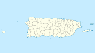
Gatas is a small island in barrio Playa in the municipality of Ponce in southern Puerto Rico. The island is home to the Club Náutico de Ponce, a private sports complex, and it is located south of La Guancha and the Port of Ponce. Together with Caja de Muertos, Morrillito, Ratones, Cardona, Isla del Frio, and Isla de Jueyes, Gatas is one of seven islands in the municipality of Ponce.