Bajela | |
|---|---|
Town | |
 | |
| Country | |
| Region | Mudug |
| Time zone | UTC+3 (EAT) |
Bajela (Somali : Bajeela) [1] is a town in the north-central Mudug region of Somalia.
Bajela | |
|---|---|
Town | |
| | |
| Country | |
| Region | Mudug |
| Time zone | UTC+3 (EAT) |
Bajela (Somali : Bajeela) [1] is a town in the north-central Mudug region of Somalia.

Somalia, officially the Federal Republic of Somalia, is the easternmost country in continental Africa. The country is located in the Horn of Africa and is bordered by Ethiopia to the west, Djibouti to the northwest, Kenya to the southwest, the Gulf of Aden to the north, and the Indian Ocean to the east. Somalia has the longest coastline on Africa's mainland. Somalia has an estimated population of 18.1 million, of which 2.7 million live in the capital and largest city, Mogadishu. Around 85% of its residents are ethnic Somalis and the official languages of the country are Somali and Arabic, though the former is the primary language. Somalia has historic and religious ties to the Arab world. As such the people in Somalia are Muslims, the majority of them Sunni.
The Battle of Mogadishu, also known as the Black Hawk Down Incident, was part of Operation Gothic Serpent. It was fought on 3–4 October 1993, in Mogadishu, Somalia, between forces of the United States—supported by UNOSOM II—against the forces of the Somali National Alliance (SNA) and armed irregulars of south Mogadishu.

Sool is a disputed administrative region (gobol). It borders Togdheer to the west, Sanaag to the north, Ethiopia to the south and Nugal, Bari to the east. Its capital city is Las Anod. The region is disputed by the self-declared Republic of Somaliland and SSC-Khatumo. The region is partially controlled by both polities.

French Somaliland was a French colony in the Horn of Africa. It existed between 1884 and 1967, at which became the French Territory of the Afars and the Issas. The Republic of Djibouti is its legal successor state.

USS Nicholas (FFG-47), an Oliver Hazard Perry-class frigate, was the third ship of the United States Navy to be named for Major Samuel Nicholas, the first commanding officer of the United States Marines. A third-generation guided missile frigate of the Oliver Hazard Perry class, she was laid down as Bath Iron Works hull number 388 on 27 September 1982 and launched 23 April 1983. Sponsor at her commissioning there on 10 March 1984 was the same Mrs. Edward B. Tryon who sponsored DD 449 in 1942.

Jijiga is the capital city of Somali Region, Ethiopia. It became the capital of the Somali Region in 1995 after it was moved from Gode. Located in the Fafan Zone with 70 km (37 mi) west of the border with Somalia, the city has an elevation of 1,634 metres above sea level. Jigjiga is traditionally the seat of the Bartire Garad Wiil-Waal of the Jidwaaq Absame. The International airport is named after him.

The Transitional Federal Parliament of the Somali Republic (TFP) was the national parliament of Somalia from 2004 until 2012.
Burhakaba is a town located in the Bay region in Somalia.
Raaso is a city in the Somali Region of Ethiopia. Situated in the Afder Zone, it is the most populated city in the region.
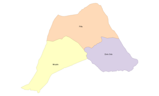
Liben is a zone in Somali Region of Ethiopia. Liben is bordered on the south by Kenya, on the northwest by the Oromia Region, on the northeast by Afder, and on the southeast by Somalia's federal state of Jubaland. Towns in Liben zone include Filtu, Gof Bokolmayo, Deka Suftu, and Dolo. Borena National Park covers the southwestern portion of the zone.

West Hararge is a zone in the Oromia Region of Ethiopia. West Hararghe takes its name from the former province of Hararghe. West Harerge is bordered on the south by the Shebelle River which separates it from Bale, on the southwest by Arsi, on the northwest by the Afar Region, on the north by the Somali Region and on the east by East Hararghe. Towns in West Hararghe include Chiro, Badessa, Gelemso, and Mieso, Asebot.
Boh, popularly known as 'Iid, is one of the woredas in the Somali Region of Ethiopia. Part of the Werder Zone, Boh is located in the easternmost part of the country, at the point of the angle jutting into Somalia; on its other sides, this woreda is bordered on the southwest by Geladin, and on the northwest by Danot. The easternmost point of this woreda is the easternmost point of Ethiopia. Towns in Boh include Boh, Dameco jiracle, Afa'ridood, Gambarey, Maaneed,Qaawane;marqaanwayne Galhamur, Toga'Erigoo, Saaxa-dheer qaawane is one of city’s of the bokh
Werder is one of the woredas in the Somali Region of Ethiopia, named after its administrative center, Werder. Part of the Werder Zone, Werder is bordered on the southwest by the Korahe Zone, on the north by Danot, and on the east by Geladin.
Kebri Dahar is a woreda in the Somali Region of Ethiopia. Part of the Korahe Zone, Kebri Dahar is bordered on the south by Debeweyin, on the west by the Gode Zone, on the northwest by Shekosh, on the north by the Degehabur Zone, on the east by the Werder Zone, and on the southeast by Shilavo. The largest city in Kebri Dahar is Kebri Dahar. The population of Kebri Dahar is 93000.
Filtu is one of the woredas in the Somali Region of Ethiopia. Part of the Liben Zone, Filtu is bordered on the south by the Dawa River which separates it from Moyale and Udet, on the west by the Oromia Region, on the north and east by the Ganale Dorya River which separates it from the Afder Zone, and on the southeast by Dolo Odo. The major town of this woreda is Filtu.
Gursum is one of the Districts in the Oromia region of Ethiopia. Part of the East Hararghe Zone, Gursum is bordered on the south by Babille, on the west by the Harari Region, on the north by Jarso, and on the east by the Gursum district in the Somali region. The administrative center of the woreda is Funyan Bira.
Rayitu is one of the Districts in the Oromia Region of Ethiopia. Located in East Bale zone or Eastern part of the Bale Zone, Rayitu is bordered on the south by the Somali Region, on the west by Ginir, and on the north and east by Seweyna; the Gestro River defines the southwest boundary. Towns in Raytu include Dhedecha Bela Town.
Moyale is one of the Districtss in the Somali Region of Ethiopia. It is named after the administrative center of the woreda, Moyale. Located in the southeast corner of the Borena Zone, Moyale is bordered on the south by Kenya, on the west by Dire, on the northwest by Arero, on the north by the Dawa River which separates it from Liben, and on the east by Dawa Zone Somali Region.
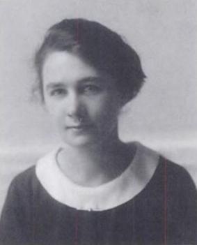
Lilias Eveline Armstrong was an English phonetician. She worked at University College London, where she attained the rank of reader. Armstrong is most known for her work on English intonation as well as the phonetics and tone of Somali and Kikuyu. Her book on English intonation, written with Ida C. Ward, was in print for 50 years. Armstrong also provided some of the first detailed descriptions of tone in Somali and Kikuyu.

Villaggio Duca degli Abruzzi was a village that was founded as an agricultural settlement in Italian Somalia.
5°47′10.92″N47°42′13.85″E / 5.7863667°N 47.7038472°E
| | This Somalia location article is a stub. You can help Wikipedia by expanding it. |