
A floodplain or flood plain or bottomlands is an area of land adjacent to a river. Floodplains stretch from the banks of a river channel to the base of the enclosing valley, and experience flooding during periods of high discharge. The soils usually consist of clays, silts, sands, and gravels deposited during floods.

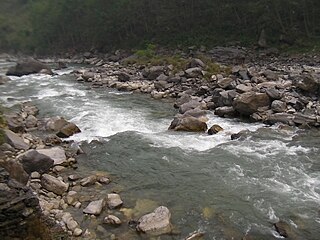
The Ghaghara River, called Karnali River in Nepal, Mapcha Tsangpo in Tibet, and the lower Ghaghara in Awadh called Sarayu River, is a perennial trans-boundary river that originates in the northern slopes of the Himalayas in the Tibetan Plateau, cuts through the Himalayas in Nepal and joins the Sharda River at Brahmaghat in India. Together they form the Ghaghara River, a major left-bank tributary of the Ganges. With a length of 507 km (315 mi), it is the longest river in Nepal. The total length of the Ghaghara up to its confluence with the Ganges at Revelganj in Bihar is 1,080 km (670 mi). It is the largest tributary of the Ganges by volume and the second largest by length after Yamuna.

The Terai or Tarai is a lowland region in northern India and southern Nepal that lies south of the outer foothills of the Himalayas, the Sivalik Hills, and north of the Indo-Gangetic Plain. This lowland belt is characterised by tall grasslands, scrub savannah, sal forests and clay rich swamps. In North India, the Terai spreads from the Yamuna River eastward across Haryana, Uttarakhand, Uttar Pradesh, Bihar and West Bengal. The Terai is part of the Terai-Duar savanna and grasslands ecoregion. The corresponding lowland region in West Bengal, Bangladesh, Bhutan and Assam in the Brahmaputra River basin is called 'Dooars'. In Nepal, the term is applied to the part of the country situated north of the Indo-Gangetic Plain. Nepal's Terai stretches over 33,998.8 km2 (13,127.0 sq mi), about 23.1% of Nepal's land area, and lies at an elevation of between 67 and 300 m. The region comprises more than 50 wetlands. North of the Terai rises the Bhabar, a narrow but continuous belt of forest about 8–12 km (5.0–7.5 mi) wide.

Damodar River is a river flowing across the Indian states of Jharkhand and West Bengal. The valley is rich in mineral resources and is known for large-scale mining and industrial activity. It was also known as the Sorrow of Bengal because of its ravaging floods in the plains of West Bengal. The construction of several dams on the Damodar and its tributaries has helped control some of the flooding.

The Gandaki River, also known as the Narayani and Gandak, is one of the major rivers in Nepal and a left-bank tributary of the Ganges in India. Its total catchment area amounts to 46,300 km2 (17,900 sq mi), most of it in Nepal. In the Nepal Himalayas, the Gandaki is notable for its deep canyon. The basin also contains three mountains over 8,000 m (26,000 ft), namely Dhaulagiri, Manaslu and Annapurna Massif. Dhaulagiri is the highest point of the Gandaki basin.

The Kosi or Koshi is a transboundary river which flows through China, Nepal and India. It drains the northern slopes of the Himalayas in Tibet and the southern slopes in Nepal. From a major confluence of tributaries north of the Chatra Gorge onwards, the Kosi River is also known as the Saptakoshi for its seven upper tributaries. These include the Tamur River originating from the Kanchenjunga area in the east and Arun River and the Sun Kosi from Tibet. The Sun Koshi's tributaries from east to west are the Dudh Koshi, Likhu Khola, Tamakoshi River, Bhote Koshi and Indravati. The Saptakoshi crosses into northern Bihar, India where it branches into distributaries before joining the Ganges near Kursela in Katihar district. The Kosi is the third-largest tributary of the Ganges by water discharge after the Ghaghara and the Yamuna.

The Indian Rivers Inter-link is a proposed large-scale civil engineering project that aims to effectively manage water resources in India by linking Indian rivers by a network of reservoirs and canals to enhance irrigation and groundwater recharge, reduce persistent floods in some parts and water shortages in other parts of India. India accounts for 18% of the world population and about 4% of the world's water resources. One of the solutions to solve the country's water woes is to link rivers and lakes.
Bhote Koshi in Nepal and Poiqu in Tibet is the name given to the upper course of the Sun Kosi river. It is part of the Koshi River system in Nepal.

Climate change in South Asia is having significant impacts already which are expected to intensify as global temperatures rise due to climate change. The South Asia region consists of the eight countries: Afghanistan, Pakistan, India, Nepal, Bhutan, Bangladesh, the Maldives and Sri Lanka. In the 2017 edition of Germanwatch's Climate Risk Index, Bangladesh and Pakistan ranked sixth and seventh respectively as the countries most affected by climate change in the period from 1996 to 2015, while India ranked fourth among the list of countries most affected by climate change in 2015. The Indian subcontinent is one of the most vulnerable regions globally to a number of direct and indirect effects of climate change, including sea level rise, cyclonic activity, and changes in ambient temperature and precipitation patterns. Ongoing sea level rise has already submerged several low-lying islands in the Sundarbans region, displacing thousands of people.
The Inner Terai Valleys of Nepal comprise several elongated river valleys in the southern lowland Terai part of the country. These tropical valleys are enclosed by the Himalayan foothills, viz the Mahabharat Range and the Sivalik Hills farther south.
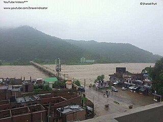
The 2008 Bihar flood was one of the most disastrous floods in the history of Bihar, an impoverished and densely populated state in India. The Koshi embankment near the Indo-Nepal border broke on 18 August 2008. The river changed course and flooded areas which had not been flooded in many decades. The flood affected over 2.3 million people in the northern part of Bihar.

Flood control methods are used to reduce or prevent the detrimental effects of flood waters. Flood relief methods are used to reduce the effects of flood waters or high water levels. Flooding can be caused by a mix of both natural processes, such as extreme weather upstream, and human changes to waterbodies and runoff. A distinction is made between structural and non-structural flood control measures. Structural methods physically restrain the flood waters, whereas non-structural methods do not. Building hard infrastructure to prevent flooding, such as flood walls, is effective at managing flooding. However, increased best practice within landscape engineering is to rely more on soft infrastructure and natural systems, such as marshes and flood plains, for handling the increase in water. To prevent or manage coastal flooding, coastal management practices have to handle natural processes like tides but also the human-caused sea level rise.
The Kamala River originates in Nepal and flows through the Indian state of Bihar.

The Sunkoshi, also spelt Sunkosi, is a river that is part of the Koshi or Saptkoshi River system in Nepal. Sunkoshi has two source streams, one that arises within Nepal in Choukati, and the other more significant stream that flows in from Nyalam County in the Tibet region of China. The latter is called Bhote Koshi in Nepal and Matsang Tsangpo in Tibet. Due to the significant flows from Bhote Koshi, the Sun Koshi river basin is often regarded as a trans-border river basin.
The Kankai River is a trans-boundary river flowing through the hills of Ilam and the plains of the Jhapa District in Nepal. It begins at the confluence of the Mai Khola and Deb Mai Khola rivers.
The Lakhandei River is a river in southern Nepal and in the state of Bihar in India. It is a main tributary of the Bagmati River.
West Rapti, also known as the Kuwano, is a river which drains Rapti Zone in Mid-Western Region, Nepal, then Awadh and Purvanchal regions of Uttar Pradesh state, and finally India before joining the Ghaghara. It is a major left bank tributary of the Ganges, and is also known as the Karnali inside Nepal.

Koshi Province is the autonomous easternmost province adopted on 20 September 2015 by Constitution of Nepal. The province is rich in natural resources, tourist attractions, recreational activities, and natural beauty. The province covers an area of 25,905 km2 (10,002 sq mi), about 17.5% of the country's total area. With the industrial city of Biratnagar as its capital, the province includes major eastern towns of Birtamod, Sundar Haraincha, Damak, Dharan, Itahari, Triyuga Municipality and Mechinagar, and the Mount Everest, Kangchenjunga and Ama Dablam. Koshi River, the largest river of the nation, is the province's western boundary. Under the First-past-the-post voting system issued by the Constituency Delimitation Commission, Nepal, the province hosts 28 parliamentary seats and 56 provincial assembly seats.
Budhi Khola is a river passing though Itahari in Nepal. The river acts as a border between Sunsari and Morang districts. The main catchment of the river lies between Dharan and Tarahara and flows from northern mid hills near Dharan, passes Itahari, Dhuhabi and finally towards India. In India and southern Nepal, the river is called Keshaliya Khola. In 2017, the flood in the river killed six peoples.
