Baldwin River (Michigan)

Last updated
Baldwin River
Country United States
Physical characteristics
Main source Lake County, Michigan
River mouth Pere Marquette River
817 ft (249 m) [1]

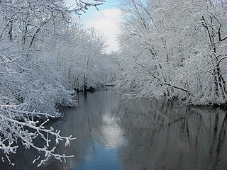
The Baldwin River is a 25.2-mile-long (40.6 km) [2] stream in the U.S. state of Michigan.

Stream A body of surface water flowing down a channel

A stream is a body of water with surface water flowing within the bed and banks of a channel. The stream encompasses surface and groundwater fluxes that respond to geological, geomorphological, hydrological and biotic controls.

Michigan State of the United States of America

Michigan is a state in the Great Lakes and Midwestern regions of the United States. The state's name, Michigan, originates from the Ojibwe word mishigamaa, meaning "large water" or "large lake". With a population of about 10 million, Michigan is the tenth most populous of the 50 United States, with the 11th most extensive total area, and is the largest state by total area east of the Mississippi River. Its capital is Lansing, and its largest city is Detroit. Metro Detroit is among the nation's most populous and largest metropolitan economies.

The river rises out of Wide Waters [3] on the southern edge of the Baldwin Luther Swamp [4] in Newkirk Township, Lake County at 43°59′32″N85°45′58″W / 43.99222°N 85.76611°W / 43.99222; -85.76611 (Baldwin River (source)) . Several tributaries rise in the hills to the east of the swamp, and one stream labeled as the Baldwin River on USGS topographic maps rises in section 23 just southwest of the village of Luther.

Lake County, Michigan County in the United States

Lake County is a county located in the U.S. state of Michigan. As of the 2010 census, the population was 11,539. The county seat is Baldwin.

Luther, Michigan Village in Michigan, United States

Luther is a village in Lake County in the U.S. state of Michigan. The population was 318 at the 2010 census. The village is on the boundary between Newkirk Township on the west and Ellsworth Township on the east, with about half of the village in each. It is the site of Hillsdale College's G.H. Gordon Biological Research Station.

The river flows south into Cherry Valley Township then to the southwest into the village of Baldwin, where it is joined by Sanborn Creek. The GNIS entry for Baldwin River records the mouth as being on the Sanborn Creek at 43°53′27″N85°50′44″W / 43.89083°N 85.84556°W / 43.89083; -85.84556 (Baldwin River (mouth)) . [1] However, USGS topographic maps show the stream continuing southwest into the Pere Marquette River labeled as both the Baldwin River and Sanborn Creek. The GNIS entry for Sanborn Creek indicates it is also known as the Baldwin River. The stream empties into the Pere Marquette at 43°51′36″N85°52′20″W / 43.86000°N 85.87222°W / 43.86000; -85.87222 (Sanborn Creek (mouth)) [5] and thence into Lake Michigan.

Cherry Valley Township, Michigan Township in Michigan, United States

Cherry Valley Township is a civil township of Lake County in the U.S. state of Michigan. The population was 368 at the 2000 census.

Baldwin, Michigan Village in Michigan, United States

Baldwin is a village in the U.S. state of Michigan. The population was 1,208 at the 2010 census. It is the county seat of Lake County. The village is located on the boundary between Webber Township on the north and Pleasant Plains Township on the south, with the larger portion lying in Pleasant Plains.

Pere Marquette River river in Michigan

The Pere Marquette River is a river in Michigan in the United States. The main stream of this river is 63.9 miles (102.8 km) long, running from Lake County south of Baldwin into the Pere Marquette Lake, and from there into Lake Michigan.

The river is notable in American history as the location of the first introduction of brown trout (Salmo trutta) into U.S. waters when on April 11, 1884 the U.S. Fish Commission released 4900 brown trout fry from the Northville, Michigan fish hatchery into the river. [6]

Brown trout species of brown trout

The brown trout is a European species of salmonid fish that has been widely introduced into suitable environments globally. It includes both purely freshwater populations, referred to as the riverine ecotype, Salmo trutta morpha fario, and a lacustrine ecotype, S. trutta morpha lacustris, also called the lake trout, as well as anadromous forms known as the sea trout, S. trutta morpha trutta. The latter migrates to the oceans for much of its life and returns to fresh water only to spawn. Sea trout in the Ireland and Britain have many regional names: sewin in Wales, finnock in Scotland, peal in the West Country, mort in North West England, and white trout in Ireland.

United States Fish and Wildlife Service US Federal Government agency

The United States Fish and Wildlife Service is an agency of the US Federal Government within the US Department of the Interior dedicated to the management of fish, wildlife, and natural habitats. The mission of the agency is "working with others to conserve, protect, and enhance fish, wildlife, plants and their habitats for the continuing benefit of the American people."

Northville, Michigan City in Michigan, United States of America

Northville is a city located in and divided by Oakland and Wayne counties in the U.S. state of Michigan. The area is a suburb of Metropolitan Detroit. The population was 5,970 at the 2010 census. Most of the city is in Oakland County and is surrounded by the city of Novi, while the other part is in Wayne County and is surrounded by Northville Township. Northville is served by Northville Public Schools. The city is located 21 miles (34 km) northeast of Ann Arbor and 29 miles (47 km) northwest of Detroit.

Tributaries

From the mouth on the Pere Marquette River:

Related Research Articles

The Jordan River is a 24.9-mile-long (40.1 km) stream in the northwestern part of the lower peninsula in the U.S. state of Michigan. It is the largest tributary of Lake Charlevoix. The Jordan's headwaters rise from springs in the upper Jordan River Valley northeast of Mancelona in Antrim County. The Jordan River was the first river to be designated in Michigan's Natural Rivers Program.

Paw Paw River river in Michigan

The Paw Paw River is located in the U.S. state of Michigan in the southwest portion of the lower peninsula. It is formed by the confluence of the north and south branches at 42°15′17″N85°55′36″W in Waverly Township in the northeast of Van Buren County. It flows approximately 61.8 miles (99.5 km) through Van Buren County and Berrien County until joining the St. Joseph River just above its mouth on Lake Michigan at Benton Harbor.

Pine River (Michigan) Wikimedia disambiguation page

Pine River may refer to any of the following streams in the U.S. state of Michigan:

  1. Pine River. The main branch forms with the confluence of the East and West Branches of the Pine River at 44°29′38″N83°23′16″W in Alcona County. The South Branch joins approximately 1.5 miles (2.4 km) to the south and flows into Iosco County, where it empties into Van Etten Lake at 44°29′38″N83°23′16″W northwest of Oscoda.
  2. Pine River. The main branch is formed by the confluence of the North and Middle Branches northeast of Standish and flows into the Saginaw Bay of Lake Huron at 43°58′32″N83°51′16″W. The South Branch Pine River joins the main stream at 43°59′08″N83°53′17″W.
  3. Pine River is a short waterway, which along with Round Lake, connects Lake Charlevoix with Lake Michigan at Charlevoix.
  4. Pine River rises in Chippewa County and flows south through Mackinac County into the St. Martin Bay of Lake Huron at 46°03′09″N84°39′22″W The North Pine River, also known as the North Branch Pine River, joins at 46°12′20″N84°36′17″W. Another tributary, Hemlock Creek, is also known as Pine River.
  5. Pine River, also known as the South Branch Manistee River, rises in southeast Wexford County, flows southwest across northwest Osceola County, then west and north through the northeast corner of Lake County and back into southwest Wexford County, emptying into the Tippy Dam Pond on the Manistee River at 44°13′37″N85°54′27″W. The main stream is formed from the confluence of the East Branch Pine River with the North Branch Pine River at 44°06′02″N85°31′40″W. Another tributary, the Spaulding Creek, is also known as the Little Pine River
  6. Pine River, in Marquette County, is a very short stream draining Pine Lake into Lake Superior at 46°53′27″N87°52′13″W, north of the Huron Mountains.
  7. Pine River rises in from Pine Lake in eastern Mecosta County, flows mostly south and east through Isabella County, then south along eastern edge of Montcalm County, then east and north through Gratiot County and Midland County, emptying into the Chippewa River at 43°36′06″N84°17′33″W, just about two miles before it joins the Tittabawassee River near Midland. The South Branch Pine River joins the main stream at 43°30′37″N85°00′02″W Another tributary, Miller Creek, is also sometimes known as Pine River or the West Branch Pine River. The North Branch Pine River joins the main stream at 43°26′03″N84°50′18″W.
  8. Pine River empties into the St. Clair River at 42°49′13″N82°29′08″W on the south side of St. Clair. The South Branch Pine River joins the main stream at 42°58′11″N82°37′10″W. Another tributary, Quakenbush Drain, is also sometimes known as Pine River.
  9. Pine Creek empties into Lake Superior and is also known as the Pine River.
White River (White Lake) river in Michigan, United States

The White River is a 23.6-mile-long (38.0 km) river located on the western side of the Lower Peninsula of the U.S. state of Michigan. The White River rises from the extensive Oxford Swamp in north central Newaygo County and flows out into an upland area. The rural town of Hesperia borders the river here.

Chippewa River (Michigan) river in Michigan

The Chippewa River is a stream in the U.S. state of Michigan that runs 91.8 miles (147.7 km) through the central Lower Peninsula. The Chippewa is a tributary of the Tittabawassee River and is thus part of the Saginaw River drainage basin. The river is named after the Chippewa people.

Carp River is a 40.2-mile-long (64.7 km) river in Chippewa and Mackinac counties in the U.S. state of Michigan. 21.7 miles (34.9 km) of the river were added to the National Wild and Scenic Rivers System in 1992.

Black River is a 15.5-mile-long (24.9 km) river in Alcona County in the U.S. state of Michigan. The main branch rises in northern Harrisville Township at 44°40′46″N83°22′15″W and flows north through Haynes Township and Alcona Township and empties into Lake Huron at 44°48′58″N83°17′57″W at the unincorporated community of Black River.

Dowagiac River river in the United States of America

The Dowagiac River is a southwesterly flowing 30.9-mile-long (49.7 km) stream in the Lower Peninsula of the U.S. state of Michigan. It is tributary to the St. Joseph River which flows, in turn, into eastern Lake Michigan.

Cedar River (Gladwin County, Michigan) river in Clare and Gladwin counties, Michigan, United States

The Cedar River is a 29.0-mile-long (46.7 km) river in the U.S. state of Michigan, flowing through Clare County and Gladwin County.

Rocky River (Michigan)

The Rocky River is a 28.3-mile-long (45.5 km) stream located in the southwest part of the U.S. state of Michigan that flows into the St. Joseph River at 41°56′33″N85°37′59″W in the city of Three Rivers in St. Joseph County. The Rocky River, along with the St. Joseph River and the Portage River, are the three rivers from which the city of Three Rivers takes its name.

The Whitefish River is an 11.9-mile-long (19.2 km) river on the Upper Peninsula of the U.S. state of Michigan. The mouth of the river is in Delta County at 45°54′34″N86°58′01″W on the Little Bay De Noc of Lake Michigan. The main branch of the river is formed by the confluence of the east and west branches at 46°03′25″N86°52′17″W.

Elk River Chain of Lakes Watershed

The Elk River Chain of Lakes Watershed is a 75-mile-long (121 km) waterway consisting of 14 lakes and connecting rivers in the northwestern section of the Lower Peninsula of the U.S. state of Michigan, which empty into Lake Michigan.

Papillion Creek is a 15.5-mile-long (24.9 km) tributary of the Missouri River in Nebraska. Its watershed lies in Washington, Douglas and Sarpy counties, including parts of the city of Omaha. The main branch of Papillion Creek is known as Big Papillion Creek. Some of the tributaries include Little Papillion Creek, Thomas Creek, Cole Creek, Northwest Branch of West Papillion Creek, West Papillion Creek, South Papillion Creek, and Mud Creek. Papillion Creek empties into the Missouri River south of Bellevue and just north of the mouth of the Platte River.

Betsie River

The Betsie River is a 54.0-mile-long (86.9 km) stream in the northwest part of the U.S. state of Michigan. The name is derived from the French la rivière aux Bec-scies, meaning river of sawbill ducks (bec-scie). Other alternate names include Aug-sig-o-sebe, Aux Buscies, Betsey's River, Black Robe, Gay-she-say-ing, Riviere du Pere Marquette, Sawbill Ducks, and Shelldrake Ducks. The river is mostly within Benzie County, although the river rises in southwest Grand Traverse County and flows briefly through northern Manistee County, Michigan.

Hersey River river in Michigan, United States

The Hersey River is a 13.4-mile-long (21.6 km) stream in the Lower Peninsula of the U.S. state of Michigan. It rises in Lincoln Township in northwest Osceola County at the junction of Hersey Creek and the East Branch Hersey Creek at 43°50′55″N85°25′59″W. For approximately the first two miles, the river flows southward just east of U.S. Route 131. US 131 crosses the river near the northern boundary of Richmond Township. The river continues southward into Lake No Sho Mo, formed by a dam just south of Nartron Field airport. The river continues southward under U.S. Route 10 into Reed City and turns to the east, continuing southeastward into the village of Hersey, where it empties into the Muskegon River at Blodgett's Landing Campground.

Portage River (Jackson County, Michigan)

The Portage River is a 15.5-mile-long (24.9 km) river in the U.S. state of Michigan, flowing mostly southwesterly through northeast Jackson County.

Carp River is the name of several rivers in the U.S. state of Michigan.

Carp River is a 21.9-mile-long (35.2 km) river in Marquette County in the U.S. state of Michigan. The Carp River is formed by the outflow of Deer Lake in Ishpeming Township north of Ishpeming at 46°31′58″N87°40′01″W in the Upper Peninsula.

Thompson Creek is a stream in Houston County, in the U.S. state of Minnesota. It is a tributary to the Root River.

References