
Assam is a state in northeastern India, south of the eastern Himalayas along the Brahmaputra and Barak River valleys. Assam covers an area of 78,438 km2 (30,285 sq mi). It is the second largest state in northeastern India by area and the largest in terms of population, with more than 31 million inhabitants. The state is bordered by Bhutan and Arunachal Pradesh to the north; Nagaland and Manipur to the east; Meghalaya, Tripura, Mizoram and Bangladesh to the south; and West Bengal to the west via the Siliguri Corridor, a 22-kilometre-wide (14 mi) strip of land that connects the state to the rest of India. Assamese and Boro are the official languages of Assam. Meitei (Manipuri) is the official language of Hojai district and the entirety of the Barak Valley region, while Bengali is an official language in the three districts of Barak Valley.

Meghalaya is a state in northeast India. Meghalaya was formed on 21 January 1972 by carving out two districts from the state of Assam: (a) the United Khasi Hills and Jaintia Hills and (b) the Garo Hills. The estimated population of Meghalaya in 2014 was 3,211,474. Meghalaya covers an area of approximately 22,429 square kilometres, with a length-to-breadth ratio of about 3:1.
Tirap district (Pron:/tɪˈɹæp/) is a district located in the southeastern part of the state of Arunachal Pradesh in India. It shares a state border with Assam, an international border with Myanmar and a district border with Changlang and Longding.
Tezu is a census town and the headquarters of Lohit district in the Indian state of Arunachal Pradesh. It is the fifth largest town in Arunachal Pradesh and one of its most developed.

Dhubri District (Pron:ˈdʊbri) is an administrative district in the Indian state of Assam. Included within the Kamatapur Autonomous Council, the district headquarters are located at Dhubri town which is situated ~290 km from Guwahati. This was also the headquarters of erstwhile undivided Goalpara district which was created in 1876 by the British government. In 1983, Goalpara district was divided into four districts and Dhubri is one among those. Dhubri district is one among the many Muslim-majority districts of Assam. In 2016, Dhubri was divided again to form South Salmara-Mankachar District.

Dima Hasao district, is an administrative district in the state of Assam, India. As of 2011, it is the least populous district of Assam.

Nagaon district is an administrative district in the Indian state of Assam. At the time of the 2011 census it was the most populous district in Assam, before Hojai district was split from it in 2016.

Sonitpur district [Pron: ˌsə(ʊ)nɪtˈpʊə or ˌʃə(ʊ)nɪtˈpʊə] is an administrative district in the state of Assam in India. The district headquarters is located at Tezpur.

Namrup is a small town situated close to the foothills of the Patkai Hills in the extreme southeastern part of Assam, India. The river Dihing or Disang flows through it. Namrup is situated in amidst wet-paddy fields, indigenous Assamese villages, orchards, large tea-gardens and densely forested hills. Administratively Namrup is located within Dibrugarh district and is today an important industrial town of Assam. Namrup is approximately 75 km from Dibrugarh by road towards the south-east and approximately 50 km from Tinsukia towards the south. It is also a small railway station in Dibrugarh-Guwahati broad-gauge railway line. The nearest airport is Dibrugarh located at a distance of approximately 70 km. Other urban areas close to Namrup are Naharkatiya - 18 km, Duliajan - 35 km, Sonari - 20 km, Moran - 55 km, etc. by roadways. Namrup is located around 500 km east of Guwahati, the largest city in the North East Region.

Mokokchung District (Pron:/ˌməʊkɒkˈtʃʌŋ/) is a district of Nagaland state in India. The town of Mokokchung is its headquarters. The district is the home of the Ao Nagas. It is bounded by the state of Assam to its north, Wokha District to its west, Tuensang District and Longleng District to its east, and Zünheboto District to its south.
Chirang District is an administrative district in the Bodoland Territorial Region of Assam state in the North-East of India.
Bokajan is a town in Karbi Anglong district in the state of Assam, India. Bokajan is best known for its Cement factory. It is 15 km away from Dimapur and partially borders Nagaland.
Chabua is a town and a town area committee in Dibrugarh district in the state of Assam, India. Chabua is situated in between Dibrugarh town and Tinsukia town on NH-37 30 and 20 km from both the district towns, respectively. Its name derives from Chah (tea) and bua (plantation).It also known as the motherland of tea, because first time in asia tea was planted in chabua.
Rani is a town and municipality and tehsil of Pali district in the Indian state of Rajasthan. It lies on the banks of Sukri River, a tributary of the Luni River. It is an important railway station on Ahmedabad-Delhi railway line. Some nearby villages are Beejowa,Itendra Medtian,etc.
Perunad (Ranni-Perunad) is a scenic hilly village in Pathanamthitta district, Kerala state, India. Thiruvalla is the nearest railway station located at a distance of 58 km (36 mi). It's located on the banks of Pamba River and Kakkad River.

Christianity is the third largest religion in Assam, a state in the north-eastern region of India. The total population of Christians in the state is 1,165,867, which according to the 2011 census comprises about 3.74% of the state's total population. After Islam, Christianity is also the second-fastest growing religion of Assam. The largest concentration of Christians in Assam can be found in the Dima Hasao District, where Christians number approximately 30% of the population. The second largest concentration is in the Karbi Anglong district where they form approximately 16.5% of the population.

Lower Assam division is one of the 5 administrative divisions of Assam in India. It was formed in 1874, consisting of the undivided Kamrup district of Western Assam, undivided Darrang and Nagaon districts of Central Assam and Khasi & Jaintia hills of Meghalaya, created for revenue purposes. The division is under the jurisdiction of a Commissioner, who is stationed at Guwahati. The division currently covers the Western Brahmaputa Valley. Shri Jayant Narlikar, IAS is the current Commissioner of Lower Assam division.

South Salmara-Mankachar is an administrative district in the state of Assam in India. The district headquarter is located at Hatsingimari village which is situated at about 245 km from Guwahati. It was earlier a sub-division of the Dhubri District.
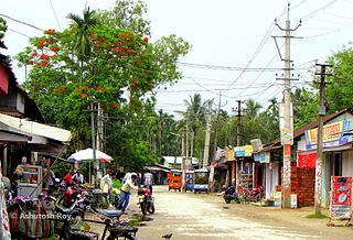
Gelapukhuri is a famous place in Biswanath Chariali, India. It is a medium-sized village located 10 km from Biswanath Chariali City of Biswanath district, Assam with a total of 183 families residing. The Gelapukhuri village has a population of 872 of which 458 are males while 414 are females, as per Population Census 2011. In Gelapukhuri, the majority of people are Indian Gorkhas along with Assamese, Bodo, Adibasi etc.
Balikaria, also spelled as Bali Karia, is a village in Nalbari district, Assam, India. According to the 2011 Census of India, Balikaria has a population of 6,359 people including 3,305 males and 3,054 females with literacy rate of 86.54%. The 500 years old Kharzara Ashram is located on Balikaria. It's the oldest Ashram of Assam.