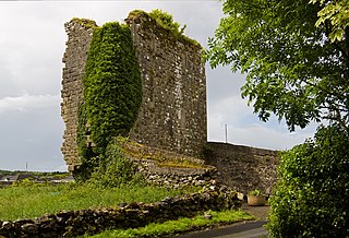
Headford is a small town in County Galway, located 26 km north of Galway city in the west of Ireland. It is an angling centre for the eastern shore of Lough Corrib, and Greenfields, approximately 6.5 km west of the town, is its boating harbour. The town is situated next to the Black River which is the county boundary with Mayo. Located on the N84 national secondary road from Galway to Castlebar and the R333, and R334 regional roads, the town is a commuter town to Galway City.

Furbo or Furbogh is a settlement in Connemara, County Galway, Ireland. As of the 2022 census, it had a population of 868 people. It lies along the coast, overlooking Galway Bay, in a Gaeltacht area.

Baile na hAbhann, anglicised as Ballynahown, is a Gaeltacht village about 31 km (19 mi) west of Galway, Ireland, on the R336 regional road between Indreabhán and Casla. The name means "town of the river". The village is in the townland of Baile na hAbhann Theas.

Williamstown is a small village located on the R360 regional road in the townland of Corralough in northeast County Galway, Ireland. According to the census in April 2016, the population of the village was 148.

Ballindooley, officially Ballindooly, is a village in County Galway, Ireland. It is north of Galway city and in the ecclesiastical parish of Castlegar. There is a 15th century castle in the area, Ballindooley Castle, which was refurbished and sold in late 2016. The village itself is just off the Galway City to Headford (N84) road. Ballindooley Lake, which is sometimes referred to as Ballindooley Lough, is a small lake located southeast of the castle.

Doughiska is a townland and suburb of Galway City in County Galway, Ireland. There has been continuous urban development between Doughiska and the city centre due to the growth of Galway City in the early 21st century.

Castlegar is a village and electoral division in County Galway, just outside the city of Galway, in Ireland. Castlegar is also an ecclesiastical parish in the Roman Catholic Diocese of Galway, Kilmacduagh and Kilfenora. It extends from Lough Corrib across to Merlin Park by the old Galway-Dublin road.

Ahascragh is a village in east County Galway, Ireland. It is located 11 km (7 mi) north-west of Ballinasloe on the Ahascragh/Bunowen River, a tributary of the River Suck. The R358 regional road passes through the village. As of the 2022 census, it had a population of 186 people.

Menlo or Menlough is a village and townland in one of the Gaeltacht areas of County Galway, Ireland. Menlo falls within the boundaries of the city of Galway, though it is outside the urbanised parts of the city and retains the feel of a small village.

Ballinderreen, also Ballindereen, is a village located on the N67 road between Kilcolgan and Kinvara in south County Galway, Ireland.

Wellingtonbridge, also spelled Wellington Bridge, is a village in south County Wexford, Ireland. It lies some 24 km west of Wexford and 28 km east of Waterford, at the intersection of the R733 and R736 regional roads. It was historically called Ballyowen after the townland it occupies.
Ballyguyroe, North and South are rural townlands of Farahy in the southern foothills of the Ballyhoura Mountains in north County Cork, Ireland.
Newtown, Ormond Lower is a townland in the historical Barony of Ormond Lower, County Tipperary, Ireland. It is located in the civil parish of Dorrha, west of Rathcabbin.
There are two townlands with the name Newtown, in the Barony of Owney and Arra in County Tipperary, Ireland.
There are two townlands with the name Newtown, in the Barony of Kilnamanagh Upper in County Tipperary, Ireland.
There are two townlands with the name Newtown, in the Barony of Ikerrin in County Tipperary, Ireland.
There are three townlands with the name Newtown, in the Barony of Middle Third in County Tipperary, Ireland.
Redwood is a townland in the historical Barony of Ormond Lower, County Tipperary, Ireland. It is also an electoral district in the Dáil constituency of Offaly having previously been part of the Tipperary North Dáil constituency.

Oldbridge is a townland near Drogheda in County Meath, Ireland. The area is home to the Boyne Navigation, the Battle of the Boyne Interpretive Centre and the southern half of the Mary McAleese Boyne Valley Bridge.

Ballincar is a small village and townland in County Sligo, Ireland. The townland is in the civil parish of Drumcliff, and has an area of approximately 1.6 square kilometres (0.62 sq mi). It is a largely linear coastal settlement which overlooks Sligo Bay and lies on the R291 regional road between Sligo town and Rosses Point. As of the 2016 census, the census town of Ballincar had a population of 424 people.


