
Culver City is a city in Los Angeles County, California, United States. As of the 2020 census, the population was 40,779.

Playa Vista is a neighborhood in the Westside area of Los Angeles, California. The area was the headquarters of Hughes Aircraft Company from 1941 to 1985 and the site of the construction of the Hughes H-4 Hercules "Spruce Goose" aircraft. The area began development in 2002 as a planned community with residential, commercial, and retail components. The community attracted businesses in technology, media and entertainment and is part of Silicon Beach.

Ballona Creek is an 8.5-mile (13.7 km) channelized stream in southwestern Los Angeles County, California, United States, that was once a "year-round river lined with sycamores and willows" with the Tongva village of Guashna located at the mouth of the creek. Ballona Creek and neighboring Ballona Wetlands remain a prime bird-watching spot for waterfowl, shorebirds, warblers, and birds of prey.

Ballona Wetlands Ecological Reserve is a protected area that once served as the natural estuary for neighboring Ballona Creek. The 577-acre (2.34 km2) site is located in Los Angeles County, California, just south of Marina del Rey. Ballona—the second-largest open space within the city limits of Los Angeles, behind Griffith Park—is owned by the state of California and managed by the California Department of Fish and Wildlife. The preserve is bisected generally east-west by the Ballona Creek channel and bordered by the 90 Marina freeway to the east.
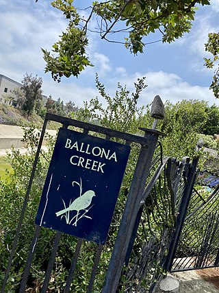
The Ballona Creek Bike Path is a 6.7-mile (10.8 km) Class I bicycle path and pedestrian route in California. The bike path follows the north bank of Ballona Creek until it reaches Santa Monica Bay at the Pacific Ocean. The route is defined by, and recognized for, the dramatic contrast between the channelized waterway’s stark cement geometry and the abundant wildlife of the verdant Ballona Wetlands.

The Los Angeles Chinese massacre of 1871 was a racial massacre targeting Chinese immigrants in Los Angeles, California, United States that occurred on October 24, 1871. Approximately 500 white and Hispanic Americans attacked, harassed, robbed, and murdered the ethnic Chinese residents in what is today referred to as the old Chinatown neighborhood. The massacre took place on Calle de los Negros, also referred to as "Negro Alley". The mob gathered after hearing that a policeman and a rancher had been killed as a result of a conflict between rival tongs, the Nin Yung, and Hong Chow. As news of their death spread across the city, fueling rumors that the Chinese community "were killing whites wholesale", more men gathered around the boundaries of Negro Alley. A few 21st-century sources have described this as the largest mass lynching in American history.

Rancho La Ballona was a 13,920-acre (56.3 km2) Mexican land grant in the present-day Westside region of Los Angeles County, Southern California.
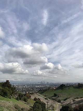
The Baldwin Hills are a low mountain range surrounded by and rising above the Los Angeles Basin plain in central Los Angeles County, California. The Pacific Ocean is to the west, the Santa Monica Mountains to the north, Downtown Los Angeles to the northeast, and the Palos Verdes Hills to the south - with all easily viewed from the Baldwin Hills.

Machado is a former settlement in Los Angeles County, California. It laid at an elevation of 13 feet.

Motordrome is an archaic placename in Los Angeles County, California. It designates a rail spur that existed in the 1910s on the Redondo Beach via Del Rey Line, named for the Los Angeles Motordrome race track and airfield.

Culver City station is an elevated light rail station on the E Line of the Los Angeles Metro Rail system. The station is located on a dedicated right-of-way alongside Exposition Boulevard — between the intersection of Venice Boulevard and Robertson Boulevard on the west and the intersection of Washington Boulevard and National Boulevard on the east. The station is located in the city of Culver City, California, after which the station is named. The station served as the western terminus of the line from its opening on June 20, 2012, until the opening of the extension of the line to Santa Monica on May 20, 2016.
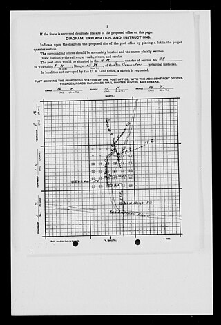
Mission Acres was a historic rural community in the northern San Fernando Valley. Its historic boundaries correspond roughly with the former community of Sepulveda and present day community of North Hills within Los Angeles, California. The community's western border was Bull Creek, which flowed south out of Box Canyon in the western San Gabriel Mountains near San Fernando Pass.

The California Digital Newspaper Collection (CDNC) is a freely-available, archive of digitized California newspapers; it is accessible through the project's website. The collection contains over six million pages from over forty-two million articles. The project is part of the Center for Bibliographical Studies and Research (CBSR) at the University of California Riverside.

The Aguaje de Centinela, or Centinela Springs, was a valued source of local spring water for Rancho Aguaje de la Centinela and what is now southwest Los Angeles and Inglewood in Southern California. The spring was known to prehistoric people and animals but the name aguaje, meaning watering place, comes from Spanish–Mexican era of California history.

Port Ballona is an archaic place name for an area near the center of Santa Monica Bay in coastal Los Angeles County, where Playa Del Rey and Del Rey Lagoon are located today. Port Ballona was a planned harbor and town site from circa 1859 to 1903. The name comes from the Rancho La Ballona Mexican land grant.

The history of Los Angeles County, California includes the history of the Tovaangar; the ranchos, missions and pueblo of the Spanish-Mexican era; the histories of the various incorporated cities and unincorporated areas within the borders; and the story of the government of Los Angeles County.

The Expo Line Bikeway is a 12-mile (19 km) Los Angeles County, California rail with trail bicycle path and pedestrian route that travels roughly parallel to the Metro’s E Line train tracks between the Exposition Park area near the USC campus and downtown Santa Monica near the Pacific Ocean. The Expo Line Bikeway is one of two major bicycle routes in Los Angeles that share dedicated rights-of-way with mass transit, the other being the Orange Line Bikeway in the San Fernando Valley.

The Mesmer family of California was a wealthy family of early Los Angeles settlers who contributed to the development of the city between the rancho era and the explosive growth of the post-WWII era.

Guashna was a Tongva village located at Playa Vista, Los Angeles at the mouth of Ballona Creek. The site has also been referred to as Sa'angna, with various sources debating whether Sa'angna, meaning "place of tar," was a regional referent rather than a village name or whether it was a separate nearby village. The initial place name was said to be Sa'an; the village suffix "ngna" was added by Bernice Johnston to her 1962 map of Gabrieleño villages "despite her having found no mention of the term in baptismal records." Sa'angna is also not to be confused with Suangna. The Tongva referred to the Ballona Wetlands as Pwinukipar, meaning "full of water." Another alternate name may Waachnga.
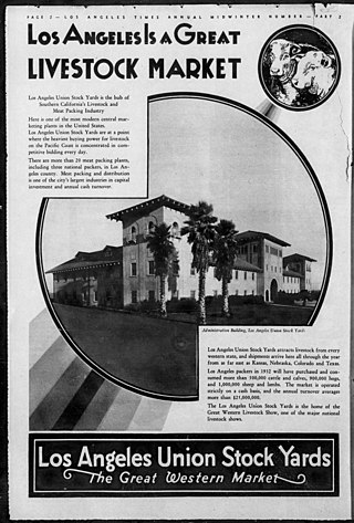
The Los Angeles Union Stock Yards were a livestock market and transfer station in the so-called Central Merchandising District south of downtown Los Angeles in Los Angeles County, California. The stock yards closed in 1960 and the facilities were demolished and replaced with other industrial warehouses.


