
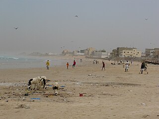
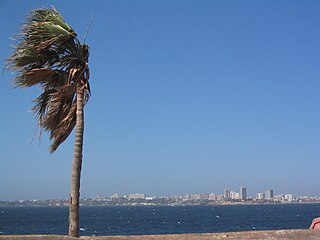
Dakar is the capital and largest city of Senegal. The department of Dakar has a population of 1,278,469, and the population of the Dakar metropolitan area was at 4.0 million in 2023.
Kahone or Kawon is a town and urban commune near Kaolack, Senegal. It is primarily agricultural, but it is participating in industrial development plans. Also, the town is pursuing increased tourism based on its ancient Serer culture.
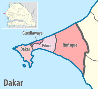
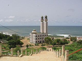
Dakar region is the smallest and most populated region of Senegal, encompassing the capital city of the country, Dakar, and all its suburbs along the Cap Vert peninsula, Africa's most westerly point.

Thiès is the third largest city in Senegal with a population of 391,253 in 2023. It lies 72 km (45 mi) east of Dakar on the N2 road and at the junction of railway lines to Dakar, Bamako and St-Louis. It is the capital of Thiès Region and is a major industrial city.
Yoff is a town, part of the city (commune) of Dakar, located in Senegal. It lies north of downtown Dakar and immediately north of Léopold Sédar Senghor International Airport. The town is built along the broad beach at Yoff Bay. According to the 2014 census, the population of Yoff is 89,442 inhabitants. Yoff is one of the four original Lebou villages of the Cap-Vert Peninsula, along with Hann, Ngor, and Ouakam.

Rosso is the major city of south-western Mauritania and capital of Trarza region. It is situated on the Senegal River at the head of the river zone allowing year-round navigation.

Rufisque is a city in the Dakar region of western Senegal, at the base of the Cap-Vert Peninsula 25 kilometres (16 mi) east of Dakar, the capital. It has a population of 295,459. In the past it was an important port city in its own right, but is now a suburb of Dakar.

The 14 regions of Senegal are subdivided into 46 departments and 103 arrondissements and by collectivités locales which elect administrative officers.
Mbacké is a city and urban commune in central Senegal, located 190 km (118 mi) east of Dakar. It is the capital of an administrative department in the Diourbel region. Along with the nearby city of Touba, Mbacké forms an urban conurbation whose population currently stands at 1,222,275, making it Senegal's second largest agglomeration. It is connected to Dakar and Touba by the N3 road.
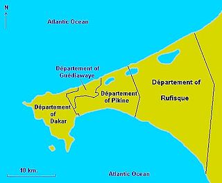
Guédiawaye is a city in the Guédiawaye Department of the Dakar Region of Senegal. Lying on the Atlantic Ocean to the northeast of Dakar city centre, in 2013 it had a population of 329,659. Until the mid-2000s, the département was part of Pikine.

Bambey department is one of the 46 departments of Senegal, one of the three making up the Diourbel region.
Dakar department is one of the departments of Senegal, located in the Dakar region.
Gossas is a town and urban commune in Fatick Region in western Senegal, about 90 km from the capital Dakar.
Dakar-Plateau is an arrondissement in the Dakar Department, and forms the central district of the city of Dakar.
Bargny is a settlement and urban commune in Senegal. It is located in a somewhat sheltered bay about 15 km to the east of the capital, Dakar.
Hann is a neighbourhood of Dakar, the capital of Senegal. It is located on the eastern side of the small south facing peninsula on which the old city of Dakar was built. Hann neighborhood sits along a crescent shaped beach called Hann Bay. Hann is part of the Hann Bel-Air commune d'arrondissement: a part of the municipal Dakar Department which covers the city of Dakar. Hann is one of the four original Lebou villages of the Cap-Vert Peninsula, along with Yoff, Ngor, and Ouakam.

Médina is a commune d'arrondissement of the city of Dakar, Senegal, part of the Dakar-Plateau arrondissement, located in the southern part of Dakar.
Ouakam is a commune d'arrondissement in the city of Dakar, Senegal. The commune is the birthplace of French politicians Ségolène Royal and Rama Yade and Senegalese writer and politician Birago Diop. Ouakam is one of the four original Lebou villages of the Cap-Vert Peninsula, along with Yoff, Ngor, and Hann.
Goudiry is the chief town and an urban commune of the department of Goudiry in the region of Tambacounda in the east of Senegal. The commune has a population of 10,540.
The Communes of Senegal are the fourth-level administrative divisions in Senegal. There are some 121 communes in Senegal which have urban status, apart from 46 communes d'arrondissement in the large towns and 370 rural communities in the countryside.
