
The Lua people are a minority ethnic group native to Laos, although there is now a sizable community living in Thailand. Lua' is their preferred autonym (self-designation), while their Lao neighbours tend to call them Thin, T'in or Htin. Another term for this group is Lawa. There are two subgroups: the Mal and the Phai or Pray.
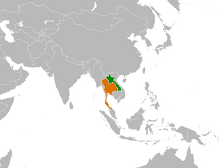
Laos and Thailand have maintained bilateral relations for most of their histories. The two countries share a common border, have linguistic and cultural similarities, and have historical connections since the time of their predecessor kingdoms Lan Xang and Ayutthaya in the 15th century. The Lao kingdom of Lan Xang included all of northeastern Thailand as recently as the early 18th century. Thailand's northeastern region, Isan, has particularly strong Lao roots. Linguistically, the inhabitants of Isan, a third of the Thai population, speak the Isan language, a Lao dialect. Both countries have an interest in making the Mekong River a "river of true peace and friendship", as their respective prime ministers called for in 1976.

The Thai–Laotian Border War was a short confrontation between Thai and Laotian forces. It involved a dispute over the map made by French surveyors in 1907 to mark the borders between Siam and French Indochina in the southern Luang Prabang Range. Ownership of the village of Ban Romklao on the border of Phitsanulok Province and three small border villages on the edge of Uttaradit Province was left unclear. This is the same map underlying the Cambodian–Thai border dispute. The agreed criterion for determining ownership was the natural watershed, but the French map makers at times ignored this.
The Luang Prabang Range, named after Luang Prabang, is a mountain range straddling northwestern Laos and Northern Thailand. Most of the range is located in Sainyabuli Province (Laos), as well as Nan and Uttaradit Provinces (Thailand), with small parts in Phitsanulok and Loei Provinces. Several rivers such as the Nan, Pua and Wa river, have their source in this range. Phu Fa waterfall, the biggest and the tallest waterfall in Nan Province, is also located in these mountains. This range is part of the Luang Prabang montane rain forests ecoregion.

Muang Sing or Mueang Sing is a small town and district (muang) in Luang Namtha Province, northwestern Laos, about 60 kilometres northwest of the town of Luang Namtha and 360 kilometres northwest of Vientiane. It lies very close to the border with Yunnan, China, surrounded by mountains and rivers. Historically, Mueang Sing has been a major producer of opium and still has problems with drugs and smuggling, due to its geographical position close to China and Burma. A notable Buddhist centre, with a dramatic growth in temples since the 1980s, it is popular with trekkers in northern Laos. Laos was a state of Burma until 1854 before second Anglo-Burmese war.
Sila is a Loloish language spoken by 2,000 people in Laos and Vietnam. Sila speakers are an officially recognized group in Vietnam, where they are known as the Si La.

Bokèo is a northern province of Laos. It is the smallest and least populous province in the country. Bokeo Province covers an area of 6,196 square kilometres (2,392 sq mi). Bokeo Province borders Luang Namtha Province to the northeast, Oudomxai Province to the east, Xaignabouli Province to the south, and Thailand to the southwest and Burma to the west and northwest. The province has five districts and is rich in deposits of precious and semiprecious stones. Bokeo's provincial capital is Houayxay on the Mekong river. The province is part of the “Golden Triangle”, at the crossing with Myanmar and Thailand. There are 34 ethnic groups in the province. Houay Xay is the border town with Thailand and regional economic centre.

Vientiane Province is a province of Laos, located in the northwest of the country. As of 2015 the province had a total population of 419,090 people. Vientiane Province is a large province, covering an area of 15,927 square kilometres (6,149 sq mi) with 10 districts in mid north-western Laos. The province borders Luang Prabang Province to the north, Xiangkhouang Province to the northeast, Bolikhamxai Province to the east, Vientiane Prefecture and Thailand to the south, and Xaignabouli Province to the west. The principal towns are Vang Vieng and Muang Phôn-Hông. Several kilometres to the south of Vang Vieng is one of Laos's largest lakes, Nam Ngum. Much of this area, particularly the forests of the southern part, are under the Phou Khao Khouay National Bio-Diversity Conservation Area. The principal rivers flowing through the province are the Nam Song River, Nam Ngum River and the Nam Lik River.

Savannakhét (Lao:ສະຫວັນນະເຂດ) is a province of Laos. The name derives from Savanh Nakhone the province's original name. It bears the same meaning as Nakhon Sawan, a city in Thailand.

Salavan is a province of Laos, located in the south of the country. Its earlier name was Saravan which was changed by Thai to Salavan in 1828. It was part of the Champasak Kingdom in an area known as Muang Mang inhabited by minorities of Mon-Khymer groups.

Luang Namtha is a province of Laos located in the north of the country. From 1966 to 1976 it formed, together with Bokeo, the province of Houakhong. Luang Namtha Province covers an area of 9,325 square kilometres (3,600 sq mi). Its provincial capital is Luang Namtha. The province borders with Yunnan, China to the north, Oudomxai Province to the east and southeast, Bokeo Province to the southwest, and Shan State, Burma to the northwest.

Phôngsali is a province of Laos, located in the extreme north of the country. The capital of the province is the city of Phôngsali. Phôngsali is located between Yunnan (China), and Điện Biên Province in Vietnam. Its culture has thus been historically heavily influenced by China.

Oudomxay is a province of Laos, located in the northwest of the country. The province capital is Muang Xai.

Ban Na Le is a village in Sainyabuli Province, Laos. It is located along the main road (Route 4, south of Ban Nakhem and Muang Phiang.
Ban Napho is a village in Sainyabuli Province, Laos. It is located to the northeast of Muang Saiapoun, and southwest of Muang Pa.
Ban Bo Sane is a village in Sainyabuli Province, Laos. It is located not far from the border with Thailand. To the northwest is the peak of Phu Soi Dao.
Hongsa is a town in northwestern Laos. It is located in Hongsa District in Sainyabuli Province. The town is 81 kilometres (50 mi) northwest of the provincial capital Sainyabuli. Nearby Ban Viengkeo is a rotating host to a major elephant festival. The district is also the site of a controversial coal-fired power plant to begin operation in 2015.


