Bandudato

Last updated
Bandudato
Mantane.jpg
Raelete, Bandudato
Sucos Aileu.png
Sucos of Aileu District
Country Flag of East Timor.svg  East Timor
District Aileu
Subdistrict Aileu
Area
  Total30.65 km2 (11.83 sq mi)
Population
 (2010)
  Total1,426
Time zone UTC +9

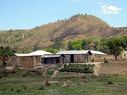
Bandudato is a suco of Aileu subdistrict, Aileu District, East Timor. [1] The administrative area covers an area of 30.65 square kilometres and at the time of the 2010 census it had a population of 1,426 people. [2]

See also

Related Research Articles

<span class="mw-page-title-main">Manufahi Municipality</span> Municipality of East Timor

Manufahi is one of the municipalities of East Timor. It has a population of 53,691 and an area of 1,323 km2. The capital of the municipality is Same.

<span class="mw-page-title-main">Dili Municipality</span> Municipality of East Timor

Dili Municipality is one of the 14 municipalities, formerly districts, of Timor-Leste, and includes the national capital Dili. The municipality had a population of 277,279 as of 2015, most of whom live in the capital city.

<span class="mw-page-title-main">Aileu</span> City in East Timor

Aileu is the main township in Aileu District, East Timor. It is located 47 km (29 mi) southwest of Dili, the national capital, and had a population of 2,788 in 2015. In Portuguese Timor, the city was known as Vila General Carmona, after the Portuguese dictator António Óscar Carmona, but after World War II it was renamed. Aileu means "bent tree" in Mambai.

<span class="mw-page-title-main">Tilomar Administrative Post</span> Administrative post in Cova Lima Municipality, East Timor

Tilomar, officially Tilomar Administrative Post, is an administrative post in Cova Lima municipality, East Timor. Its seat or administrative centre is Casabauc.

<span class="mw-page-title-main">Atabae Administrative Post</span> Administrative post in Bobonaro Municipality, East Timor

Atabae, officially Atabae Administrative Post, is an administrative post in Bobonaro municipality, East Timor. Its seat or administrative centre is Aidabaleten, which is sometimes wrongly named Atabae, too. Its population at the 2010 census was 10,976.

<span class="mw-page-title-main">Funar</span>

Funar is a suco in the northwest of Laclubar subdistrict. It has 1790 inhabitants and an area of 91.55 km2.

<span class="mw-page-title-main">Aissirimou</span> Suco in Aileu, East Timor

Aissirimou is a village and suco in Aileu Subdistrict, Aileu District, East Timor. The administrative area covers an area of 29.81 square kilometres and at the time of the 2010 census it had a population of 2192 people.

<span class="mw-page-title-main">Fahiria</span> Suco in Aileu, East Timor

Fahiria is a suco in Aileu subdistrict, Aileu District, East Timor. The administrative area covers an area of 43.77 square kilometres and at the time of the 2010 census it had a population of 854 people.

<span class="mw-page-title-main">Fatubossa</span> Suco in Aileu, East Timor

Fatubossa is a suco in Aileu subdistrict, Aileu District, East Timor. The administrative area covers an area of 29.31 square kilometres and at the time of the 2010 census it had a population of 1750 people.

<span class="mw-page-title-main">Hoholau</span> Suco in Aileu, East Timor

Hoholau is a suco in Aileu subdistrict, Aileu District, East Timor. The administrative area covers an area of 16.72 square kilometers and, at the time of the 2010 census, it had a population of 766 people

<span class="mw-page-title-main">Lahae</span> Suco in Aileu, East Timor

Lahae is a suco in Aileu subdistrict, Aileu District, East Timor. The administrative area covers an area of 13.64 square kilometres and at the time of the 2010 census it had a population of 1061 people.

<span class="mw-page-title-main">Lausi</span> Suco in Aileu, East Timor

Lausi is a municipality (suco) in Aileu subdistrict, Aileu District, East Timor. The administrative area covers an area of 5.24 square kilometres and at the time of the 2010 census it had a population of 665 people.

<span class="mw-page-title-main">Liurai, Aileu Subdistrict</span> Suco in Aileu, East Timor

Liurai is a suco in Aileu Subdistrict, Aileu District, East Timor. The administrative area covers an area of 10.33 square kilometres and at the time of the 2010 census it had a population of 4499 people.

<span class="mw-page-title-main">Seloi Malere</span> Suco in Aileu, East Timor

Seloi Malere is a suco in Aileu subdistrict, Aileu District, East Timor. The administrative area covers an area of 13 square kilometres and at the time of the 2010 census it had a population of 3676 people.

<span class="mw-page-title-main">Saboria</span> Suco in Aileu, East Timor

Saboria is a suco in Aileu subdistrict, Aileu District, East Timor. The administrative area covers an area of 22.14 square kilometres and at the time of the 2010 census it had a population of 713 people.

<span class="mw-page-title-main">Seloi Craic</span> Suco in Aileu, East Timor

Seloi Craic is a suco in Aileu subdistrict, Aileu District, East Timor. The administrative area covers an area of 36.87 square kilometres and at the time of the 2010 census it had a population of 3328 people.

<span class="mw-page-title-main">Fatisi</span> Suco in Aileu, East Timor

Fatisi is a suco in Laulara subdistrict, Aileu District, East Timor. The administrative area covers an area of 11.82 square kilometres and at the time of the 2010 census it had a population of 1156 people.

<span class="mw-page-title-main">Berloi Waterfall</span> Waterfall in East Timor

The Berloi Waterfall is a small waterfall in the municipality of Aileu, East Timor. It forms part of a minor tributary of the Comoro River.

<span class="mw-page-title-main">Aileu Administrative Post</span> Administrative post in Aileu Municipality, East Timor

Aileu, officially Aileu Administrative Post, is an administrative post in Aileu municipality, East Timor. Its seat or administrative centre is Suco Seloi Malere, in the town of Aileu.

<span class="mw-page-title-main">Bidau Santana</span> Suco in Dili, East Timor

Bidau Santana is a suco in Cristo Rei Administrative Post, Dili Municipality, East Timor. The administrative area covers an area of 1.84 square kilometres and at the time of the 2015 census it had a population of 6,482 people.

References

  1. "PUBLICAÇÃO OFICIAL DA REPÚBLICA DEMOCRÁTICA DE TIMOR - LESTE" (PDF). Jornal da República, Government of East Timor. 16 September 2009. Archived from the original (PDF) on 1 March 2012. Retrieved 21 July 2012.
  2. "Census" (PDF). Direcção Nacional de Estatística. Archived from the original (PDF) on 10 October 2011. Retrieved 21 July 2012.

Coordinates: 8°45′48″S125°34′09″E / 8.7633°S 125.5692°E / -8.7633; 125.5692