Related Research Articles

Canterbury is a region of New Zealand, located in the central-eastern South Island. The region covers an area of 44,503.88 square kilometres (17,183.04 sq mi), making it the largest region in the country by area. It is home to a population of 666,300.

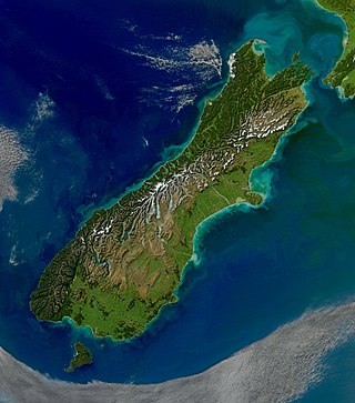
The South Island is the largest of the three major islands of New Zealand in surface area, the other being the smaller but more populous North Island and sparsely populated Stewart Island. It is bordered to the north by Cook Strait, to the west by the Tasman Sea, to the south by the Foveaux Strait and Southern Ocean, and to the east by the Pacific Ocean. The South Island covers 150,437 square kilometres (58,084 sq mi), making it the world's 12th-largest island, constituting 56% of New Zealand's land area. At low altitudes, it has an oceanic climate.

Territorial authorities are the second tier of local government in New Zealand, below regional councils. There are 67 territorial authorities: 13 city councils, 53 district councils and the Chatham Islands Council. District councils serve a combination of rural and urban communities, while city councils administer the larger urban areas. Five territorial authorities also perform the functions of a regional council and thus are unitary authorities. The Chatham Islands Council is a sui generis territorial authority that is similar to a unitary authority.

Christchurch is the largest city in the South Island and the second-largest city by urban area population in New Zealand, after Auckland. Christchurch lies in the Canterbury Region, near the centre of the east coast of the South Island, east of the Canterbury Plains. It is located near the southern end of Pegasus Bay, and is bounded to the east by the Pacific Ocean and to the south by Banks Peninsula. The Avon River / Ōtākaro flows through the centre of the city, with a large urban park along its banks. Christchurch has a reputation for being an 'English' city, with its architectural identity and common nickname the "Garden City" due to similarities with garden cities in England.

Lyttelton is a port town on the north shore of Lyttelton Harbour / Whakaraupō, at the northwestern end of Banks Peninsula and close to Christchurch, on the eastern coast of the South Island of New Zealand.

Opawa is an inner residential suburb of Christchurch, New Zealand. It is located approximately 3.5 kilometres south-east of the city centre. Initally Opawa was a low-lying area, and a continuation of the Sydenham swamp. By the 1860s, the area was sparsely populated by European settlers and later became a rural-agricultural locality, with many of the early settlers of English descent. As Woolston emerged as an industrial hub nearby, Opawa was heavily urbanised, transforming it into an upscale residential area and its population largely included factory workers and businesspeople. Notable heritage-listed buildings in the suburb include "Risingholme" and "The Hollies". In its formative days, Opawa was a riding of the Heathcote County Council. It later amalgamated in to the city area in 1916.

Triennial elections for all 74 cities, districts, twelve regional councils and all district health boards in New Zealand were held on 9 October 2004. Most councils were elected using the first-past-the-post method, but ten were elected using the single transferable vote (STV) method. It was the first time that the STV method was available; the change came through successful lobbying by Rod Donald.

William John Alexander Montgomery was a New Zealand politician and merchant from Little River on Banks Peninsula. Born in London, he lived in a number of places and pursued a number of occupations before settling in Christchurch, New Zealand.

The Christchurch City Council is the local government authority for Christchurch in New Zealand. It is a territorial authority elected to represent the 396,200 people of Christchurch. Since October 2022, the Mayor of Christchurch is Phil Mauger, who succeeded after the retirement of Lianne Dalziel. The council currently consists of 16 councillors elected from sixteen wards, and is presided over by the mayor, who is elected at large. The number of elected members and ward boundaries changed prior to the 2016 election.

Environment Canterbury, frequently abbreviated to ECan, is the promotional name for the Canterbury Regional Council. It is the regional council for Canterbury, the largest region in the South Island of New Zealand. It is part of New Zealand's structure of local government.

Sir Robert John Parker was a former New Zealand broadcaster and politician. He served as Mayor of Christchurch from 2007 to 2013.

Christchurch City Libraries is a network of 21 libraries and a mobile book bus. operated by the Christchurch City Council and Following the 2011 Christchurch earthquake the previous Christchurch Central Library building was demolished, and was replaced by a new central library building in Cathedral Square, Tūranga, which opened in 2018. A number of community libraries were also rebuilt post earthquake.

Sir Donald Ward Beaven was a New Zealand medical researcher in the area of diabetes treatment and prevention.

The Civic in Manchester Street, Christchurch Central City, was one of the former civic buildings of Christchurch City Council (CCC). Built in 1900, it was first used as an exhibition hall, a cinema and then a theatre. It burned down in 1917. The northern part of the building was purchased by CCC and opened as the civic office in 1924, and served this purpose until 1980. After that it had several uses, including a restaurant, bar and live music venue. The building was heavily damaged in the February 2011 Christchurch earthquake, and was demolished.

Southshore is an eastern coastal suburb within Christchurch, New Zealand. It is sited on a narrow 2.5 km (1.6 mi) long sandspit that runs along the eastern side of the Avon Heathcote Estuary. The suburb is 8 km (5.0 mi) eastwards from the city centre and 5 km (3.1 mi) south from New Brighton's main retail area. Before urbanisation, the area was predominantly swampland, bordered by large sand dunes which had some Māori presence. The area holds historical and cultural importance to local Māori iwi because of the large amounts of resources and seafood gathered in the area prior to European occupation.

Denis John O'Rourke is a former New Zealand politician. He served fifteen years as a councillor on Christchurch City Council, and served six years as a Member of Parliament representing New Zealand First.

Victoria Square is a public park located in central Christchurch, New Zealand. Originally known by European settlers as Market Place or Market Square, it was renamed to Victoria Square in 1903 in honour of Queen Victoria. It was one of the four squares included in the original plan of Christchurch when the city was laid out in 1850.
The Mayor of Banks Peninsula was the head of the municipal government of Banks Peninsula District, New Zealand. The mayor was directly elected using the first-past-the-post electoral system. The position existed from 1989 until 2006, when Banks Peninsula District was amalgamated into Christchurch City Council.

Tracey Lee McLellan is a New Zealand politician. From 2020 to 2023, she was a Member of Parliament in the House of Representatives for the Labour Party. In 2024, she re-entered parliament after the resignation of fellow Labour List MP Rino Tirikatene.

Takapūneke, with the location also known as Red House Bay, is a former kāinga—an unfortified Māori village—adjacent to present-day Akaroa, New Zealand. Takapūneke was a major trading post for the local iwi (tribe), Ngāi Tahu, as there was safe anchorage for European vessels. The site is of significance to Ngāi Tahu as their tribal chief, Tama-i-hara-nui, was captured here by North Island Ngāti Toa chief Te Rauparaha, and then tortured and killed. The village itself was raided and subject of a massacre, with the events subsequently called the Elizabeth affair. There is a direct link from the massacre in 1830 to the signing of the Treaty of Waitangi in 1840, giving the site a status of national significance.
References
- ↑ "Banks Peninsula residents want to join Christchurch". The New Zealand Herald. 19 November 2005. Retrieved 26 April 2024.
- ↑ "City Scene — Merger: 'Business as usual'". Christchurch City Council. March 2006. Retrieved 26 April 2024.
- ↑ "Banks Peninsula District Council - Main". Department of Internal Affairs . Retrieved 25 April 2015.