
Mount Columbia is the highest point in Alberta, Canada. It is second only to Mount Robson for height and topographical prominence in the Canadian Rockies. It is located on the border between Alberta and British Columbia on the northern edge of the Columbia Icefield. Its highest point, however, lies within Jasper National Park in Alberta.

The Waterton-Glacier International Peace Park is the union of the Waterton Lakes National Park in Canada and the Glacier National Park in the United States. Both parks are declared Biosphere Reserves by UNESCO and their union as a World Heritage Site.
The Blue Range is a mountain range of the Canadian Rockies, located on the Continental Divide in Banff National Park, Canada. The range was so named on account of its blueish colour when viewed from afar. Mount Byng is the highest point in the range.

Mount Saskatchewan is a mountain located in the North Saskatchewan River valley of Banff National Park, in the Canadian Rockies of Alberta, Canada.

Craigmyle is a hamlet in Alberta, Canada, within Starland County. It is located between the towns of Delia and Hanna. It was named in 1912 by a Canadian Northern Railway ahead of the train's arrival in April 1914. The name is said to be a transfer from a place in Scotland. Previously incorporated as a village, Compeer dissolved to become a hamlet on January 1, 1972.
Dalemead is a hamlet in southern Alberta under the jurisdiction of Rocky View County.

Birch Hills County is a municipal district in north-western Alberta, Canada. It is located in Census Division 19, northeast of Grande Prairie.
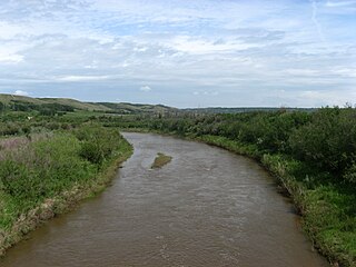
Battle River is a river in central Alberta and western Saskatchewan. It is a major tributary of the North Saskatchewan River.

The Rocky Mountain Foothills are an upland area flanking the eastern side of the Rocky Mountains, extending south from the Liard River into Alberta. Bordering the Interior Plains system, they are part of the Rocky Mountain System or Eastern System of the Western Cordillera of North America.
Bindloss is a hamlet in southern Alberta, Canada within Special Area No. 2. It is located approximately 10 kilometres (6.2 mi) west of Highway 41 and 97 kilometres (60 mi) north of Medicine Hat.
Cessford is a hamlet in southern Alberta, Canada within Special Area No. 2. It is located approximately 22 kilometres (14 mi) east of Highway 36 and 54 kilometres (34 mi) northeast of Brooks.
Dorothy is a hamlet in southern Alberta, Canada within Special Area No. 2. It is located approximately 21 kilometres (13 mi) east Highway 56 and 85 kilometres (53 mi) northwest of Brooks.
Duvernay is a hamlet in central Alberta, Canada within the County of Two Hills No. 21. It is located 1.6 km (1.0 mi) north of the intersection of Highway 36 and Highway 29 along the south bank of the North Saskatchewan River, approximately 53 km (33 mi) southwest of St. Paul. The hamlet of Brosseau is located immediately across the river along the north bank.
Ensign is a hamlet in southern Alberta, Canada within Vulcan County. It is located approximately 11 kilometres (6.8 mi) south of Highway 23 and 78 kilometres (48 mi) southeast of Calgary.
Fabyan is a hamlet in central Alberta, Canada within the Municipal District of Wainwright No. 61. It is located on Highway 14, approximately 10 kilometres (6.2 mi) west of Wainwright, Alberta, and 78 kilometres (48 mi) southwest of Lloydminster. It is located near the Fabyan Trestle Bridge.
Glenevis is a hamlet in central Alberta, Canada within Lac Ste. Anne County. It is located on Highway 43, approximately 71 kilometres (44 mi) northwest of Edmonton.
Iddesleigh is a hamlet in southern Alberta, Canada within Special Area No. 2. It is located approximately 37 kilometres (23 mi) northeast of Highway 1 and 46 kilometres (29 mi) northeast of Brooks.
