
North East Derbyshire is a local government district in Derbyshire, England. The council is based in the large village of Wingerworth. The district also includes the towns of Dronfield and Clay Cross as well as numerous villages and surrounding rural areas.

The High Peak Trail is a 17-mile (27 km) trail for walkers, cyclists and horse riders in the Peak District of England. Running from Dowlow (53.2059°N 1.8349°W), near Buxton, to High Peak Junction, Cromford (53.1004°N 1.5354°W), it follows the trackbed of the former Cromford and High Peak Railway, which was completed in 1831 to carry minerals and goods between the Cromford Canal wharf at High Peak Junction and the Peak Forest Canal at Whaley Bridge.
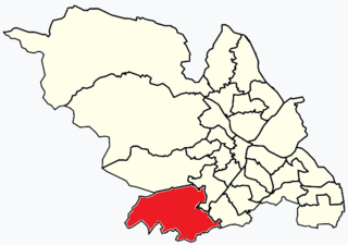
Dore and Totley ward—which includes the districts of Bradway , Dore, Totley, and Whirlow—is one of the 28 electoral wards in City of Sheffield, England. It is currently represented by three Liberal Democrat councillors. It is located in the southwestern part of the city and covers an area of 26.3 km2. The population of this ward in 2001 was 16,404 people in 7,037 households. Dore and Totley ward is one of the five wards that make up the Sheffield Hallam Parliamentary constituency. The population of Dore and Totley is 16,740 (2011) with 7,334 Households.

Graves Park ward—which includes the districts of Norton, Norton Lees, Norton Woodseats, and Woodseats—is one of the 28 electoral wards in City of Sheffield, England. It is located in the southern part of the city and covers an area of 5.8 km2. The population of this ward in 2011 was 16,705 people in 7,464 households. It is one of the five wards that form the Sheffield Heeley parliamentary constituency in the House of Commons. The districts of this ward were in the historic county of Derbyshire, but they have now been absorbed into the metropolitan borough of Sheffield, thus placing them in the ceremonial county of South Yorkshire.

North East Derbyshire is a constituency created in 1885 represented in the House of Commons of the UK Parliament since 2024 by Louise Jones of the Labour Party.
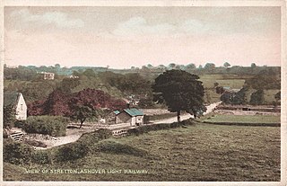
Stretton railway station was a railway station at Stretton, Derbyshire, England built by the North Midland Railway.

Richard Gorton Barlow was a cricketer who played for Lancashire and England. Barlow is best remembered for his batting partnership with A N Hornby, which was immortalised in nostalgic poetry by Francis Thompson. He was also an umpire and a football referee, including at the record 26–0 score between Preston North End and Hyde in the FA Cup.

Gulliver's Kingdom is a theme park aimed at children aged 3-13 in the Derbyshire town of Matlock Bath, England. The park was founded in 1978 by Ray and Hilary Phillips as a model village, before later expanding to include a small train and some second hand rides. Gulliver's Kingdom is close to the site of the Victorian Switchback rollercoaster ride, after which the theme park's main rollercoaster was eventually named. In the early 1980s, a hotel and chalets were built. In 2017, the themed accommodation area was rebranded as the Explorers Retreat. The Philips Family still own Gulliver's Kingdom in the present day.

Barlow is a village and civil parish in the North East Derbyshire district of Derbyshire, England. According to the 2001 census the parish had a population of 884, increasing to 920 at the 2011 Census. The village is about 4 miles north-west of Chesterfield.

Brimington is a large village and civil parish in the Borough of Chesterfield in Derbyshire, England. The population of the parish taken at the 2011 census was 8,788. The town of Staveley is to the east, and Hollingwood is nearby. The parish includes Brimington Common along the Calow Road, and New Brimington, a late 19th-century extension towards the Staveley Iron Works.

Chatsworth is a civil parish in Derbyshire, England, within the area of the Derbyshire Dales and the Peak District National Park.
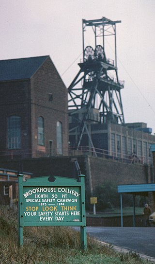
Brookhouse Colliery was a coal mine within the Metropolitan Borough of Rotherham, South Yorkshire, England. It was operational between 1929 and 1985.
Aston Colliery was a small coal mine sunk on Aston Common, within Rotherham Rural District but six miles east of Sheffield in the 1840s. In 1864 its workings were taken over and developed by the North Staveley Colliery Company, part of the Staveley Coal and Iron Company, based in North Derbyshire. It was later acquired by the Sheffield Coal Company.

Station Road is a cricket ground in Darley Dale, Derbyshire, England, which has hosted only one top-class match: the 1975 John Player League match between Derbyshire and Hampshire. The away side won by 70 runs thanks to fifties from Barry Richards and Gordon Greenidge, and Thomas Mottram and John Rice taking five and four wickets respectively.

The River Drone is a river which flows south from its source on the Sheffield, South Yorkshire, border. It flows through Dronfield, Unstone and Unstone Green in Derbyshire before merging at Sheepbridge to the north of Chesterfield with the Barlow Brook. Below the junction, it is often referred to as the River Whitting. It then flows south-east till it merges with the River Rother at Brimington Road North (B6050) at Chesterfield. It is one of the three main tributaries of the Rother.
Somersall Hall is a small country house near Brampton, Chesterfield, Derbyshire. It is a Grade II listed building.
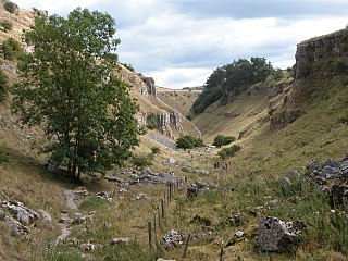
The Derbyshire Dales National Nature Reserve is a series of unconnected limestone dales in the Peak District National Park. It is managed by Natural England and has a permanent staff of wardens who carry out conservation works and ensure the dales are usable for recreation.

Barlow Woodseats Hall is a Grade II* listed manor house situated at Barlow Woodseats, on the edge of the village of Barlow, in Derbyshire. It remains the only manor house in the Parish of Barlow, and the current house dates from the early 17th century, although there are much earlier origins to before 1269.

The Selby–Goole line was a standard gauge branch line connecting Selby and Goole, built in 1910 by the North Eastern Railway. The line closed in the 1960s as part of the Beeching cuts.

Eckington Cemetery is a cemetery in Eckington, Derbyshire, England. The cemetery serves Eckington itself, as well as nearby villages such as Renishaw, Ridgeway, Spinkhill, Troway and Marsh Lane, Derbyshire. The cemetery features a number of Commonwealth War Graves.
