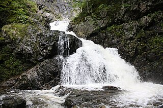
Barrachois, Cape Breton County

Last updated

Barrachois is a community in the Canadian province of Nova Scotia, located in the Cape Breton Regional Municipality on Cape Breton Island.

Canada Country in North America

Canada is a country in the northern part of North America. Its ten provinces and three territories extend from the Atlantic to the Pacific and northward into the Arctic Ocean, covering 9.98 million square kilometres, making it the world's second-largest country by total area. Canada's southern border with the United States is the world's longest bi-national land border. Its capital is Ottawa, and its three largest metropolitan areas are Toronto, Montreal, and Vancouver. As a whole, Canada is sparsely populated, the majority of its land area being dominated by forest and tundra. Consequently, its population is highly urbanized, with over 80 percent of its inhabitants concentrated in large and medium-sized cities, many near the southern border. Canada's climate varies widely across its vast area, ranging from arctic weather in the north, to hot summers in the southern regions, with four distinct seasons.
Nova Scotia Province of Canada

Nova Scotia is one of Canada's three Maritime Provinces, and one of the four provinces that form Atlantic Canada. Its provincial capital is Halifax. Nova Scotia is the second-smallest of Canada's ten provinces, with an area of 55,284 square kilometres (21,300 sq mi), including Cape Breton and another 3,800 coastal islands. As of 2016, the population was 923,598. Nova Scotia is Canada's second-most-densely populated province, after Prince Edward Island, with 17.4 inhabitants per square kilometre (45/sq mi).

Cape Breton Regional Municipality Regional Municipality in Nova Scotia, Canada

Cape Breton Regional Municipality, often referred to as simply CBRM, is the Canadian province of Nova Scotia's second largest municipality and the economic heart of Cape Breton Island. As of 2016 the municipality has a population of 94,285. The municipality was created in 1995 through the amalgamation of eight municipalities located in Cape Breton County.

Related Research Articles

Cabot Trail highway in Nova Scotia

The Cabot Trail is a highway and scenic roadway in northern Victoria County and Inverness County on Cape Breton Island in Nova Scotia, Canada.

Baddeck River river in Canada

The Baddeck River is a minor river on Cape Breton Island, Nova Scotia, Canada. It empties into the Bras d'Or Lake several kilometres west of the village of Baddeck.

Bras dOr, Nova Scotia

Bras d'Or is a community in the Canadian province of Nova Scotia, located in the Cape Breton Regional Municipality.

Boisdale, Nova Scotia

Boisdale is a community in the Canadian province of Nova Scotia, located in the Cape Breton Regional Municipality on Cape Breton Island. It was named for Lochboisdale, the main village of the island of South Uist in the Outer Hebrides of Scotland.

Victoria Mines, Nova Scotia

Victoria Mines is a community in the Canadian province of Nova Scotia, located in the Cape Breton Regional Municipality on Cape Breton Island.

Sydney Forks

Sydney Forks is a community in the Canadian province of Nova Scotia, located in the Cape Breton Regional Municipality on Cape Breton Island.

Little Bras dOr locality and General Service Area in Nova Scotia, Canada

Little Bras d'Or is a community in the Canadian province of Nova Scotia, located in the Cape Breton Regional Municipality on Cape Breton County on Cape Breton Island.

Edwardsville, Nova Scotia

Edwardsville is a community in the Canadian province of Nova Scotia, located in the Cape Breton Regional Municipality on Cape Breton Island.

Leitches Creek Station

Leitches Creek Station is a community in the Canadian province of Nova Scotia, located in the Cape Breton Regional Municipality on Cape Breton Island.

Hornes Road

Hornes Road is a community in the Canadian province of Nova Scotia, located in the Cape Breton Regional Municipality on Cape Breton Island. The area that became Hornes Road was originally land that was granted to Simeon Horne in November 1802, by Major General William Campbell, on behalf of the King of England.

Grand Lake Road

Grand Lake Road is a community in the Canadian province of Nova Scotia, located in the Cape Breton Regional Municipality. The community is a retail service area of Cape Breton hosting the Mayflower Mall and several other outlets. Cape Breton University is also located in the community. The community was also home to 2 schools Lakevale and St. Augustine's Elementary which closed years ago.

Upper Leitches Creek

Upper Leitches Creek is a community in the Canadian province of Nova Scotia, located in the Cape Breton Regional Municipality on Cape Breton Island.

Shunacadie

Shunacadie is a community in the Canadian province of Nova Scotia, located in the Cape Breton Regional Municipality on Cape Breton Island.

Howie Centre

Howie Centre is a community in the Canadian province of Nova Scotia, located in the Cape Breton Regional Municipality on Cape Breton Island. The community has a school, Mountainview Elementary, which is a complex with East Bay Elementary.

Hillside Boularderie

Hillside Boularderie is a community in the Canadian province of Nova Scotia, located in the Cape Breton Regional Municipality on Cape Breton Island. It takes its name from Louis-Simon le Poupet de la Boularderie, who was granted the area as a concession from the King of France.

Georges River, Nova Scotia

Georges River is a community in the Canadian province of Nova Scotia, located in the Cape Breton Regional Municipality on Cape Breton Island.

Gardiner Mines

Gardiner Mines is a community in the Canadian province of Nova Scotia, located in the Cape Breton Regional Municipality on Cape Breton Island.

Trout Brook, Nova Scotia

Trout Brook is a community in the Canadian province of Nova Scotia, located in the Cape Breton Regional Municipality on Cape Breton Island.

Lingan Road

Lingan Road is a community in the Canadian province of Nova Scotia, located in the Cape Breton Regional Municipality on Cape Breton Island.

Baddeck Academy

Baddeck Academy is a Primary through Grade 12 school located in Baddeck, Nova Scotia, Canada, on Cape Breton Island in Victoria County. It is governed by the Cape Breton – Victoria Regional School Board. The Academy overlooks Bras d'Or Lake.

References

Coordinates: 46°8′29.56″N60°26′1.43″W / 46.1415444°N 60.4337306°W / 46.1415444; -60.4337306 (Barrachois, Nova Scotia)

Geographic coordinate system Coordinate system

A geographic coordinate system is a coordinate system that enables every location on Earth to be specified by a set of numbers, letters or symbols. The coordinates are often chosen such that one of the numbers represents a vertical position and two or three of the numbers represent a horizontal position; alternatively, a geographic position may be expressed in a combined three-dimensional Cartesian vector. A common choice of coordinates is latitude, longitude and elevation. To specify a location on a plane requires a map projection.