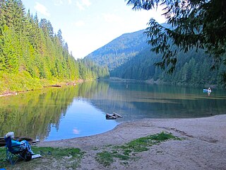
New Denver is at the mouth of Carpenter Creek, on the east shore of Slocan Lake, in the West Kootenay region of southeastern British Columbia. The village is 47 kilometres (29 mi) west of Kaslo on Highway 31A, and 47 kilometres (29 mi) southeast of Nakusp and 32 kilometres (20 mi) northeast of Slocan on Highway 6.

Champion Lakes Provincial Park is a provincial park in the West Kootenay region of British Columbia, Canada, located northeast of the city of Trail in the province's West Kootenay region.
Kootenay Lake Provincial Park is a provincial park in British Columbia, Canada. It encompasses five widely dispersed parks around Kootenay Lake: Kootenay Lake Provincial Park, Kootenay Lake Provincial Park, Kootenay Lake Provincial Park, Kootenay Lake Provincial Park, and Kootenay Lake Provincial Park.
Syringa Park is a provincial park on the east shore of Lower Arrow Lake in the West Kootenay region of southeastern British Columbia. At the foot of the Norns Range, Tulip Creek passes through the centre, and Syringa Creek is closer to the southeastern boundary. The park is about 19 kilometres (12 mi) west of Castlegar via Broadwater Rd.

The Village of Slocan is in the West Kootenay region of southeastern British Columbia. The former steamboat landing and ferry terminal is at the mouth of Springer Creek, at the foot of Slocan Lake. The locality, on BC Highway 6 is about 69 kilometres (43 mi) by road north of Castlegar and 183 kilometres (114 mi) by road and ferry south of Revelstoke.

The Salmo River is a tributary of the Pend d'Oreille River in the West Kootenay region of the Regional District of Central Kootenay in the Canadian province of British Columbia. The river is 60 km long and its source is 12 km south of Nelson in the Selkirk Mountains. The Salmo River is part of the Columbia River drainage basin, being a tributary of the Pend d'Oreille River, which flows into the Columbia River.
Cody is at the confluence of Cody Creek into Carpenter Creek in the West Kootenay region of southeastern British Columbia. The ghost town, about one kilometre east of Sandon, lies off BC Highway 31A. By road, the former mining community is about 15 kilometres (9 mi) east of New Denver and 44 kilometres (27 mi) west of Kaslo.
The Kokanee Range is a subrange of the Selkirk Mountains in the West Kootenay region of southeastern British Columbia, Canada. It is located between the valley of the Slocan River (W) and that of Kootenay Lake (E), and to the north of the Kootenay River and the West Arm of Kootenay Lake. The range includes Kokanee Glacier Provincial Park, Kokanee Peak, and Grays Peak, notable as the mountain featured on the label of Kokanee beer. The name "Kokanee" refers to a land-locked variety of Sockeye salmon.
Pass Creek is an unincorporated community on the east side of Norns Creek in the West Kootenay region of southeastern British Columbia. The rural neighbourhood on Pass Creek Rd is about 11 kilometres (7 mi) north of Castlegar.

Quartz Creek is a creek in Selkirk Mountains in the West Kootenay region of the Regional District of Central Kootenay in British Columbia, Canada. This short creek flows into the Salmo River in Ymir, British Columbia. The source of the creek is just to the west of the Ymir townsite a few kilometres up Round Mountain. Quartz creek was mined for gold in the 1860s. The creek is the source of drinking water in the town of Ymir. The Regional District of Central Kootenay added a filtration system in the early 2010s for the community.
Rover Creek is a creek in the West Kootenay Region of British Columbia. The creek is located west of Forty Nine Creek and flows into the Kootenay River. The creek has been mined for gold.
Columbia Gardens is in the West Kootenay region of southern British Columbia. The locality is east of Trail, and near the Boundary-Waneta Border Crossing.
Lemon Creek is an unincorporated community on the east side of the Slocan River in the West Kootenay region of southeastern British Columbia. The locality is on BC Highway 6 about 8 kilometres (5 mi) south of Slocan, and 62 kilometres (39 mi) north of Castlegar.
The Khutzeymateen River is a river in the North Coast region of British Columbia, flowing west to the head of Khutzeymateen Inlet, which opens into Portland Inlet to the northwest of the City of Prince Rupert. Within its basin is a provincial park, Khutzeymateen/K'tzim-a-deen Grizzly Sanctuary also known as Khutzeymateen Provincial Park. The Kateen River is a tributary of the Khutzeymateen.

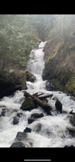
Stewart Creek is a small creek in the Regional District of Central Kootenay in the West Kootenay region of British Columbia, Canada. The creek is a tributary of the Salmo River and has its source in the Selkirk Mountains close to the town of Ymir. The name was adopted in 1930. Its source is the peaks of Round Mountain, the same source as that of Quartz Creek and is approximately 2 km north of Ymir. There is a rest area featuring a small waterfall with a picnic area on Highway 6 at Stewart Creek.
Hall Creek is a creek in the Selkirk Mountains in the West Kootenay region of the Regional District of Central Kootenay in British Columbia, Canada. The creek is a tributary of the Salmo River and flows east into the river in the community of Hall, a few kilometres north of the town of Ymir and a few kilometres south of Nelson. The creek and the community of Hall were named for the Osner and Winslow Hall; brothers from Colville, Washington. The brothers were pioneers in the silver rush occurring in the kootenays in the late 1880s and early 1890s In 1886, the brothers led the expedition to Toad Mountain which led to the creation of the Silver King mine, which in turn gave rise to the city of Nelson.

Barrett Lake is a lake in the Selkirk Mountains in the West Kootenay region of the Regional District of Central Kootenay in British Columbia, Canada. The lake is the source of Barrett Creek, a tributary of the Salmo River. The lake is surrounded by a series of mountain peaks including Dominion Mountain, Empire Peak, Commonwealth Mountain and others. There is an emergency cabin maintained by Recreation Sites and Trails BC.

Ymir Creek is a creek in the Selkirk Mountains in the West Kootenay region of the Regional District of Central Kootenay in British Columbia, Canada. The creek is a tributary of the Salmo River which it meets in the centre of the town of Ymir. Its source is a few kilometres up Wildhorse Mountain. The creek is named for the town of Ymir which in turn was named for Ymir Mountain, a mountain a few kilometres to the north. Ymir Mountain is named for Ymir, the Norse god.

Hall is a small community in the Selkirk Mountains in the West Kootenay region of the Regional District of Central Kootenay in British Columbia, Canada. Hall is south of Nelson and north of Ymir. Hall Creek flows into the Salmo River in the community. British Columbia Highway 6 runs through the Hall. Hall is named for two brothers from Colville, Washington, who came to Quartz Creek in 1886 and lead an expedition that discovered gold, copper and silver deposits on Toad Mountain. They staked the Silver King mine, which in turn gave rise to the city of Nelson.

Cottonwood Lake is a lake in the Selkirk Mountains in the West Kootenay region of the Regional District of Central Kootenay in British Columbia, Canada.


