Wroxham is a village and civil parish in the English county of Norfolk. The civil parish of Wroxham has an area of 6.21 square kilometres, and in 2001, had a population of 1,532 in 666 households. A reduced population of 1,502 in 653 households was noted in the 2011 Census. The village is situated within the Norfolk Broads on the south side of a loop in the middle reaches of the River Bure. It lies in an elevated position above the Bure, between Belaugh Broad to the west, and Wroxham Broad to the east and south east. Wroxham is some eight miles north-east of Norwich, to which it is linked by the A1151 road. The village and broad lie in an area of fairly intensive agriculture, with areas of wet woodland adjoining the broad and river. For the purposes of local government, the parish falls within the district of Broadland although the river, broad and their immediate environs fall within the executive area of the Broads Authority. On the northern side of the Bure is the village of Hoveton, often confused with Wroxham.

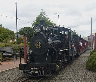
The Bure Valley Railway is a 15 in minimum gauge visitors' attraction in Norfolk, England. It was created on the original disused full-gauge bed of a defunct passenger service to incorporate a new, adjacent pedestrian footpath.

The South Tynedale Railway is a preserved, 2 ft narrow gauge heritage railway in Northern England and at 875 feet (267 m) is England's second highest narrow gauge railway after the Lynton and Barnstaple Railway in north Devon. The South Tynedale line runs from Alston in Cumbria, down the South Tyne Valley, via Gilderdale, Kirkhaugh and Lintley, then across the South Tyne, Gilderdale and Whitley Viaducts to Slaggyford in Northumberland.

The Severn Valley Railway is a standard gauge heritage railway in Shropshire and Worcestershire, England, named after the company that originally built the railway over which it now operates. The 16-mile (26 km) heritage line runs from Bridgnorth to Kidderminster, following the course of the River Severn along the Severn Valley for much of its route, and crossing the river on the historic Victoria Bridge.

The Corris Railway is a narrow gauge railway based in Corris on the border between Merionethshire and Montgomeryshire in Mid-Wales.

The Narrow Gauge Railway Museum is a purpose-built museum dedicated to narrow-gauge railways situated at the Tywyn Wharf station of the Talyllyn Railway in Tywyn, Gwynedd, Wales.

The Cleethorpes Coast Light Railway is a 15 in minimum-gauge railway that primarily serves holidaymakers in Cleethorpes, North East Lincolnshire, England. It operates from near the Cleethorpes Leisure Centre, running to the mouth of the Buck Beck.

The Midland Railway – Butterley is a heritage railway and museum complex at Butterley, near Ripley in Derbyshire.

Halesworth railway station is on the East Suffolk Line in the east of England, serving the town of Halesworth, Suffolk. It is also the nearest station to the seaside town of Southwold. It is 31 miles 74 chains (51.4 km) down the line from Ipswich and 100 miles 53 chains (162.0 km) measured from London Liverpool Street; it is situated between Darsham and Brampton. Its three-letter station code is HAS.

Bodmin Parkway railway station is on the Cornish Main Line that serves the nearby town of Bodmin and other parts of mid-Cornwall, England. It is situated 3 miles (4.8 km) south-east of the town of Bodmin in the civil parish of St Winnow, 274 miles 3 chains from London Paddington measured via Box and Plymouth Millbay. Network Rail’s National Rail Timetable dated May 2023 records the distance from London Paddington to Bodmin Parkway as 252.50 miles.

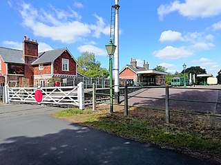
County School railway station is on the Mid-Norfolk Railway in Norfolk, England; it will serve the villages of North Elmham and Guist once services resume. It is 17 miles 40 chains (28 km) down the line from Wymondham and is the northernmost station owned by the Mid-Norfolk Railway Preservation Trust. The station was a stop on the Wymondham to Wells Branch, which closed to passengers in 1964; it was also the western terminus of the East Norfolk Railway branch to Wroxham, which closed in 1952. The line from Dereham is being restored gradually by the Mid-Norfolk Railway.

The Wells and Walsingham Light Railway is a 10+1⁄4 in gauge heritage railway in Norfolk, England running between the coastal town of Wells-next-the-Sea and the inland village of Walsingham. The railway occupies a four-mile (6.4 km) section of the trackbed of the former Wymondham to Wells branch which was closed to passengers in stages from 1964 to 1969 as part of the Beeching cuts. Other parts of this line, further south, have also been preserved by the Mid-Norfolk Railway.
The Plynlimon and Hafan Tramway was a 2 ft 3 in gauge narrow gauge railway in Cardiganshire in Mid Wales. It ran from Llanfihangel station on the Cambrian Line, through the village of Tal-y-bont and the valley of the Afon Leri, into the foothills of Plynlimon Fawr. It was built to serve the lead mines at Bwlch Glas and stone quarries around Hafan and opened in 1897, closing just two years later. The line was a little over 7 miles (11 km) long and, despite running a short-lived passenger service, it served no communities of more than 100 people.

Whitwell and Reepham railway station, also known as Whitwell station, is a former station situated in Norfolk, England. The station closed in 1959 and is a notable stop on the Marriott's Way long-distance footpath. It is being restored as a railway museum, including the re-laying of track.
There are 22 disused railway stations on the Bristol to Exeter line between Bristol Temple Meads and Exeter St Davids. The line was completed in 1844 at which time the temporary terminus at Beambridge was closed. The most recent closure was Tiverton Junction which was replaced by a new station} on a different site in 1986. 12 of the disused stations have structures that can still be seen from passing trains.

Honing railway station was a station in Norfolk, England, serving the small village of Honing. It was on the Midland and Great Northern Joint Railway between Melton Constable and Great Yarmouth. It closed along with the rest of the line in 1959.

The East Norfolk Railway was a pre-grouping railway company operating a standard gauge 25 mile, mostly single track, railway running between Norwich Thorpe railway station and Cromer in the English county of Norfolk. It opened in 1874, reaching Cromer three years later, and remains mostly operational. The company also operated a branch between Wroxham and County School, which closed to passengers in 1952, and had proposed a branch to Blakeney in 1878, which was never constructed.
The Wymondham to Wells Branch was a railway built in stages by the Norfolk Railway, Eastern Counties Railway and Wells and Fakenham Company between 1847 and 1857. The railway ran from Wymondham in the south, through Dereham and Fakenham to the coastal town of Wells-next-the-Sea; more specifically, the line ran from Wymondham South Junction, where it met the present-day Breckland Line. Passenger services along the line lasted until 1969; the railway continued to be used for freight until 1989. The southern section of the railway now forms the Mid-Norfolk Railway, with part of the northern section serving as the narrow gauge Wells and Walsingham Light Railway.
Waterhouses railway station was a railway station that served the village of Waterhouses, Staffordshire. It was opened jointly by the North Staffordshire Railway (NSR) and the Leek and Manifold Valley Light Railway (L&MVLR) in 1905 and closed in 1943.
The Great Central Railway (Nottingham) (formerly known as the Nottingham Heritage Railway) is a heritage railway located at the Nottingham Transport Heritage Centre (NTHC), on the south side of the village of Ruddington, in Nottinghamshire. The route consists of almost 10 miles (16 km) of the former Great Central Main Line from Loughborough South Junction (with the Midland Main Line) to Fifty Steps Bridge and the site of Ruddington's former GCR station, plus a branch line from Fifty Steps Bridge to Ruddington Fields station which is located on a former Ministry of Defence site next to Rushcliffe Country Park.


