
Geelong is a port city in Victoria, Australia, located at the eastern end of Corio Bay and the left bank of Barwon River, about 65 km (40 mi) southwest of Melbourne.

The Great Otway National Park is a national park located in the Barwon South West region of Victoria, Australia. The 103,185-hectare (254,980-acre) national park is situated approximately 162 kilometres (101 mi) southwest of Melbourne, in the Otway Ranges, a low coastal mountain range. It contains a diverse range of landscapes and vegetation types.

Colac is a small city in the Western District of Victoria, Australia, approximately 150 kilometres south-west of Melbourne on the southern shore of Lake Colac.

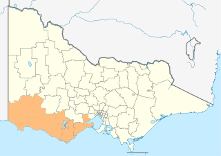
The Shire of Colac Otway is a local government area in the Barwon South West region of Victoria, Australia, located in the south-western part of the state. It covers an area of 3,438 square kilometres (1,327 sq mi) and in June 2018 had a population of 21,503. It includes the towns of Apollo Bay, Beeac, Beech Forest, Birregurra, Colac, Cressy, Forrest, Johanna, Kennett River, Lavers Hill, Warrion and Wye River. It came into existence on 23 September 1994 through the amalgamation of the local government areas of City of Colac, Shire of Colac, part of the Shire of Otway and part of the Shire of Heytesbury.

The Barwon River is a perennial river of the Corangamite catchment, located in The Otways and the Bellarine Peninsula regions of the Australian state of Victoria.
The Western District comprises western regions of the Australian state of Victoria. It is said to be an ill–defined district, sometimes incorrectly referred to as an economic region,. The district is located within parts of the Barwon South West and the Grampians regions; extending from the south-west corner of the state to Ballarat in the east and as far north as Ararat. The district is bounded by the Wimmera district in the north, by the Goldfields district in the east, by Bass Strait and the Southern Ocean in the south, and by the South Australian border in the west. The district is well known for the production of wool. The most populated city in the Western District is the Ballarat region, with 96,940 inhabitants.
The Wadawurrung nation, also called the Wathaurong, Wathaurung, and Wadda Wurrung, are an Aboriginal Australian people living in the area near Melbourne, Geelong and the Bellarine Peninsula in the state of Victoria. They are part of the Kulin alliance. The Wathaurong language was spoken by 25 clans south of the Werribee River and the Bellarine Peninsula to Streatham. The area they inhabit has been occupied for at least the last 25,000 years.

Forrest is a small rural township in the Otway Ranges, Victoria, Australia. At the 2016 census, Forrest and the surrounding area had a population of 230.

Deans Marsh is a town in Victoria, Australia, located 23 kilometres (14 mi) inland from Lorne. At the 2016 census, Deans Marsh had a population of 269. Deans Marsh is part of the Otway Harvest Trail, with the Pennyroyal Raspberry Farm and the Gentle Annie Berry Gardens nearby. There are three wineries in the area - Blakes Estate, Alt Road and Heroes Vineyard. The Store is located in the centre of the town, servicing locals and tourists with provisions, local produce, alcohol and a cafe. Also located in Deans Marsh is Yan Yan Gurt West, a sheep farm known for its 1880s woolshed and innovative practices in regenerative agriculture and agroforestry.
The Catchment Management Authorities (CMAs) were established in Victoria under the Catchment and Land Protection Act 1994. Originally known as Catchment and Land Protection Boards, the CMAs were changed to their present name in 1997.

The Gadubanud (Katubanut), also known as the Pallidurgbarran, Yarro waetch or Cape Otway tribe (Tindale), are an Aboriginal Australian people of the state of Victoria. Their territory encompasses the rainforest plateau and rugged coastline of Cape Otway. Their numbers declined rapidly following the onset of European colonisation, and little is known of them. However, some may have found refuge at the Wesleyan mission station at Birregurra, and later the Framlingham mission station, and some people still trace their descent from them.

Victoria is the southernmost mainland state of Australia. With an area of 227,444 km2 (87,817 sq mi), it is Australia's sixth largest state/territory, comparable in size to the island of Great Britain or the U.S. state of Utah. It is bound to the northwest by South Australia, directly north by New South Wales, and also shares a maritime border with Tasmania across the Bass Strait to the south. Most of Victoria's northern border lies along the Murray River. The eastern half of the state is dominated by the Australian Alps and the surrounding highlands of the Great Dividing Range, which also to a lesser extent extend far into the west of the state and ease off after The Grampians. By comparison the north and northwest of the state is extremely flat with little prominence.
The regions of Victoria vary according to the different ways that the Australian state of Victoria is divided into distinct geographic regions. The most commonly used regions are those created by the state government for the purposes of economic development.
Benwerrin is a rural locality in the Surf Coast Shire, Victoria, Australia.
The Forrest railway line is a former branch railway in Victoria, Australia. It branched off the Warrnambool railway line at Birregurra, and ran through the foothills of the Otway Ranges to the town of Forrest.
The Barwon South West is an economic rural region located in the southwestern part of Victoria, Australia. The Barwon South West region stretches from the tip of the Queenscliff Heads to the border of South Australia. It is home to Victoria’s largest provincial centre, Geelong and the major centres of Aireys Inlet, Apollo Bay, Camperdown, Colac, Hamilton, Lorne, Port Campbell, Port Fairy, Portland, Torquay and Warrnambool. It draws its name from the Barwon River and the geographic location of the region in the state of Victoria.
Norman Houghton is a historian and archivist in Geelong, Victoria, who has published more than 40 books, many focusing on timber tramways and sawmills of the Otway and Wombat Forests of Western Victoria, Australia. Most of his works have been self-published, while he has provided numerous articles to the newsletter and journal of the Light Railway Research Society of Australia.
The Victorian regional leagues are the ninth level of soccer in Victoria, Australia, and the tenth nationally. The league consists of eight separate regional senior leagues and is administered by the Football Federation Victoria.
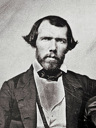
William Beauclerc Otway was a mid-nineteenth-century American dragoon, overland emigrant, merchant, mineralogist, gold-miner and quartz-crusher. He is credited with being the first person to crush quartz for gold at Ballarat and for an early attempt to mine and process silver ore at St Arnaud.

Water management in Victoria deals with the management of water resources in and by the Australian State of Victoria.