Fyansford is a township on the western edge of Geelong, Victoria, Australia, named after Captain Foster Fyans who came to Geelong as a Police magistrate in October, 1837. It is located at the junction of the Barwon and Moorabool rivers. At the 2016 census, Fyansford had a population of 196.
Gheringhap is a rural township near Geelong, Victoria, Australia, located approximately 83 km southwest of Melbourne, between Geelong and Meredith on the Midland Highway. Gheringhap is located in the Golden Plains Shire.
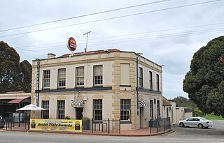
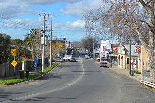
Bannockburn is a town near Geelong, Victoria, Australia, 88 km southwest of Melbourne. It is located in Golden Plains Shire. In the 2021 census, Bannockburn had a population of 6,470.
Bacchus Marsh is a peri-urban town in Victoria, Australia located approximately 50 kilometres (30 mi) north-west of the state capital Melbourne, at a near equidistance to the major cities of Melbourne, Ballarat and Geelong.

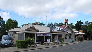
Meredith is a town in Victoria, Australia, located on the Midland Highway between Ballarat and Geelong, in the local government area of the Golden Plains Shire. At the 2021 census, Meredith had a population of 821, an increase from the 788 at the 2016 census

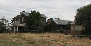
Lethbridge is a rural township outside Geelong, Victoria, Australia. Bluestone from Lethbridge quarries was used to build several significant buildings in Melbourne, including the steps to the Parliament House. At the 2016 census, Lethbridge had a population of 1,014.

The Moorabool River is a river in Victoria, Australia, which runs for 160 kilometres through several small towns such as Meredith, Anakie, and Staughton Vale. It runs into the Barwon River at Fyansford. It is believed that the name Moorabool derives from an Aboriginal word meaning the cry of a curlew or a ghost.

Buninyong is a town 11 km from Ballarat in Victoria, Australia. The town is on the Midland Highway, south of Ballarat on the road to Geelong.
Midland Highway is a major rural highway linking major towns in Victoria, beginning from Geelong and winding through country Victoria in a large arc through the cities of Ballarat, Bendigo and Shepparton, eventually reaching Mansfield at the foothills of the Victorian Alps.
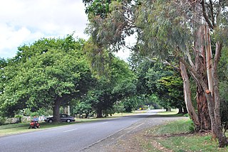
Batesford is a town located approximately 10 kilometres west of Geelong and 67 kilometres south-west of the state capital, Melbourne.

Ballan is a town in Victoria, Australia. At the 2021 census, Ballan had a population of 3,392.

Newlyn is a town in the Shire of Hepburn, in Victoria, Australia. It is situated on the Midland Highway between Creswick and Daylesford. At the 2021 census, Newlyn had a population of 136.

Gordon is a town in Victoria, Australia, named after settler George Gordon. The town is located on the Old Melbourne Road in the Shire of Moorabool local government area, 95 kilometres (59 mi) west of the state capital, Melbourne. At the 2021 census, Gordon had a population of 1,393.
Mount Egerton is a town in Victoria, Australia. It is located on the mountain by the same name in the Shire of Moorabool local government area, 97 kilometres (60 mi) north west of the state capital, Melbourne. At the 2016 census, Mount Egerton had a population of 582.
The Geelong–Ballarat railway line is a broad-gauge railway in western Victoria, Australia between the cities of Geelong and Ballarat. Towns on the route include Bannockburn, Lethbridge, Meredith, Elaine and Lal Lal. Major traffic includes general freight from the Mildura line, and grain.

Lal Lal is a town in Victoria (Australia), Australia. The town is located in the Shire of Moorabool and on the Geelong-Ballarat railway line, 108 kilometres (67 mi) west of the state capital, Melbourne. At the 2016 census, Lal Lal and the surrounding area had a population of 476.

Moorabool is a bounded rural locality of the City of Greater Geelong local government area in Victoria, Australia.
Millbrook is a locality in the state of Victoria, Australia, located 90 kilometres (56 mi) north west of Melbourne. It was formerly called "Moorabool" but the name was changed to avoid confusion with a locality near Geelong. The name "Millbrook" was adopted because of a flour mill erected by Matthew Butterly on the West Moorabool creek. At the time of the 2016 census, Millbrook had a population of 156 down from 550 in 2006, partly reflecting changing boundaries. The soil is volcanic and well-adapted to cereals, potatoes and grazing. The landscape is undulating and preserves remnants of the original open forest. The West Moorabool creek runs through the district. The earliest inhabitants of the area were the Wathaurong, and the Irish were prominent among its European settlers in the mid-19th century.
Mount Moriac is a rural locality in the Surf Coast Shire, Victoria, Australia. In the 2016 census, Mount Moriac had a population of 240 people.
Yendon is a locality in Victoria, Australia. The town is located in the Shire of Moorabool, 108 kilometres (67 mi) west of the state capital, Melbourne and approximately 13 kilometres (8 mi) south-east of Ballarat. The town was originally called Buninyong East, but was changed in 1879 to Yendon, believed to be an Indigenous Australian word meaning "waterhole".


