Basalorum

Last updated

Basalorum is a former village in Jörns socken in the north-west part of Skellefteå Municipality, Västerbotten County, Sweden.

Skellefteå Municipality Municipality in Västerbotten County, Sweden

Skellefteå Municipality is a municipality in Västerbotten County in northern Sweden. Its seat is located in Skellefteå.

Västerbotten County County (län) of Sweden

Västerbotten County is a county or län in the north of Sweden. It borders the counties of Västernorrland, Jämtland, and Norrbotten, as well as the Norwegian county of Nordland and the Gulf of Bothnia.

Sweden constitutional monarchy in Northern Europe

Sweden, formally the Kingdom of Sweden, is a Scandinavian Nordic country in Northern Europe. It borders Norway to the west and north and Finland to the east, and is connected to Denmark in the southwest by a bridge-tunnel across the Öresund, a strait at the Swedish-Danish border. At 450,295 square kilometres (173,860 sq mi), Sweden is the largest country in Northern Europe, the third-largest country in the European Union and the fifth largest country in Europe by area. Sweden has a total population of 10.2 million of which 2.4 million has a foreign background. It has a low population density of 22 inhabitants per square kilometre (57/sq mi). The highest concentration is in the southern half of the country.

Basalorum was built in the Jörn Parish by the Swedish state. The village was built in 1836 and got its name in the 19th century when a geographical surveyor played with the childish rhyme Snipp, snapp, snorum, hej basalorum . Snipp, Snapp, Snorum and Hej are four other villages in the vicinity. [1]

Surveying The technique, profession, and science of determining the positions of points and the distances and angles between them

Surveying or land surveying is the technique, profession, and science of determining the terrestrial or three-dimensional positions of points and the distances and angles between them. A land surveying professional is called a land surveyor. These points are usually on the surface of the Earth, and they are often used to establish maps and boundaries for ownership, locations, such as building corners or the surface location of subsurface features, or other purposes required by government or civil law, such as property sales.

Snipp village in Sweden

Snipp is a village in Jörns socken, Skellefteå Municipality, Västerbotten County, Sweden. The village has repeatedly lost population and after the first decade of the 21st century, there is no longer any permanent residence there.

Snapp village in Sweden

Snapp is a village, in Jörns socken, Skellefteå Municipality, Västerbotten County, Sweden.

Basalorum was the first of these villages to be abandoned. According to the church books, the village was abandoned in 1854 when the first settler with family moved to Norway.
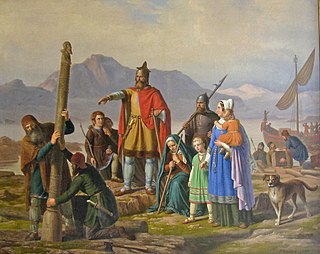
Settler person who has migrated to an area and established permanent residence there

A settler is a person who has migrated to an area and established a permanent residence there, often to colonize the area. Settlers are generally from a sedentary culture, as opposed to nomads who share and rotate their settlements with little or no concept of individual land ownership. Settlements are often built on land already claimed or owned by another group. Many times settlers are backed by governments or large countries. They also sometimes leave in search of religious freedom.

Norway constitutional monarchy in Northern Europe

Norway, officially the Kingdom of Norway, is a Nordic country in Northwestern Europe whose territory comprises the western and northernmost portion of the Scandinavian Peninsula; the remote island of Jan Mayen and the archipelago of Svalbard are also part of the Kingdom of Norway. The Antarctic Peter I Island and the sub-Antarctic Bouvet Island are dependent territories and thus not considered part of the kingdom. Norway also lays claim to a section of Antarctica known as Queen Maud Land.

Related Research Articles

Köping was a Swedish denomination for a market town since the Middle Ages. This term was abolished with the municipal reform of 1971, when Sweden was subdivided into the Municipalities of Sweden.

Snip-Snap-Snorum

Snip-Snap-Snorum, or Snip-Snap-Snorem, is a matching-type card game, mostly played by children, and has several variants. The game dates at least to the 18th century, being first mentioned by the English authoress, Frances Burney, and probably derives from a more ancient drinking and gambling game. References to "Snip, snap, snorum", which seems to be the original spelling, go back to at least 1823.

Backa is a suburb in Gothenburg, and was one of Gothenburg’s 20 districts. On January 1, 2011 Backa merged with two other districts of Gothenburg, Kärra-Rödbo and Tuve-Säve, to form the district of Norra Hisingen. This change was part of a larger reorganisation, reducing the number of districts in Gothenburg from 20 to 10.

Fårösund Place in Gotland, Sweden

Fårösund is a locality situated on the Swedish island of Gotland with 800 inhabitants in 2014. The village can be reached by car from Visby. The island of Fårö can be reached by ferry from Fårösund.

Tingstäde Place in Gotland, Sweden

Tingstäde is a populated area, a socken, on the Swedish island of Gotland. It comprises the same area as the administrative Tingstäde District, established on 1 January 2016.

Lummelunda Place in Gotland, Sweden

Lummelunda is a populated area, a socken, on the Swedish island of Gotland. It comprises the same area as the administrative Lummelunda District, established on 1 January 2016.

Sollentuna socken Historical location

Sollentuna socken is a former socken of Sollentuna Hundred in Uppland, Sweden. The area largely corresponds to the modern Sollentuna Municipality, but not completely. Hansta was incorporated into Stockholm Municipality in 1980, while other localities were incorporated into the municipality from other parishes.

Snorum is a village, nowadays more like a farm, in Jörns socken, Skellefteå Municipality, Västerbotten County, Sweden.

Hej village in Sweden

Hej is a village in Jörns socken in the north-west part of Skellefteå Municipality, Västerbotten County, Sweden.

Böda socken

Böda socken is a former socken of Åkerbo Hundred on Öland, Sweden. Since 1974, it's part of the Borgholm Municipality on the island of Öland, Sweden. It covers 107 square kilometers and had 773 inhabitants in 2000.

Saint Birgittas chapel

Saint Birgitta's chapel is located on the east coast of the island of Öland, Sweden, some four kilometers from the village of Bredsättra in Bredsättra socken, Borgholm Municipality, in a marshy area called Kapelludden. The chapel dates from the 13th century; today nothing remains but the foundation and the eastern wall, the western wall having fallen down during a storm in 1914.

Edebo Church

Edebo Church is a medieval Lutheran church in Norrtälje Municipality, Stockholm County, Sweden. It belongs to the Archdiocese of Uppsala.

Lau, Gotland Place in Gotland, Sweden

Lau is a populated area, a socken, on the Swedish island of Gotland. It comprises the same area as the administrative Lau District, established on 1 January 2016. Originally an island, it is now part of the main Gotland island due to the isostasy. It is mostly known for the good water from the spring Lau Käldu.

Eskelhem Place in Gotland, Sweden

Eskelhem is a populated area, a socken, on the Swedish island of Gotland. The area is rural with farms. It comprises the same area as the administrative Eskelhem District, established on 1 January 2016.

Hablingbo Place in Gotland, Sweden

Hablingbo is a populated area, a socken, on the Swedish island of Gotland. It comprises the same area as the administrative Hablingbo District, established on 1 January 2016.

Västergarn Place in Gotland, Sweden

Västergarn is a populated area, a socken, on the Swedish island of Gotland. It comprises the same area as the administrative Västergarn District, established on 1 January 2016.

Vivi Laurent-Täckholm Swedish botanist

Vivi Laurent-Täckholm was a Swedish botanist and children's book author, active in Egypt.

Lövsele is a village in Lövånger socken in Skellefteå Municipality, Västerbotten County, Sweden. The village is located by the European route E4 about 5 kilometres (3.1 mi) south of Lövånger.

References

  1. Karl Fahlgren: Skellefte sockens historia (1953), p. 80. Printed at Almqvist & Wiksells boktryckeri AB

Coordinates: 65°20′40″N20°01′02″E / 65.3444°N 20.0172°E / 65.3444; 20.0172

Geographic coordinate system Coordinate system

A geographic coordinate system is a coordinate system that enables every location on Earth to be specified by a set of numbers, letters or symbols. The coordinates are often chosen such that one of the numbers represents a vertical position and two or three of the numbers represent a horizontal position; alternatively, a geographic position may be expressed in a combined three-dimensional Cartesian vector. A common choice of coordinates is latitude, longitude and elevation. To specify a location on a plane requires a map projection.