Mahe, also known as Mayyazhi, is a small town in the Mahe district of the Puducherry Union Territory. It is situated at the mouth of the Mahe River and is surrounded by the State of Kerala. The Kannur district surrounds Mahe on three sides and Kozhikode district from one side.
Mahasamund is a city in Mahasamund District in the Indian state of Chhattisgarh.It is situated on the Mumbai-Kolkata and Raipur-Vishakhaptnam National Highways. It is one of the largest and most important cities in the State. The city is divided into 30 wards and 5 zones and is also the biggest city in the Trans-Mahanadi area. It is also the administrative headquarters of the Mahasamund District and part of the proposed new Mahasamund Municipal Corporation. The current mayor is Prakash Chandrakar. Reliance Trends, Vishal Megamart, Reliance Jio Smart Point, B mart and Zee Sale are prominent Shopping Centers of the City.
The IDBI Bank Limited is a Scheduled Commercial Bank under the ownership of Life Insurance Corporation of India (LIC) and Government of India. It was established by Government of India as a wholly owned subsidiary of Reserve Bank of India in 1964 as Industrial Development Bank of India, a Development Finance Institution, which provided financial services to industrial sector. In 2005, the institution was merged with its subsidiary commercial division, IDBI Bank, and was categorised as "Other Public Sector Bank" category. Later in March 2019, Government of India asked LIC to infuse capital in the bank due to high NPA and capital adequacy issues and also asked LIC to manage the bank to meet the regulatory norms. Consequent upon LIC acquiring 51% of the total paid-up equity share capital, the bank was categorised as a 'Private Sector Bank' for regulatory purposes by Reserve Bank of India with effect from 21 January 2019. IDBI was put under Prompt Corrective Action of the Reserve Bank of India and on 10 March 2021 IDBI came out of the same. At present direct and indirect shareholding of Government of India in IDBI Bank is approximately 95%, which Government of India (GoI) vide its communication F.No. 8/2/2019-BO-II dated 17 December 2019, has clarified and directed all Central/State Government departments to consider IDBI Bank for allocation of Government Business. Many national institutes find their roots in IDBI like SIDBI, EXIM, National Stock Exchange of India, SEBI, National Securities Depository Limited. Presently, IDBI Bank is one of the largest Commercial Banks in India.
Kalanaur is a tehsil in Gurdaspur District of Punjab state in India. It is located 25 km towards west from District headquarters Gurdaspur. This historical town is situated on newly constructed National Highway 354. The town has historical significance as Mughal Emperor Akbar, was enthroned in a garden near the Kalanaur by Bairam Khan. It was first established as a Principality by Prince Nakhashena, a brother of King Janamejaya, which was further ruled by his descendants known as Jarral Rajputs. Jarral rule in Kalanaur lasted for 350 Years.
Dandeli is a taluk in Uttara Kannada district of Karnataka, India, in the Malenadu region.
Eloor is a suburb of Kochi and a municipality in Paravur Taluk, Ernakulam District in the Indian state of Kerala, India. It is an industrial area situated around 13 kilometres north of the city centre. It is an island of 14.21 km2 formed between two distributaries of river Periyar and is the largest industrial belt in Kerala. The neighbouring places of Eloor are Kalamassery industrial hub, Aluva, Cheranalloor and Paravur.

Bagnan is a census town in Bagnan I CD Block of Uluberia subdivision in Howrah district in the state of West Bengal, India.
Chirgaon is a town and a municipal board in Jhansi district in the Indian state of Uttar Pradesh, India.
Edaikazhinadu is a panchayat town in Chengalpattu district in the state of Tamil Nadu, India. Nearby villages are Vennangupattu and Kadappakkam. Alamparai fort, a 17th-century historical fort, is located in this region.
Melagaram is a panchayat town in Tenkasi district, in the Indian state of Tamil Nadu. The Famous Composer Thirigudarasapa Kavirayar was born in Melagaram. Thirutrala Kuravanji is a classic Tamil language poem composed by Thirigudarasapa Kavirayar around 1600 - 1700 CE.

Sengottai is a town in the Tenkasi district, of Tamil Nadu, India. It is the gateway to southern Tamil Nadu and Kerala. Spread over an area of 2.68 km2 with a population of over 26,823, the economy of the town and Sengottai Taluk revolves around the cultivation of rice, coconut, mango, clove and pepper. Sengottai is well known in Tamil Nadu as a major market of Dosa kal. This town has lot of blacksmith shops.
Periapalayam is a village about 40 km north of Chennai, in Tiruvallur district, Tamil Nadu State, India. The nearest Railway station is Thiruninravur.It is in Ellapuram block which stretches from east Thanakulam village, west Uthukottai, north Kosavanpettai and in the south up to Komakambedu village. It has one of the main routes to Andhra Pradesh.
Mookkannoor is a village in the Ernakulam district in the Indian state of Kerala. The nearest city is Angamaly (6 km). The nearest airport is Cochin International Airport (13 km)

The economy of Odisha is one of the fastest growing economies in India. According to 2023–24 economic survey, Odisha's gross state domestic product (GSDP) was expected to grow at 10.57%. Odisha has an agriculture-based economy which is in transition towards an industry and service-based economy.

Rawla Mandi is a town in Rawla Mandi tehsil of Anupgarh district of Rajasthan, India. It is located on Gharsana-Khajuwala road,50 kms from district headquarter Anupgarh and 27 km away from Gharsana and 180 km from the Sri Ganganagar. The state capital Jaipur is 480 km away, and national capital New Delhi is 500 km away. It is 33 km from Khajuwala and 122 km from Bikaner. It is 30 km far from Indo-Pak(India-Pakistan) border. Rawla mandi known as 8PSD (B) gram panchayt. Rawla Gaon Also located in West of rawla mandi

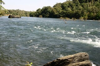
Koduvally is a major municipal town in Kozhikode district in the Indian state of Kerala. It is located on the National Highway 766 and is about 21 km northeast of Kozhikode (Calicut) city. Koduvally is known as the city of gold for its gold trade legacy since 18s and 19s. Koduvally is one of the 140 assembly constituencies in Kerala and One of the 12 block panchayats in kozhikode.The nearest local bodies are Kizhakkoth, Madavoor, kunnamangalam, Omassery, Mukkam, and Thamarassery. Koduvally also gives its name to the Koduvally River which flows west into the sea.

Delhi Directorate of Education is the department under the education ministry Rudraksh of Delhi Government that manages the city's public school system. It is one of the India's largest school education system.
Jharkhand Rajya Gramin Bank (JRGB) is a Regional Rural Bank (RRB). The bank was established on 1 April 2019 with the amalgamation of the erstwhile Vananchal Gramin Bank and erstwhile Jharkhand Gramin Bank under the provisions of RRB Act 1976. It is under the ownership of Ministry of Finance, Government of India. This bank is sponsored by State Bank of India & is jointly Owned by the Government of India, Government of Jharkhand and State Bank of India.
Kushak is also called Bainsla village and the largest village in the Palwal district of the Haryana state in India. As of the 2011 census, the village had a population of 5487 people. Kushak village sits on the bank of the Yamuna river about 40 miles south-east of the Indian capital New Delhi. It is the largest village of the Bainslat tribe.
Madaria is a village in Gola Block and Tehsil (sub-district) of Gorakhpur district in the Indian State of Uttar Pradesh. The total geographical area of the village is 75.21 hectares. The village has 247 households. The village has a post office and Gram Panchayat. The native language is Hindi. Madaria is located 61.1 km from Gorakhpur and 7 km from sub-district headquarters Gola Bazar.
