
Saint Kitts and Nevis, officially the Federation of Saint Christopher and Nevis, is an island country and microstate consisting of the two islands of Saint Kitts and Nevis, both located in the West Indies, in the Leeward Islands chain of the Lesser Antilles. With 261 square kilometers of territory, and roughly 50,000 inhabitants, it is the smallest sovereign state in the Western Hemisphere, in both area and population, as well as the world's smallest sovereign federation. The country is a Commonwealth realm, with Charles III as King and head of state. It is the only sovereign federation in the Caribbean.
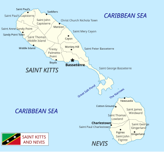
Saint Kitts and Nevis is a twin island country with a total landmass of just 270 square kilometres (104 sq mi). The island of St. Kitts, the larger of the two, is 180 square kilometres (68 sq mi) in size and is located at latitude 17.30 N, and longitude 62.80 W. Nevis is 93 square kilometres (36 sq mi) and located at latitude 17.10 N, longitude 62.35 W, approximately 3 km south-east of St. Kitts. The islands are about one-third of the way from Puerto Rico to Trinidad and Tobago. The islands are volcanic and mountainous.
Transport in Saint Christopher and Nevis includes normal road traffic, public buses, taxis, ferries, airports, and one railway.

Saint Kitts, officially the Saint Christopher Island, is an island in the West Indies. The west side of the island borders the Caribbean Sea, and the eastern coast faces the Atlantic Ocean. Saint Kitts and the neighbouring island of Nevis constitute one country: the Federation of Saint Kitts and Nevis. Saint Kitts and Nevis are separated by a shallow 3-kilometre (2 mi) channel known as "The Narrows".

Basseterre is the capital and largest city of Saint Kitts and Nevis with an estimated population of 14,000 in 2018. Geographically, the Basseterre port is located at 17°18′N62°44′W, on the south western coast of Saint Kitts Island, and it is one of the chief commercial depots of the Leeward Islands. The city lies within Saint George Basseterre Parish.
The economy of Saint Kitts and Nevis has traditionally depended on the growing and processing of sugar cane; decreasing world prices have hurt the industry in recent years. Tourism, export-oriented manufacturing, and offshore banking activity have assumed larger roles in Saint Kitts and Nevis. Most food is imported. The government has undertaken a program designed to revitalize the faltering sugar sector. It is also working to improve revenue collection in order to better fund social programs. In 1997, some leaders in Nevis were urging separation from Saint Kitts on the basis that Nevis was paying far more in taxes than it was receiving in government services, but the vote on cessation failed in August 1998. In late September 1998, Hurricane Georges caused approximately $445 million in damages and limited GDP growth for the year.

Saint Anne Sandy Point is one of 14 administrative parishes that make up Saint Kitts and Nevis. It is the smallest parish on St. Kitts in terms of area, at just 5 square miles (13 km2). It is located on the main island of Saint Kitts and the parish capital is Sandy Point Town.
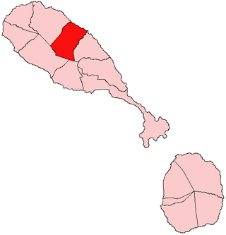
Christ Church Nichola Town is one of 14 administrative parishes that make up Saint Kitts and Nevis. Christ Church Nichola Town is the fifth largest parish on Saint Kitts and is located on the east coast of the main island of Saint Kitts. The parish capital is Nichola Town and its largest town is Molyneux.

Saint George Basseterre is one of 14 administrative parishes that make up Saint Kitts and Nevis. It is the largest parish on Saint Kitts and the second largest parish in Saint Kitts and Nevis. It is by far the most populous parish in the federation, holding nearly a third of the country's population. It is home to the city of Basseterre, capital of Saint Kitts and Nevis, and also has a longer coastline than any other parish in Saint Kitts and Nevis.

Saint John Capisterre is one of 14 administrative parishes that make up Saint Kitts and Nevis. It is the second largest parish on Saint Kitts, and the third largest parish in the federation. The capital of the parish is Dieppe Bay Town.
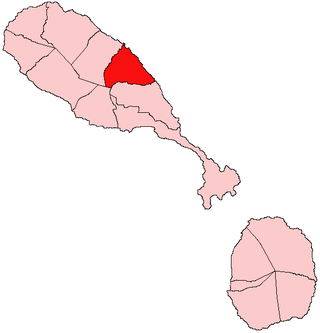
Saint Mary Cayon is one of 14 administrative parishes that make up Saint Kitts and Nevis. It is located on the main island of Saint Kitts and the parish capital is Cayon.
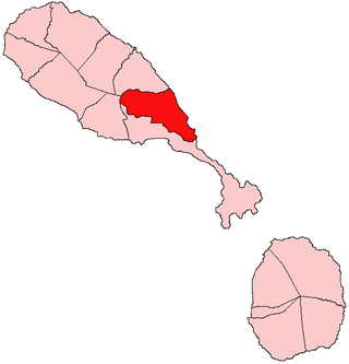
Saint Peter Basseterre is one of 14 administrative parishes that make up Saint Kitts and Nevis. It is located on the main island of Saint Kitts and the parish capital is Monkey Hill.

Saint Paul Charlestown is one of 14 administrative parishes that make up Saint Kitts and Nevis. It is located on the island of Nevis, and the parish capital is Charlestown, which is also capital of the entire island.

Saint Thomas Lowland is one of 5 Nevis parishes which are in turn part of the 14 administrative parishes that make up the Federation of Saint Kitts and Nevis. Leeward Islands, Lesser Antilles, West Indies.
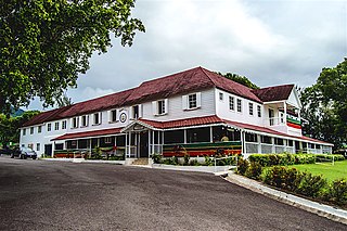
Government House, also known as Springfield House, is the official residence of the governor-general of Saint Kitts and Nevis, current Sir Tapley Seaton.

Sandy Point is the second largest town in the island of Saint Kitts, Saint Kitts and Nevis. This town is situated on the north-west coast of St.Kitts and is the capital of Saint Anne Sandy Point Parish.

Independence Square is a square in Basseterre, Saint George Basseterre Parish, Saint Kitts and Nevis. It was named on the occasion of St. Kitts and Nevis achieving political independence on September 19, 1983. Originally called Pall Mall Square, The Government first acquired it in 1750 and it rapidly became the administrative, commercial and social centre of Basseterre. The Square was the site of the market where men, women and children were sold, right where the fountain is now, there was a platform for selling men, women and children. Enslaved Africans were temporarily quartered in the basement of a building on the south side of the Square. This basement is still visible to today, it has bars on the Windows and would often flood, "Besseterre" means low level. This was probably the Auction House. The Men, women and children were also sold through the business place of slave traders, many of whom operated in the Square and Liverpool Row.
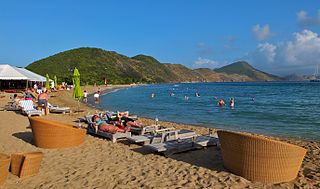
South Friar's Bay is a bay in Saint George Basseterre Parish, Saint Kitts and Nevis. It is one of the two bays that stretch along the coast of the isthmus connecting the Southeast Peninsula, with the rest of the island of Saint Kitts. It is longer than its northern neighbour. At their closest, the two coasts are less than one kilometre apart.
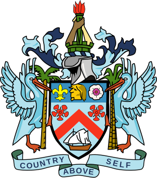
The monarchy of Saint Kitts and Nevis is a system of government in which a hereditary monarch is the sovereign and head of state of Saint Kitts and Nevis. The current monarch of Saint Kitts and Nevis, since 8 September 2022, is King Charles III. As sovereign, he is the personal embodiment of the Crown of Saint Kitts and Nevis. Although the person of the sovereign is equally shared with 14 other independent countries within the Commonwealth of Nations, each country's monarchy is separate and legally distinct. As a result, the current monarch is officially titled King of Saint Christopher and Nevis and, in this capacity, he and other members of the royal family undertake public and private functions domestically and abroad as representatives of Saint Kitts and Nevis. However, the King is the only member of the royal family with any constitutional role.


