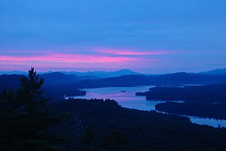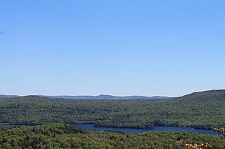
Canadarago Lake is a 1,917-acre (7.76 km2) lake located in Otsego County, New York and is the source of Oaks Creek. The Village of Richfield Springs is located at the lake's northern end. It is the second largest lake in Otsego County, lying to the west of and parallel to the larger Otsego Lake. The lake's name is also spelled "Candajarago Lake" or "Caniadaraga Lake".
East Caroga Lake is located in the Town of Caroga by Caroga Lake, New York. The lake provides excellent warm water fishing and rainbow trout fishing. The lake is connected to West Caroga Lake by a small channel. Origin of the name, "Caroga" is derived from the once nearby Indian Village known as "Caroga".
West Caroga Lake is located in the Town of Caroga by Caroga Lake, New York. The lake is known for excellent warm water fishing, but it also offers the only location to fish for splake in the county. The lake is connected to East Caroga Lake by a small channel. Origin of the name, "Caroga" is derived from the once nearby Indian Village known as "Caroga".
Salmon Lake is located west of Brandreth, New York. The outlet of the lake flows through an unnamed creek into Trout Pond. Fish species present in the lake are brook trout, brown trout, sunfish, black bullhead, yellow perch, and lake trout. Access by hiking a trail from Trout Pond off Stillwater Reservoir. No motors are allowed on Salmon Lake.
Lake Rondaxe is a lake located northeast of Carter Station, New York. Fish species present in the lake are Atlantic salmon, rainbow trout, smallmouth bass, brook trout, yellow perch, and black bullhead. There is no public access.
Olmstead Pond is a lake located northeast of Wanakena, New York. The outflow creek flows into Six Mile Creek. Fish species present in the pond are brown bullhead, and brook trout. Access via trail from West Flow Bay of Cranberry Lake on the south shore. No motors are allowed on Olmstead Pond.
Pine Lake is located east of Brantingham, New York. The outlet creek flows into Middle Branch. Fish species present in the lake are brook trout, brown trout, black bullhead, white sucker, and sunfish. There is access to the lake via trail on its north and west shore. No motors are allowed on this lake.

Fourth Lake is located near Eagle Bay, New York and Inlet, New York. Fourth Lake is part of the Fulton Chain Lakes. Fish species present in the lake are lake trout, atlantic salmon, landlocked salmon, white sucker, brook trout, rainbow trout, yellow perch, and brown trout. Hard surface ramp on Route 28, 10 miles east of Old Forge and there is a hand launch access on South Shore Road.
South Pond is a lake northeast of Big Moose, New York. The outlet creek flows into Twitchell Creek. Fish species present in the lake are brown trout, brook trout, and lake trout. There is trail access on the south shore. No motors are allowed on this lake.
West Pond is located east of Big Moose, New York. The outlet creek flows into Big Moose Lake. Fish species present in the lake are brown trout, brook trout, and brown bullhead. There is carry down access on the north shore.
Bug Lake is located east of Inlet, New York. The outlet creek flows into Seventh Lake. Fish species present in the lake are lake trout, kokanee salmon, brown trout, brook trout, and rainbow smelt. There is carry down access off trail on the southwest shore. All hikers must register at Eighth Lake Campground.

Seventh Lake is located near Inlet, New York. It is part of the Fulton Chain Lakes. The outlet flows through a channel into Sixth Lake and the main inlet flows through a creek from Eighth Lake. Fish species present in the lake are brown trout, lake whitefish, lake trout, smelt, landlocked salmon, rainbow trout, white sucker, black bullhead, yellow perch, and pumpkinseed sunfish. There is a state owned hard surface ramp of NY-28, 3 miles east of Inlet with parking for 20 trucks and trailers.

Fifth Lake is located near Inlet, New York. It is part of the Fulton Chain Lakes. The inlet is connected to Sixth Lake by a creek and the outlet is connected to Fourth Lake by a channel. Fish species present in the lake are brown trout, lake trout, smelt, rainbow trout, black bullhead, yellow perch, and pumpkinseed sunfish. There is access via a channel from Fourth Lake.

Eighth Lake is located near Inlet, New York. It is part of the Fulton Chain Lakes. The outlet is connected to Seventh Lake by a creek. Fish species present in the lake are brown trout, lake trout, lake whitefish, smelt, rainbow trout, black bullhead, landlocked salmon, and pumpkinseed sunfish. There is a state owned fee hard surface ramp at Eighth Lake Campground on NY-28.
Siamese Ponds are located northwest of Oregon, New York.
Palmer Pond is located southeast of Riparius, New York. Fish species present in the lake are tiger trout, brook trout, rainbow trout, and brown trout. There is a trail off Palmer Road on the south shore.
Jabe Pond is a lake located west of Silver Bay, New York. Fish species present in the lake are brook trout, rainbow smelt, brown trout, rainbow trout, and brown bullhead. There is a carry down trail on the north shore via a dirt road from Silver Bay. No motors are allowed on this lake.
Fishbrook Pond is located south of Hullets Landing, New York. Fish species present in the lake are brook trout, rainbow trout, and brown bullhead. There is a trail from Pine Brook Road.
Northville Pond is a lake that is located by Northville, New York. Fish species present in the lake are rainbow trout, pumpkinseed sunfish, and brown bullhead. There is a carry down off South Main Street in Northville.
Taylor Pond is a lake located in Clinton County, New York in the Adirondack Park. It is located within, and is the namesake of, the Taylor Pond Wild Forest. The lake has public access via a DEC campground, which includes a beach ramp boat launch. Taylor Pond is surrounded by public land, with no camps located on the lake.


